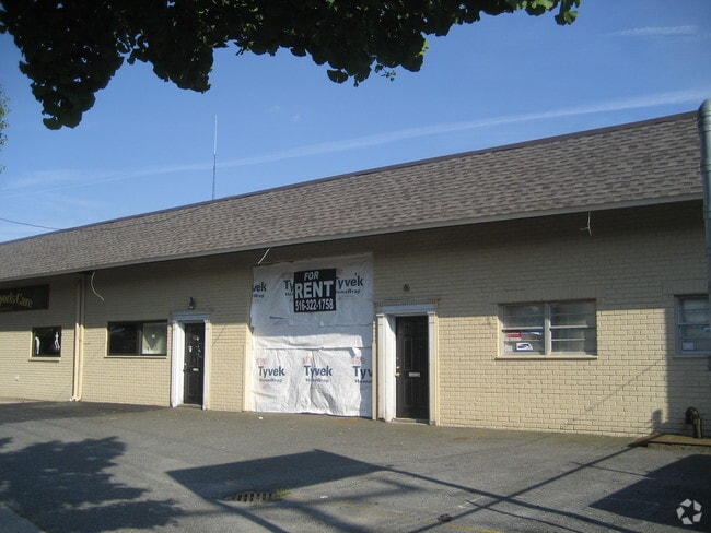
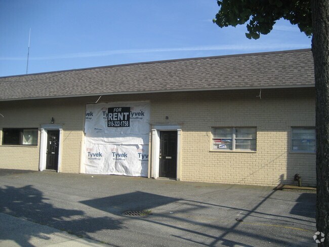
Property Record
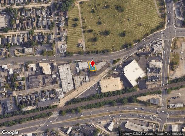
70 Merrick Rd, Lynbrook, NY 11563

NEARBY LISTINGS FOR SALE OR LEASE
-
-
-
-
-
-
-
-
-
-
No Photo
-
-
View all Lynbrook listings for sale on LoopNet.com
Property Detail
70 Merrick Rd
2025-38-095-00-0518-0
TOWN #1 SCH DIST 012
Warehouse
Nassau
X
New York
36059C0216G
518
2025
0.12 AC
2025
Southern Nassau
412000
Long Island (New York)
2,400 SF
Nassau County-Suffolk County, NY
DEMOGRAPHICS near 70 Merrick Rd
1 Mile
3 Mile
5 Mile
2024 Total Population
27,340
207,595
581,732
2029 Population
26,754
203,353
565,015
Pop Growth 2024-2029
(2.14%)
(2.04%)
(2.87%)
Average Age
43
42
41
2024 Total Households
10,821
69,299
180,159
HH Growth 2024-2029
(2.22%)
(2.15%)
(3.02%)
Median Household Inc
$106,395
$126,425
$114,620
Avg Household Size
2.40
2.90
3.10
2024 Avg HH Vehicles
2.00
2.00
2.00
Median Home Value
$632,656
$641,048
$614,855
Median Year Built
1950
1951
1952
Nearby Places
- Restaurants
- Banks
- Shops
- Fitness
- Groceries
PUBLIC TRANSPORTATION
TRANSIT/SUBWAY
Rockville Centre Station (Babylon Branch - Long Island Rail Road)
DRIVE
WALK
Distance
Rockville Centre Station (Babylon Branch - Long Island Rail Road)
2 min
16 min
0.8 mi
Lynbrook Station (Babylon Branch - Long Island Rail Road, Long Beach Branch - Long Island Rail Road)
DRIVE
WALK
Distance
Lynbrook Station (Babylon Branch - Long Island Rail Road, Long Beach Branch - Long Island Rail Road)
2 min
18 min
0.9 mi
Centre Avenue Station (Long Beach Branch - Long Island Rail Road)
DRIVE
WALK
Distance
Centre Avenue Station (Long Beach Branch - Long Island Rail Road)
3 min
17 min
0.9 mi
COMMUTER RAIL
Rockville Centre Station (Babylon Branch - Long Island Rail Road)
DRIVE
WALK
Distance
Rockville Centre Station (Babylon Branch - Long Island Rail Road)
2 min
16 min
0.8 mi
Lynbrook Station (Babylon Branch - Long Island Rail Road, Long Beach Branch - Long Island Rail Road)
DRIVE
WALK
Distance
Lynbrook Station (Babylon Branch - Long Island Rail Road, Long Beach Branch - Long Island Rail Road)
2 min
18 min
0.9 mi
AIRPORT
John F Kennedy International
DRIVE
WALK
Distance
John F Kennedy International
15 min
9.1 mi
LaGuardia
DRIVE
WALK
Distance
LaGuardia
26 min
16.5 mi
Newark Liberty International
DRIVE
WALK
Distance
Newark Liberty International
54 min
36.3 mi
Freight Ports
NY - Red Hook Container Terminal
DRIVE
WALK
Distance
NY - Red Hook Container Terminal
36 min
20.7 mi
Nearby Properties
Address
Land Use
TOTAL SIZE
Lot Size
Zoning
Address
Land Use
TOTAL SIZE
Lot Size
Zoning
64,618 SF
8.04 AC
Address
Land Use
TOTAL SIZE
Lot Size
Zoning
2,634,357 SF
57.63 AC
Address
Land Use
TOTAL SIZE
Lot Size
Zoning
202.54 AC
Address
Land Use
TOTAL SIZE
Lot Size
Zoning
Address
Land Use
TOTAL SIZE
Lot Size
Zoning
5,800 SF
10.48 AC
Address
Land Use
TOTAL SIZE
Lot Size
Zoning
88.30 AC
Address
Land Use
TOTAL SIZE
Lot Size
Zoning
30,700 SF
88.36 AC
Address
Land Use
TOTAL SIZE
Lot Size
Zoning
57,970 SF
1.69 AC
Address
Land Use
TOTAL SIZE
Lot Size
Zoning
94,204 SF
35.42 AC
Address
Land Use
TOTAL SIZE
Lot Size
Zoning
46,404 SF
38.43 AC
Address
Land Use
TOTAL SIZE
Lot Size
Zoning
29,998 SF
22.49 AC
Address
Land Use
TOTAL SIZE
Lot Size
Zoning
227,776 SF
16.06 AC
Address
Land Use
TOTAL SIZE
Lot Size
Zoning
115.42 AC
Address
Land Use
TOTAL SIZE
Lot Size
Zoning
151,757 SF
34.38 AC
Address
Land Use
TOTAL SIZE
Lot Size
Zoning
441,888 SF
22.09 AC
Address
Land Use
TOTAL SIZE
Lot Size
Zoning
99,904 SF
20.17 AC
Address
Land Use
TOTAL SIZE
Lot Size
Zoning
293,443 SF
21.86 AC
Address
Land Use
TOTAL SIZE
Lot Size
Zoning
20,670 SF
6.62 AC
Address
Land Use
TOTAL SIZE
Lot Size
Zoning
88,011 SF
15.01 AC
Address
Land Use
TOTAL SIZE
Lot Size
Zoning
502,830 SF
1.79 AC
Address
Land Use
TOTAL SIZE
Lot Size
Zoning
140,992 SF
12.07 AC
Address
Land Use
TOTAL SIZE
Lot Size
Zoning
74,813 SF
4.56 AC
Address
Land Use
TOTAL SIZE
Lot Size
Zoning
7,172 SF
0.06 AC
R6
Address
Land Use
TOTAL SIZE
Lot Size
Zoning
40,366 SF
17.80 AC
Address
Land Use
TOTAL SIZE
Lot Size
Zoning
59,715 SF
12.81 AC
Address
Land Use
TOTAL SIZE
Lot Size
Zoning
41,612 SF
3.89 AC
Address
Land Use
TOTAL SIZE
Lot Size
Zoning
60,892 SF
2.71 AC
Address
Land Use
TOTAL SIZE
Lot Size
Zoning
45,854 SF
2.31 AC
Address
Land Use
TOTAL SIZE
Lot Size
Zoning
134,821 SF
13.20 AC
Address
Land Use
TOTAL SIZE
Lot Size
Zoning
88,266 SF
2.93 AC
The World's #1 Commercial Real Estate Marketplace
Connect with us
© 2025 CoStar Group
The information above has been obtained from sources believed reliable. While we do not doubt its accuracy we have not verified it and make no guarantee, warranty or representation about it. It is your responsibility to independently confirm its accuracy and completeness. Any projections, opinions, assumptions, or estimates used are for example only and do not represent the current or future performance of the property. The value of this transaction to you depends on tax and other factors which should be evaluated by your tax, financial, and legal advisors. You and your advisors should conduct a careful, independent investigation of the property to determine to your satisfaction the suitability of the property for your needs.