Property Record
77 Nixon Ln, Evington, VA 24550

Property Detail
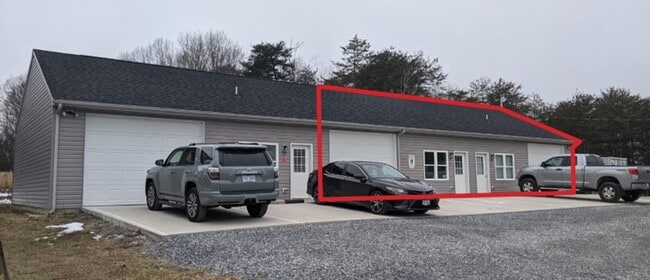
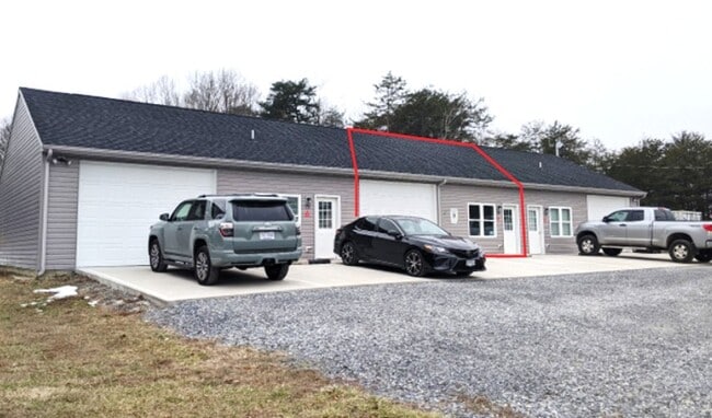
77 Nixon Ln
21C-11-2
NIXON COMMERCIAL CENTER - LOT 2
Commercialnec
Campbell
BHCC
Virginia
B and X Area of moderate flood hazard, usually the area between the limits of the 100-year and 500-year floods.
2
2025
3.65 AC
2025
Lynchburg
020403
Other Market Areas
2,400 SF
Lynchburg, VA
NEARBY LISTINGS FOR SALE OR LEASE
DEMOGRAPHICS near 77 Nixon Ln
1 mile
3 mile
5 mile
2025 Total Population
3,396
24,205
53,465
2030 Population
3,414
24,165
53,894
Pop Growth 2025-2030
+ 0.53%
(0.17%)
+ 0.80%
Average Age
40
39
39
2025 Total Households
1,413
10,199
21,800
HH Growth 2025-2030
+ 0.50%
(0.15%)
+ 0.79%
Median Household Inc
$59,120
$63,658
$66,753
Avg Household Size
2.40
2.30
2.30
2025 Avg HH Vehicles
2.00
2.00
2.00
Median Home Value
$254,379
$252,012
$259,338
Median Year Built
1983
1983
1988
Nearby Places
Map Layers
Map Styles
 Street
 Aerial
Layers
 Traffic
 Biking
Places
Listings with unknown addresses are not visible on the map
- Restaurants
- Banks
- Shops
- Fitness
- Groceries
PUBLIC TRANSPORTATION
AIRPORT
Lynchburg Regional/Preston Glenn Field
Drive
Walk
Distance
Lynchburg Regional/Preston Glenn Field
7 min
3.3 mi
Freight Ports
Virginia Port Authority - Richmond
Drive
Walk
Distance
Virginia Port Authority - Richmond
157 min
116.8 mi
SALE & LEASE HISTORY
LISTING DATE
SALE/LEASE

Jul 11, 2025
For Lease
Feb 01, 2022
For Lease
Nearby Properties
Address
Land Use
TOTAL SIZE
Lot Size
Zoning
Address
Land Use
TOTAL SIZE
Lot Size
Zoning
22.70 AC
Address
Land Use
TOTAL SIZE
Lot Size
Zoning
912 SF
52.88 AC
BGC
Address
Land Use
TOTAL SIZE
Lot Size
Zoning
4,672 SF
905.07 AC
BHC
Address
Land Use
TOTAL SIZE
Lot Size
Zoning
36,168 SF
7.96 AC
BGC
Address
Land Use
TOTAL SIZE
Lot Size
Zoning
9,508 SF
8.54 AC
RMF
Address
Land Use
TOTAL SIZE
Lot Size
Zoning
1,120 SF
16.81 AC
RMF
Address
Land Use
TOTAL SIZE
Lot Size
Zoning
3,478 SF
13.10 AC
RMFC
Address
Land Use
TOTAL SIZE
Lot Size
Zoning
95,792 SF
3.28 AC
Address
Land Use
TOTAL SIZE
Lot Size
Zoning
22,170 SF
18.84 AC
BGC
Address
Land Use
TOTAL SIZE
Lot Size
Zoning
214,400 SF
98.14 AC
Address
Land Use
TOTAL SIZE
Lot Size
Zoning
23,633 SF
6.36 AC
RSF
Address
Land Use
TOTAL SIZE
Lot Size
Zoning
3,199 SF
1.36 AC
R1
Address
Land Use
TOTAL SIZE
Lot Size
Zoning
19,200 SF
17.13 AC
IG
Address
Land Use
TOTAL SIZE
Lot Size
Zoning
41,808 SF
12.16 AC
RSF
Address
Land Use
TOTAL SIZE
Lot Size
Zoning
95,130 SF
17.79 AC
090501
Address
Land Use
TOTAL SIZE
Lot Size
Zoning
22,928 SF
13.84 AC
Address
Land Use
TOTAL SIZE
Lot Size
Zoning
41,412 SF
5.87 AC
BGC
Address
Land Use
TOTAL SIZE
Lot Size
Zoning
2,695 SF
8.43 AC
BGC
Address
Land Use
TOTAL SIZE
Lot Size
Zoning
27,915 SF
28.48 AC
Address
Land Use
TOTAL SIZE
Lot Size
Zoning
41,264 SF
2.33 AC
BGC
Address
Land Use
TOTAL SIZE
Lot Size
Zoning
16,217 SF
9.44 AC
BGC
Address
Land Use
TOTAL SIZE
Lot Size
Zoning
54,495 SF
0.38 AC
Address
Land Use
TOTAL SIZE
Lot Size
Zoning
40,674 SF
0.35 AC
Address
Land Use
TOTAL SIZE
Lot Size
Zoning
904 SF
1.92 AC
B3
Address
Land Use
TOTAL SIZE
Lot Size
Zoning
30,232 SF
0.26 AC
Address
Land Use
TOTAL SIZE
Lot Size
Zoning
29,820 SF
0.26 AC
Address
Land Use
TOTAL SIZE
Lot Size
Zoning
6,696 SF
4.94 AC
RMF
Address
Land Use
TOTAL SIZE
Lot Size
Zoning
46,133 SF
4.36 AC
B5R4
Address
Land Use
TOTAL SIZE
Lot Size
Zoning
91,632 SF
18.28 AC
Address
Land Use
TOTAL SIZE
Lot Size
Zoning
27,684 SF
0.25 AC
The World's #1 Commercial Real Estate Marketplace
Connect with us
© 2026 CoStar Group
The information above has been obtained from sources believed reliable. While we do not doubt its accuracy we have not verified it and make no guarantee, warranty or representation about it. It is your responsibility to independently confirm its accuracy and completeness. Any projections, opinions, assumptions, or estimates used are for example only and do not represent the current or future performance of the property. The value of this transaction to you depends on tax and other factors which should be evaluated by your tax, financial, and legal advisors. You and your advisors should conduct a careful, independent investigation of the property to determine to your satisfaction the suitability of the property for your needs.