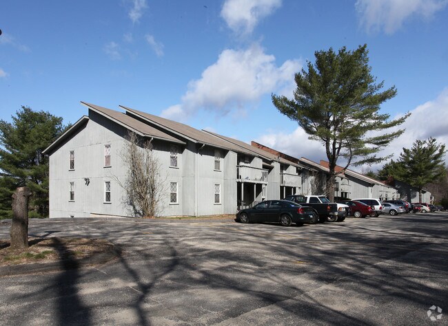
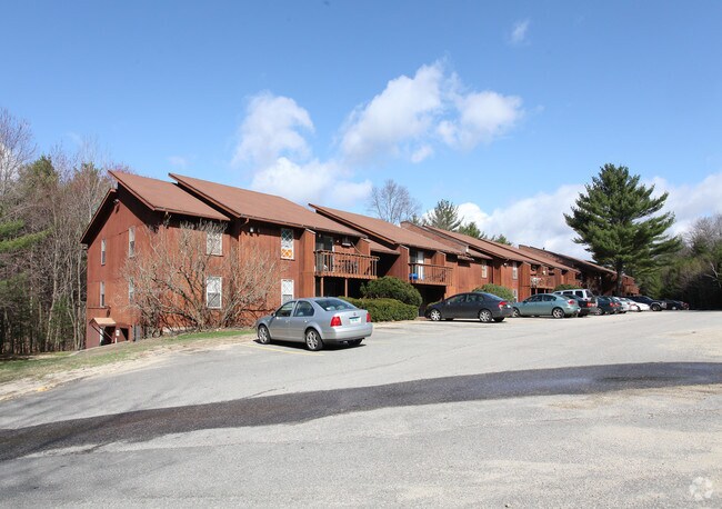
Property Record
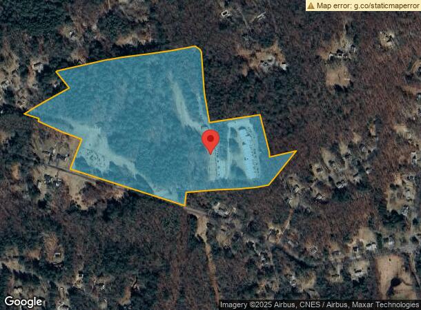
70 Pinney Hill Rd, Willington, CT 06279
NEARBY LISTINGS FOR SALE OR LEASE
-
-
View all Willington listings for sale on LoopNet.com
Property Detail
70 Pinney Hill Rd
Hartford-West Hartford-East Hartford, CT
Tolland
WILL-000000-000000-076700
Connecticut
Apartment
56-0
2025
38.80 AC
2025
Mansfield/Tolland/Willington
840100
Hartford
113,904 SF
DEMOGRAPHICS near 70 Pinney Hill Rd
1 Mile
3 Mile
5 Mile
2024 Total Population
1,509
9,792
35,360
2029 Population
1,524
9,853
35,224
Pop Growth 2024-2029
+ 0.99%
+ 0.62%
(0.38%)
Average Age
40
38
33
2024 Total Households
676
3,732
9,201
HH Growth 2024-2029
+ 0.89%
+ 0.40%
(0.49%)
Median Household Inc
$71,301
$44,867
$64,950
Avg Household Size
2.10
2.30
2.40
2024 Avg HH Vehicles
2.00
2.00
2.00
Median Home Value
$273,408
$267,955
$298,109
Median Year Built
1974
1975
1978
Nearby Places
Map Layers
Map Styles
 Street
 Aerial
- Restaurants
- Banks
- Shops
- Fitness
- Groceries
PUBLIC TRANSPORTATION
AIRPORT
Bradley International
DRIVE
WALK
Distance
Bradley International
60 min
33.2 mi
Worcester Regional
DRIVE
WALK
Distance
Worcester Regional
67 min
44.9 mi
Freight Ports
Port of New Haven
DRIVE
WALK
Distance
Port of New Haven
83 min
61.7 mi
Nearby Properties
Address
Land Use
TOTAL SIZE
Lot Size
Zoning
Address
Land Use
TOTAL SIZE
Lot Size
Zoning
168,410 SF
100.15 AC
RDD
Address
Land Use
TOTAL SIZE
Lot Size
Zoning
23.33 AC
PB3
Address
Land Use
TOTAL SIZE
Lot Size
Zoning
9.48 AC
DMR
Address
Land Use
TOTAL SIZE
Lot Size
Zoning
78,314 SF
62.05 AC
R80
Address
Land Use
TOTAL SIZE
Lot Size
Zoning
23 AC
RAR90
Address
Land Use
TOTAL SIZE
Lot Size
Zoning
75,689 SF
20 AC
R80
Address
Land Use
TOTAL SIZE
Lot Size
Zoning
63,016 SF
8.60 AC
R80
Address
Land Use
TOTAL SIZE
Lot Size
Zoning
59.01 AC
RDD
Address
Land Use
TOTAL SIZE
Lot Size
Zoning
61,155 SF
34 AC
R80
Address
Land Use
TOTAL SIZE
Lot Size
Zoning
38,376 SF
Address
Land Use
TOTAL SIZE
Lot Size
Zoning
38,103 SF
8.80 AC
RAR90
Address
Land Use
TOTAL SIZE
Lot Size
Zoning
30,480 SF
Address
Land Use
TOTAL SIZE
Lot Size
Zoning
29,696 SF
Address
Land Use
TOTAL SIZE
Lot Size
Zoning
13.47 AC
RAR90
Address
Land Use
TOTAL SIZE
Lot Size
Zoning
28,401 SF
8 AC
R80
Address
Land Use
TOTAL SIZE
Lot Size
Zoning
31,016 SF
23 AC
R80
Address
Land Use
TOTAL SIZE
Lot Size
Zoning
33,328 SF
17.48 AC
R80
Address
Land Use
TOTAL SIZE
Lot Size
Zoning
1,352 SF
50.51 AC
RAR90
Address
Land Use
TOTAL SIZE
Lot Size
Zoning
38,054 SF
35.50 AC
R80
Address
Land Use
TOTAL SIZE
Lot Size
Zoning
22.55 AC
RAR90
Address
Land Use
TOTAL SIZE
Lot Size
Zoning
14.05 AC
DMR
Address
Land Use
TOTAL SIZE
Lot Size
Zoning
9.05 AC
TCZ
Address
Land Use
TOTAL SIZE
Lot Size
Zoning
10,728 SF
39.68 AC
RDD
Address
Land Use
TOTAL SIZE
Lot Size
Zoning
13,426 SF
4.13 AC
R80
Address
Land Use
TOTAL SIZE
Lot Size
Zoning
63.40 AC
Address
Land Use
TOTAL SIZE
Lot Size
Zoning
37,437 SF
4.96 AC
PB3
Address
Land Use
TOTAL SIZE
Lot Size
Zoning
1,200 SF
108 AC
RDD
Address
Land Use
TOTAL SIZE
Lot Size
Zoning
10,107 SF
2.55 AC
PO1
Address
Land Use
TOTAL SIZE
Lot Size
Zoning
1,952 SF
56 AC
R80
The World's #1 Commercial Real Estate Marketplace
Connect with us
© 2026 CoStar Group
The information above has been obtained from sources believed reliable. While we do not doubt its accuracy we have not verified it and make no guarantee, warranty or representation about it. It is your responsibility to independently confirm its accuracy and completeness. Any projections, opinions, assumptions, or estimates used are for example only and do not represent the current or future performance of the property. The value of this transaction to you depends on tax and other factors which should be evaluated by your tax, financial, and legal advisors. You and your advisors should conduct a careful, independent investigation of the property to determine to your satisfaction the suitability of the property for your needs.