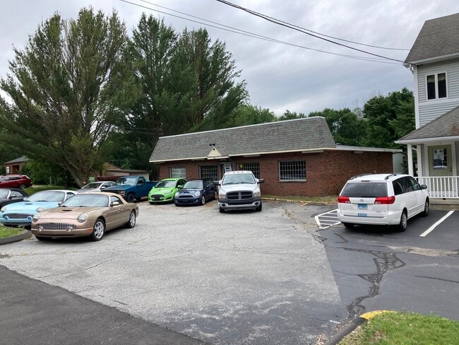
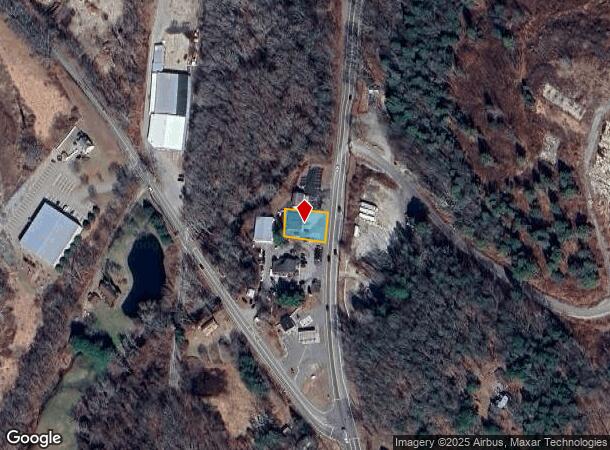
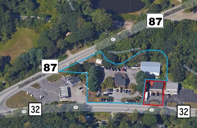
Property Record
70 Route 32, North Franklin, CT 06254
NEARBY LISTINGS FOR SALE OR LEASE
Property Detail
70 Route 32
Storebuilding
New London
X
Connecticut
09011C0184G
0.10 AC
2025
NE New London/Norwich
2025
Hartford
712100
Norwich-New London, CT
1,848 SF
FRAN-000045-000000-000054
DEMOGRAPHICS near 70 Route 32
1 Mile
3 Mile
5 Mile
2024 Total Population
893
6,866
42,434
2029 Population
876
6,776
42,225
Pop Growth 2024-2029
(1.90%)
(1.31%)
(0.49%)
Average Age
43
44
41
2024 Total Households
397
2,809
17,396
HH Growth 2024-2029
(2.02%)
(1.53%)
(0.52%)
Median Household Inc
$93,359
$99,077
$65,077
Avg Household Size
2.20
2.40
2.30
2024 Avg HH Vehicles
2.00
2.00
2.00
Median Home Value
$251,785
$246,208
$215,968
Median Year Built
1975
1967
1957
Nearby Places
Map Layers
Map Styles
 Street
 Aerial
- Restaurants
- Banks
- Shops
- Fitness
- Groceries
SALE & LEASE HISTORY
LISTING DATE
SALE/LEASE

Jul 01, 2021
For Sale
Nearby Properties
Address
Land Use
TOTAL SIZE
Lot Size
Zoning
Address
Land Use
TOTAL SIZE
Lot Size
Zoning
179,652 SF
16.82 AC
PC
Address
Land Use
TOTAL SIZE
Lot Size
Zoning
4.18 AC
R20
Address
Land Use
TOTAL SIZE
Lot Size
Zoning
2,544 SF
184.20 AC
R-2
Address
Land Use
TOTAL SIZE
Lot Size
Zoning
41,621 SF
47.24 AC
BP/R40
Address
Land Use
TOTAL SIZE
Lot Size
Zoning
11,510 SF
19.23 AC
BP/R40
Address
Land Use
TOTAL SIZE
Lot Size
Zoning
136,074 SF
8.51 AC
BP
Address
Land Use
TOTAL SIZE
Lot Size
Zoning
7.78 AC
BP
Address
Land Use
TOTAL SIZE
Lot Size
Zoning
3.85 AC
GC
Address
Land Use
TOTAL SIZE
Lot Size
Zoning
162,122 SF
8.48 AC
BP
Address
Land Use
TOTAL SIZE
Lot Size
Zoning
44,294 SF
5.18 AC
BP
Address
Land Use
TOTAL SIZE
Lot Size
Zoning
219,698 SF
14 AC
BP
Address
Land Use
TOTAL SIZE
Lot Size
Zoning
61,418 SF
6.37 AC
R-2
Address
Land Use
TOTAL SIZE
Lot Size
Zoning
26.46 AC
BP
Address
Land Use
TOTAL SIZE
Lot Size
Zoning
73,470 SF
13.11 AC
BP
Address
Land Use
TOTAL SIZE
Lot Size
Zoning
50,833 SF
3.61 AC
BP
Address
Land Use
TOTAL SIZE
Lot Size
Zoning
213,280 SF
25.58 AC
BP
Address
Land Use
TOTAL SIZE
Lot Size
Zoning
11.87 AC
C-2
Address
Land Use
TOTAL SIZE
Lot Size
Zoning
17,424 SF
14.07 AC
IND
Address
Land Use
TOTAL SIZE
Lot Size
Zoning
151.60 AC
ROS
Address
Land Use
TOTAL SIZE
Lot Size
Zoning
70,411 SF
2.31 AC
GC
Address
Land Use
TOTAL SIZE
Lot Size
Zoning
49,378 SF
6.34 AC
BP
Address
Land Use
TOTAL SIZE
Lot Size
Zoning
136,000 SF
11.63 AC
BP
Address
Land Use
TOTAL SIZE
Lot Size
Zoning
43,306 SF
2.70 AC
NC
Address
Land Use
TOTAL SIZE
Lot Size
Zoning
41,250 SF
7.96 AC
BP
Address
Land Use
TOTAL SIZE
Lot Size
Zoning
9.83 AC
BP
Address
Land Use
TOTAL SIZE
Lot Size
Zoning
46,762 SF
8.91 AC
R40/R2
Address
Land Use
TOTAL SIZE
Lot Size
Zoning
26.01 AC
ROS
Address
Land Use
TOTAL SIZE
Lot Size
Zoning
7,200 SF
75 AC
ROS
Address
Land Use
TOTAL SIZE
Lot Size
Zoning
96,654 SF
5.50 AC
BP
Address
Land Use
TOTAL SIZE
Lot Size
Zoning
4.06 AC
CD
The World's #1 Commercial Real Estate Marketplace
Connect with us
© 2025 CoStar Group
The information above has been obtained from sources believed reliable. While we do not doubt its accuracy we have not verified it and make no guarantee, warranty or representation about it. It is your responsibility to independently confirm its accuracy and completeness. Any projections, opinions, assumptions, or estimates used are for example only and do not represent the current or future performance of the property. The value of this transaction to you depends on tax and other factors which should be evaluated by your tax, financial, and legal advisors. You and your advisors should conduct a careful, independent investigation of the property to determine to your satisfaction the suitability of the property for your needs.