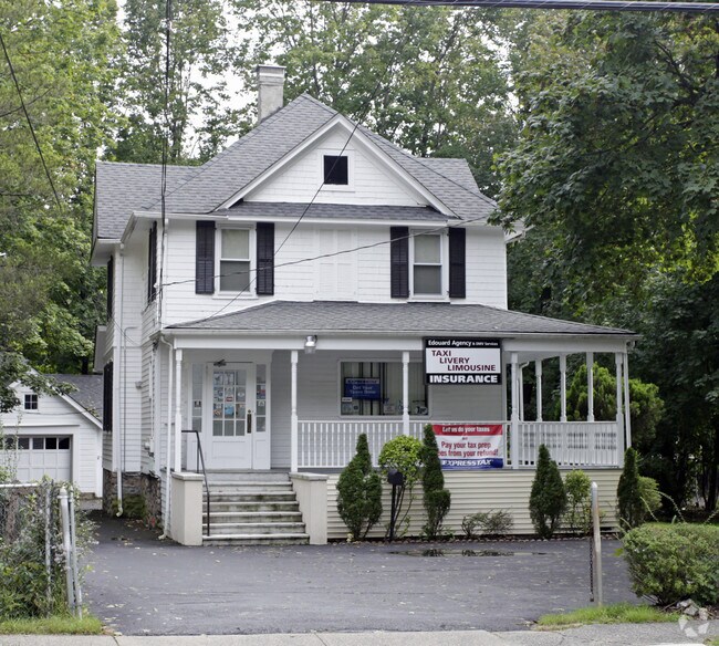
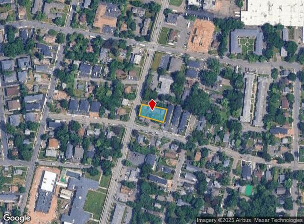
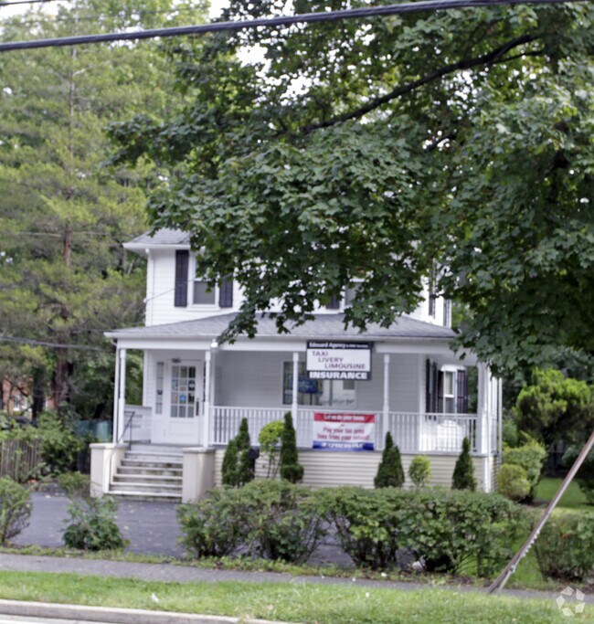
Property Record
70 S Main St S, Spring Valley, NY 10977
NEARBY LISTINGS FOR SALE OR LEASE
Property Detail
70 S Main St S
392605-057-063-0001-004-000-0000
Rockland
Commercialnec
New York
X
4.0
36087C0156G
0.26 AC
2023
Ramapo
2024
Northern New Jersey
012403
New York-Jersey City-White Plains, NY-NJ
2,550 SF
DEMOGRAPHICS near 70 S Main St S
1 Mile
3 Mile
5 Mile
2024 Total Population
30,666
143,661
247,997
2029 Population
30,343
142,608
247,329
Pop Growth 2024-2029
(1.05%)
(0.73%)
(0.27%)
Average Age
31
32
36
2024 Total Households
7,858
36,627
71,889
HH Growth 2024-2029
(1.01%)
(0.76%)
(0.22%)
Median Household Inc
$57,471
$79,972
$104,137
Avg Household Size
3.60
3.60
3.30
2024 Avg HH Vehicles
1.00
2.00
2.00
Median Home Value
$406,085
$565,584
$626,329
Median Year Built
1976
1974
1971
Nearby Places
- Restaurants
- Banks
- Shops
- Fitness
- Groceries
PUBLIC TRANSPORTATION
COMMUTER RAIL
Spring Valley (Pascack Valley Line - NJ Transit Commuter Rail (NJ Transit))
DRIVE
WALK
Distance
Spring Valley (Pascack Valley Line - NJ Transit Commuter Rail (NJ Transit))
1 min
8 min
0.5 mi
Nanuet (Pascack Valley Line - NJ Transit Commuter Rail (NJ Transit))
DRIVE
WALK
Distance
Nanuet (Pascack Valley Line - NJ Transit Commuter Rail (NJ Transit))
5 min
2.8 mi
AIRPORT
Westchester County
DRIVE
WALK
Distance
Westchester County
35 min
24.9 mi
LaGuardia
DRIVE
WALK
Distance
LaGuardia
50 min
33.2 mi
New York Stewart International
DRIVE
WALK
Distance
New York Stewart International
55 min
41.6 mi
Freight Ports
NY - Red Hook Container Terminal
DRIVE
WALK
Distance
NY - Red Hook Container Terminal
56 min
36.4 mi
Nearby Properties
Address
Land Use
TOTAL SIZE
Lot Size
Zoning
Address
Land Use
TOTAL SIZE
Lot Size
Zoning
402,385 SF
23.10 AC
LI
Address
Land Use
TOTAL SIZE
Lot Size
Zoning
63,621 SF
180.20 AC
LI
Address
Land Use
TOTAL SIZE
Lot Size
Zoning
37,600 SF
31.41 AC
Address
Land Use
TOTAL SIZE
Lot Size
Zoning
609,540 SF
174.09 AC
R-50
Address
Land Use
TOTAL SIZE
Lot Size
Zoning
116,650 SF
39.20 AC
05
Address
Land Use
TOTAL SIZE
Lot Size
Zoning
152,854 SF
18.75 AC
RS
Address
Land Use
TOTAL SIZE
Lot Size
Zoning
270,962 SF
21.80 AC
CS
Address
Land Use
TOTAL SIZE
Lot Size
Zoning
67,962 SF
8.30 AC
02 - SINGL
Address
Land Use
TOTAL SIZE
Lot Size
Zoning
345,670 SF
49.40 AC
Address
Land Use
TOTAL SIZE
Lot Size
Zoning
247,496 SF
24.20 AC
Address
Land Use
TOTAL SIZE
Lot Size
Zoning
208,628 SF
11.95 AC
Address
Land Use
TOTAL SIZE
Lot Size
Zoning
2,220 SF
15.10 AC
02 - SINGL
Address
Land Use
TOTAL SIZE
Lot Size
Zoning
129,957 SF
21.90 AC
Address
Land Use
TOTAL SIZE
Lot Size
Zoning
95,890 SF
60 AC
Address
Land Use
TOTAL SIZE
Lot Size
Zoning
70,527 SF
10.20 AC
RSH
Address
Land Use
TOTAL SIZE
Lot Size
Zoning
64,784 SF
14.30 AC
RS
Address
Land Use
TOTAL SIZE
Lot Size
Zoning
246,340 SF
14.91 AC
LI
Address
Land Use
TOTAL SIZE
Lot Size
Zoning
117,950 SF
11.13 AC
05
Address
Land Use
TOTAL SIZE
Lot Size
Zoning
141,846 SF
12.81 AC
05
Address
Land Use
TOTAL SIZE
Lot Size
Zoning
275,724 SF
40 AC
R1
Address
Land Use
TOTAL SIZE
Lot Size
Zoning
4,492 SF
14.50 AC
Address
Land Use
TOTAL SIZE
Lot Size
Zoning
64,024 SF
7.30 AC
Address
Land Use
TOTAL SIZE
Lot Size
Zoning
101,628 SF
9.23 AC
05
Address
Land Use
TOTAL SIZE
Lot Size
Zoning
38,056 SF
21.21 AC
R-15C
Address
Land Use
TOTAL SIZE
Lot Size
Zoning
78,895 SF
18.20 AC
Address
Land Use
TOTAL SIZE
Lot Size
Zoning
1,547 SF
6.60 AC
Address
Land Use
TOTAL SIZE
Lot Size
Zoning
125,097 SF
4.60 AC
05
Address
Land Use
TOTAL SIZE
Lot Size
Zoning
82,307 SF
4.30 AC
LI
Address
Land Use
TOTAL SIZE
Lot Size
Zoning
121,674 SF
11.53 AC
Address
Land Use
TOTAL SIZE
Lot Size
Zoning
1,656 SF
20 AC
02 - SINGL
The World's #1 Commercial Real Estate Marketplace
Connect with us
© 2025 CoStar Group
The information above has been obtained from sources believed reliable. While we do not doubt its accuracy we have not verified it and make no guarantee, warranty or representation about it. It is your responsibility to independently confirm its accuracy and completeness. Any projections, opinions, assumptions, or estimates used are for example only and do not represent the current or future performance of the property. The value of this transaction to you depends on tax and other factors which should be evaluated by your tax, financial, and legal advisors. You and your advisors should conduct a careful, independent investigation of the property to determine to your satisfaction the suitability of the property for your needs.