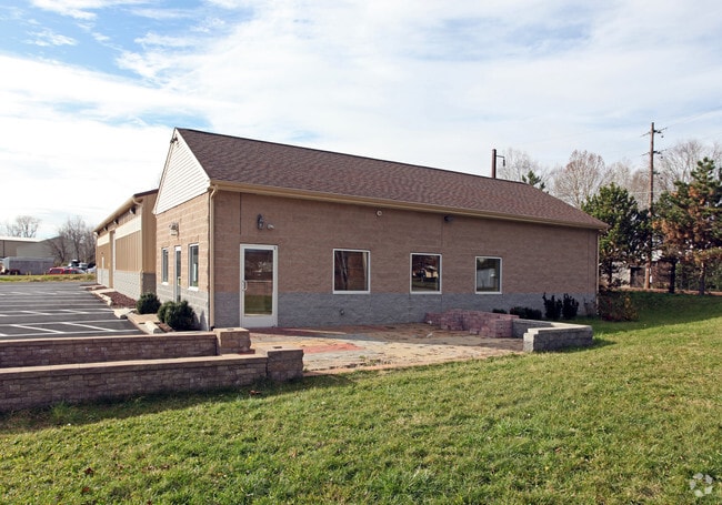
Property Record
70 S Sand Rd, Doylestown, PA 18901


NEARBY LISTINGS FOR SALE OR LEASE
Property Detail
70 S Sand Rd
Philadelphia-Camden-Wilmington, PA-NJ-DE-MD
Bodden Plan
25-002-207-001
1AC LOT 1 BODDEN PLAN 143 ON SAND HILL RD
Multipleuses
Bucks
X
Pennsylvania
42017C0287K
1
2024
1 AC
2025
Bucks
104800
Philadelphia
900 SF
DEMOGRAPHICS near 70 S Sand Rd
1 Mile
3 Mile
5 Mile
2024 Total Population
4,754
35,086
105,086
2029 Population
4,738
35,034
105,617
Pop Growth 2024-2029
(0.34%)
(0.15%)
+ 0.51%
Average Age
42
43
43
2024 Total Households
1,679
12,843
38,739
HH Growth 2024-2029
(0.42%)
(0.11%)
+ 0.56%
Median Household Inc
$139,873
$125,009
$120,704
Avg Household Size
2.70
2.60
2.60
2024 Avg HH Vehicles
2.00
2.00
2.00
Median Home Value
$429,232
$455,926
$460,525
Median Year Built
1973
1981
1983
Nearby Places
Map Layers
Map Styles
 Street
 Aerial
- Restaurants
- Banks
- Shops
- Fitness
- Groceries
PUBLIC TRANSPORTATION
COMMUTER RAIL
New Britain (R5 - Southeastern Pennsylvania Transportation Authority Regional Rail (SEPTA Regional Rail))
DRIVE
WALK
Distance
New Britain (R5 - Southeastern Pennsylvania Transportation Authority Regional Rail (SEPTA Regional Rail))
3 min
14 min
0.7 mi
Chalfont (R5 - Southeastern Pennsylvania Transportation Authority Regional Rail (SEPTA Regional Rail))
DRIVE
WALK
Distance
Chalfont (R5 - Southeastern Pennsylvania Transportation Authority Regional Rail (SEPTA Regional Rail))
5 min
1.7 mi
AIRPORT
Trenton Mercer
DRIVE
WALK
Distance
Trenton Mercer
47 min
26.3 mi
Lehigh Valley International
DRIVE
WALK
Distance
Lehigh Valley International
62 min
36.0 mi
Philadelphia International
DRIVE
WALK
Distance
Philadelphia International
69 min
39.1 mi
Freight Ports
Port of Philadelphia
DRIVE
WALK
Distance
Port of Philadelphia
50 min
27.8 mi
Nearby Properties
Address
Land Use
TOTAL SIZE
Lot Size
Zoning
Address
Land Use
TOTAL SIZE
Lot Size
Zoning
72,937 SF
42.19 AC
CR
Address
Land Use
TOTAL SIZE
Lot Size
Zoning
8,120 SF
56.80 AC
C3
Address
Land Use
TOTAL SIZE
Lot Size
Zoning
30,939 SF
28.69 AC
I
Address
Land Use
TOTAL SIZE
Lot Size
Zoning
33,337 SF
14.88 AC
C3
Address
Land Use
TOTAL SIZE
Lot Size
Zoning
144,419 SF
21.13 AC
C2
Address
Land Use
TOTAL SIZE
Lot Size
Zoning
344,604 SF
6.95 AC
LI
Address
Land Use
TOTAL SIZE
Lot Size
Zoning
12,150 SF
5.60 AC
C
Address
Land Use
TOTAL SIZE
Lot Size
Zoning
3,105 SF
1.96 AC
C
Address
Land Use
TOTAL SIZE
Lot Size
Zoning
77,964 SF
9.79 AC
R3
Address
Land Use
TOTAL SIZE
Lot Size
Zoning
54,090 SF
7.25 AC
R4
Address
Land Use
TOTAL SIZE
Lot Size
Zoning
346,977 SF
45.25 AC
I
Address
Land Use
TOTAL SIZE
Lot Size
Zoning
11,159 SF
304.23 AC
Q
Address
Land Use
TOTAL SIZE
Lot Size
Zoning
70,392 SF
2.47 AC
C3
Address
Land Use
TOTAL SIZE
Lot Size
Zoning
68,700 SF
8.41 AC
C3
Address
Land Use
TOTAL SIZE
Lot Size
Zoning
60,880 SF
4 AC
CP
Address
Land Use
TOTAL SIZE
Lot Size
Zoning
96,140 SF
26.70 AC
I
Address
Land Use
TOTAL SIZE
Lot Size
Zoning
24,195 SF
1.50 AC
R2
Address
Land Use
TOTAL SIZE
Lot Size
Zoning
42,587 SF
12.09 AC
R1
Address
Land Use
TOTAL SIZE
Lot Size
Zoning
50,522 SF
5.72 AC
C3
Address
Land Use
TOTAL SIZE
Lot Size
Zoning
52,976 SF
5.80 AC
C-2
Address
Land Use
TOTAL SIZE
Lot Size
Zoning
32,112 SF
5.53 AC
C3
Address
Land Use
TOTAL SIZE
Lot Size
Zoning
20,478 SF
10.78 AC
PRD
Address
Land Use
TOTAL SIZE
Lot Size
Zoning
10,000 SF
8.89 AC
PRD
Address
Land Use
TOTAL SIZE
Lot Size
Zoning
13.69 AC
LI
Address
Land Use
TOTAL SIZE
Lot Size
Zoning
39,365 SF
6.31 AC
LI
Address
Land Use
TOTAL SIZE
Lot Size
Zoning
82,100 SF
9.09 AC
LI
Address
Land Use
TOTAL SIZE
Lot Size
Zoning
27,178 SF
3.59 AC
C1
Address
Land Use
TOTAL SIZE
Lot Size
Zoning
1,086 SF
5.75 AC
C1
Address
Land Use
TOTAL SIZE
Lot Size
Zoning
70,051 SF
2.50 AC
LI
Address
Land Use
TOTAL SIZE
Lot Size
Zoning
59,874 SF
1.81 AC
SC
The World's #1 Commercial Real Estate Marketplace
Connect with us
© 2025 CoStar Group
The information above has been obtained from sources believed reliable. While we do not doubt its accuracy we have not verified it and make no guarantee, warranty or representation about it. It is your responsibility to independently confirm its accuracy and completeness. Any projections, opinions, assumptions, or estimates used are for example only and do not represent the current or future performance of the property. The value of this transaction to you depends on tax and other factors which should be evaluated by your tax, financial, and legal advisors. You and your advisors should conduct a careful, independent investigation of the property to determine to your satisfaction the suitability of the property for your needs.