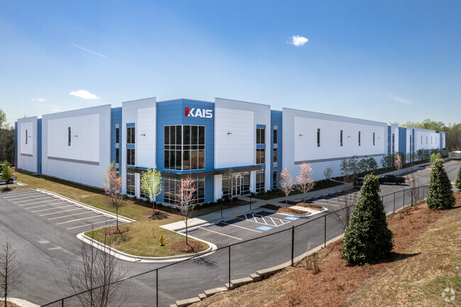
Property Record
70 Sl White Blvd, Lagrange, GA 30241

Property Detail
70 Sl White Blvd
0394 000044E
70 SL WHITE BLVD/CALLAWAY CHURCH RD
Industrialgeneral
TROUP
16- CP-GI
Georgia
2025
20.67 AC
2025
Troup County
960600
Columbus GA
190,149 SF
LaGrange, GA-AL
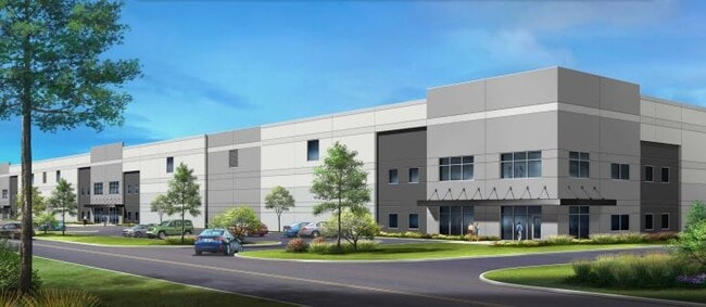
NEARBY LISTINGS FOR SALE OR LEASE
DEMOGRAPHICS near 70 Sl White Blvd
1 mile
3 mile
5 mile
2025 Total Population
202
14,450
35,835
2030 Population
214
15,105
37,211
Pop Growth 2025-2030
+ 5.94%
+ 4.53%
+ 3.84%
Average Age
40
38
38
2025 Total Households
76
5,542
13,772
HH Growth 2025-2030
+ 6.58%
+ 4.71%
+ 4.04%
Median Household Inc
$77,885
$44,631
$44,733
Avg Household Size
2.60
2.50
2.50
2025 Avg HH Vehicles
2.00
2.00
2.00
Median Home Value
$268,749
$220,105
$198,480
Median Year Built
1996
1991
1982
Nearby Places
Map Layers
Map Styles
 Street
 Aerial
Layers
 Traffic
 Biking
Places
Listings with unknown addresses are not visible on the map
- Restaurants
- Banks
- Shops
- Fitness
- Groceries
SALE & LEASE HISTORY
LISTING DATE
SALE/LEASE

Sep 21, 2022
For Sale
Feb 03, 2022
For Lease
Nearby Properties
Address
Land Use
TOTAL SIZE
Lot Size
Zoning
Address
Land Use
TOTAL SIZE
Lot Size
Zoning
Address
Land Use
TOTAL SIZE
Lot Size
Zoning
28,575 SF
45.67 AC
16- CR-MX
Address
Land Use
TOTAL SIZE
Lot Size
Zoning
117,684 SF
12.61 AC
16- AC-MX
Address
Land Use
TOTAL SIZE
Lot Size
Zoning
277,964 SF
43.40 AC
16- CP-GI
Address
Land Use
TOTAL SIZE
Lot Size
Zoning
25,314 SF
25.48 AC
16- AC-MR
Address
Land Use
TOTAL SIZE
Lot Size
Zoning
845,961 SF
214.16 AC
16- CP-GI
Address
Land Use
TOTAL SIZE
Lot Size
Zoning
Address
Land Use
TOTAL SIZE
Lot Size
Zoning
2,152 SF
21.70 AC
16- CR-MR
Address
Land Use
TOTAL SIZE
Lot Size
Zoning
92,907 SF
41.61 AC
16- CP-GI
Address
Land Use
TOTAL SIZE
Lot Size
Zoning
141,328 SF
7.18 AC
16- TN-MX
Address
Land Use
TOTAL SIZE
Lot Size
Zoning
136,640 SF
41.91 AC
16- CP-GI
Address
Land Use
TOTAL SIZE
Lot Size
Zoning
121,889 SF
8.99 AC
16- CR-MX
Address
Land Use
TOTAL SIZE
Lot Size
Zoning
3,798 SF
22.81 AC
16- CR-MR
Address
Land Use
TOTAL SIZE
Lot Size
Zoning
8,448 SF
25.78 AC
16- CR-MX
Address
Land Use
TOTAL SIZE
Lot Size
Zoning
56,620 SF
5.22 AC
16- CR-MX
Address
Land Use
TOTAL SIZE
Lot Size
Zoning
Address
Land Use
TOTAL SIZE
Lot Size
Zoning
251,428 SF
10.80 AC
16- CP-GI
Address
Land Use
TOTAL SIZE
Lot Size
Zoning
22,600 SF
15.57 AC
16- CR-MX
Address
Land Use
TOTAL SIZE
Lot Size
Zoning
3,433 SF
19.65 AC
16- CR-MR
Address
Land Use
TOTAL SIZE
Lot Size
Zoning
202,500 SF
17.55 AC
16- CP-GI
Address
Land Use
TOTAL SIZE
Lot Size
Zoning
26,150 SF
3.28 AC
16- CR-MX
Address
Land Use
TOTAL SIZE
Lot Size
Zoning
34,409 SF
12.40 AC
16- TN-R
Address
Land Use
TOTAL SIZE
Lot Size
Zoning
6,048 SF
6.99 AC
16- CR-MR
Address
Land Use
TOTAL SIZE
Lot Size
Zoning
Address
Land Use
TOTAL SIZE
Lot Size
Zoning
84,400 SF
23.54 AC
16- CP-GI
Address
Land Use
TOTAL SIZE
Lot Size
Zoning
57,494 SF
8.87 AC
16- CP-GB
Address
Land Use
TOTAL SIZE
Lot Size
Zoning
1 AC
16-G-I
Address
Land Use
TOTAL SIZE
Lot Size
Zoning
34,380 SF
59.74 AC
16- CR-MX
Address
Land Use
TOTAL SIZE
Lot Size
Zoning
125,467 SF
35.19 AC
16- CR-MX
The World's #1 Commercial Real Estate Marketplace
Connect with us
© 2026 CoStar Group
The information above has been obtained from sources believed reliable. While we do not doubt its accuracy we have not verified it and make no guarantee, warranty or representation about it. It is your responsibility to independently confirm its accuracy and completeness. Any projections, opinions, assumptions, or estimates used are for example only and do not represent the current or future performance of the property. The value of this transaction to you depends on tax and other factors which should be evaluated by your tax, financial, and legal advisors. You and your advisors should conduct a careful, independent investigation of the property to determine to your satisfaction the suitability of the property for your needs.