Property Record
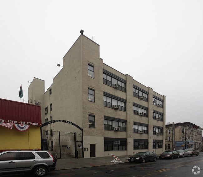
70 Wyckoff Ave, Brooklyn, NY 11237

NEARBY LISTINGS FOR SALE OR LEASE
Property Detail
70 Wyckoff Ave
03221-0031
Kings
Apartment
New York
X
31
3604970208F
0.48 AC
2024
North Brooklyn
2025
Long Island (New York)
044500
New York-Jersey City-White Plains, NY-NJ
62,075 SF
DEMOGRAPHICS near 70 Wyckoff Ave
1 mile
3 mile
5 mile
2024 Total Population
132,979
1,029,204
3,193,080
2029 Population
124,236
967,353
2,993,972
Pop Growth 2024-2029
(6.57%)
(6.01%)
(6.24%)
Average Age
36
37
39
2024 Total Households
48,246
386,901
1,295,709
HH Growth 2024-2029
(7.08%)
(6.42%)
(6.47%)
Median Household Inc
$69,389
$69,965
$81,222
Avg Household Size
2.60
2.50
2.40
2024 Avg HH Vehicles
.00
.00
.00
Median Home Value
$876,156
$838,882
$814,357
Median Year Built
1948
1948
1949
Nearby Places
Map Layers
Map Styles
 Street
 Aerial
Transit
 Traffic
 Biking
Places
Listings with unknown addresses are not visible on the map
- Restaurants
- Banks
- Shops
- Fitness
- Groceries
PUBLIC TRANSPORTATION
TRANSIT/SUBWAY
Dekalb Avenue (L Line) (L - New York MTA Subway (The Subway))
Drive
Walk
Distance
Dekalb Avenue (L Line) (L - New York MTA Subway (The Subway))
0 min
2 min
0.1 mi
Jefferson Street (L - New York MTA Subway (The Subway))
Drive
Walk
Distance
Jefferson Street (L - New York MTA Subway (The Subway))
0 min
3 min
0.2 mi
Myrtle-Wyckoff Avenues (L - New York MTA Subway (The Subway), M - New York MTA Subway (The Subway))
Drive
Walk
Distance
Myrtle-Wyckoff Avenues (L - New York MTA Subway (The Subway), M - New York MTA Subway (The Subway))
2 min
11 min
0.6 mi
Knickerbocker Avenue (M Line) (M - New York MTA Subway (The Subway))
Drive
Walk
Distance
Knickerbocker Avenue (M Line) (M - New York MTA Subway (The Subway))
2 min
12 min
0.6 mi
Central Avenue (M - New York MTA Subway (The Subway))
Drive
Walk
Distance
Central Avenue (M - New York MTA Subway (The Subway))
2 min
12 min
0.7 mi
COMMUTER RAIL
East New York Station (Far Rockaway Branch - Long Island Rail Road, Long Beach Branch - Long Island Rail Road, West Hempstead Branch - Long Island Rail Road)
Drive
Walk
Distance
East New York Station (Far Rockaway Branch - Long Island Rail Road, Long Beach Branch - Long Island Rail Road, West Hempstead Branch - Long Island Rail Road)
8 min
3.1 mi
Nostrand Avenue Station (Far Rockaway Branch - Long Island Rail Road, Hempstead Branch - Long Island Rail Road, Long Beach Branch - Long Island Rail Road, West Hempstead Branch - Long Island Rail Road)
Drive
Walk
Distance
Nostrand Avenue Station (Far Rockaway Branch - Long Island Rail Road, Hempstead Branch - Long Island Rail Road, Long Beach Branch - Long Island Rail Road, West Hempstead Branch - Long Island Rail Road)
10 min
3.3 mi
AIRPORT
LaGuardia
Drive
Walk
Distance
LaGuardia
15 min
6.6 mi
John F Kennedy International
Drive
Walk
Distance
John F Kennedy International
19 min
11.4 mi
Newark Liberty International
Drive
Walk
Distance
Newark Liberty International
32 min
16.9 mi
Freight Ports
NY - Red Hook Container Terminal
Drive
Walk
Distance
NY - Red Hook Container Terminal
14 min
5.8 mi
Nearby Properties
Address
Land Use
TOTAL SIZE
Lot Size
Zoning
Address
Land Use
TOTAL SIZE
Lot Size
Zoning
2,812,739 SF
2.10 AC
C5-3
Address
Land Use
TOTAL SIZE
Lot Size
Zoning
7,058,736 SF
147.61 AC
M3-1
Address
Land Use
TOTAL SIZE
Lot Size
Zoning
445,151 SF
C6-4
Address
Land Use
TOTAL SIZE
Lot Size
Zoning
445,151 SF
C6-4
Address
Land Use
TOTAL SIZE
Lot Size
Zoning
835,231 SF
11.32 AC
R6
Address
Land Use
TOTAL SIZE
Lot Size
Zoning
751,223 SF
2.57 AC
R6
Address
Land Use
TOTAL SIZE
Lot Size
Zoning
512,755 SF
1.19 AC
R6
Address
Land Use
TOTAL SIZE
Lot Size
Zoning
778,063 SF
2.15 AC
R8
Address
Land Use
TOTAL SIZE
Lot Size
Zoning
503,608 SF
1.64 AC
R8
Address
Land Use
TOTAL SIZE
Lot Size
Zoning
777,258 SF
4.67 AC
M3-2
Address
Land Use
TOTAL SIZE
Lot Size
Zoning
582,700 SF
1.20 AC
R8
Address
Land Use
TOTAL SIZE
Lot Size
Zoning
863,800 SF
2.71 AC
M1-4
Address
Land Use
TOTAL SIZE
Lot Size
Zoning
493,889 SF
1.84 AC
R7-3
Address
Land Use
TOTAL SIZE
Lot Size
Zoning
710,746 SF
1.88 AC
C63A
Address
Land Use
TOTAL SIZE
Lot Size
Zoning
264,691 SF
5.17 AC
M1-2
Address
Land Use
TOTAL SIZE
Lot Size
Zoning
1,119,826 SF
2.76 AC
M1-4
Address
Land Use
TOTAL SIZE
Lot Size
Zoning
1,000 SF
210.07 AC
R3-2
Address
Land Use
TOTAL SIZE
Lot Size
Zoning
1,572,198 SF
22.06 AC
M1-2
Address
Land Use
TOTAL SIZE
Lot Size
Zoning
368,870 SF
0.73 AC
R8
Address
Land Use
TOTAL SIZE
Lot Size
Zoning
445,151 SF
C6-4
Address
Land Use
TOTAL SIZE
Lot Size
Zoning
826,915 SF
8.83 AC
M3-1
Address
Land Use
TOTAL SIZE
Lot Size
Zoning
446,763 SF
12.52 AC
R6
Address
Land Use
TOTAL SIZE
Lot Size
Zoning
1,150,500 SF
15.17 AC
R6
Address
Land Use
TOTAL SIZE
Lot Size
Zoning
363,205 SF
1.38 AC
M12R7A
Address
Land Use
TOTAL SIZE
Lot Size
Zoning
894,000 SF
4.14 AC
R6
Address
Land Use
TOTAL SIZE
Lot Size
Zoning
894,000 SF
4.14 AC
R6
Address
Land Use
TOTAL SIZE
Lot Size
Zoning
894,000 SF
4.14 AC
R6
Address
Land Use
TOTAL SIZE
Lot Size
Zoning
894,000 SF
4.14 AC
R6
Address
Land Use
TOTAL SIZE
Lot Size
Zoning
894,000 SF
4.14 AC
R6
Address
Land Use
TOTAL SIZE
Lot Size
Zoning
438,857 SF
0.48 AC
R8
The World's #1 Commercial Real Estate Marketplace
Connect with us
© 2026 CoStar Group
The information above has been obtained from sources believed reliable. While we do not doubt its accuracy we have not verified it and make no guarantee, warranty or representation about it. It is your responsibility to independently confirm its accuracy and completeness. Any projections, opinions, assumptions, or estimates used are for example only and do not represent the current or future performance of the property. The value of this transaction to you depends on tax and other factors which should be evaluated by your tax, financial, and legal advisors. You and your advisors should conduct a careful, independent investigation of the property to determine to your satisfaction the suitability of the property for your needs.