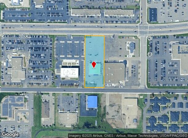
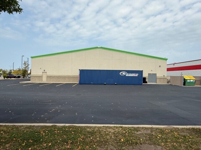
Property Record
700 2Nd St S, Waite Park, MN 56387
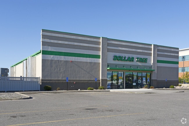
This Property Is For Sale
NEARBY LISTINGS FOR SALE OR LEASE
Property Detail
700 2Nd St S
St. Cloud, MN
Miller Park Plat Two
98.60707.0031
LOT 002 BLK 001 MILLER PARK PLAT TWO SECTION 17 TOWNSHIP 124 RANGE 028 SECTION 17 TOWNSHIP 124 RANGE 028
Wholesaleoutletdiscountstore
Stearns
X
Minnesota
27145C0640E
2
2024
1.81 AC
2025
Stearns County
000502
Minneapolis/St Paul
9,530 SF
DEMOGRAPHICS near 700 2Nd St S
1 Mile
3 Mile
5 Mile
2024 Total Population
7,785
46,281
106,982
2029 Population
8,078
47,970
110,644
Pop Growth 2024-2029
+ 3.76%
+ 3.65%
+ 3.42%
Average Age
39
38
37
2024 Total Households
3,354
19,129
42,394
HH Growth 2024-2029
+ 3.82%
+ 3.74%
+ 3.50%
Median Household Inc
$45,850
$56,414
$55,167
Avg Household Size
2.20
2.30
2.30
2024 Avg HH Vehicles
2.00
2.00
2.00
Median Home Value
$210,888
$185,704
$192,813
Median Year Built
1991
1984
1985
Nearby Places
- Restaurants
- Banks
- Shops
- Fitness
- Groceries
PUBLIC TRANSPORTATION
COMMUTER RAIL
DRIVE
WALK
Distance
11 min
4.8 mi
Nearby Properties
Address
Land Use
TOTAL SIZE
Lot Size
Zoning
Address
Land Use
TOTAL SIZE
Lot Size
Zoning
307,404 SF
105.31 AC
Address
Land Use
TOTAL SIZE
Lot Size
Zoning
38.97 AC
Address
Land Use
TOTAL SIZE
Lot Size
Zoning
639,000 SF
216.67 AC
PUD28
Address
Land Use
TOTAL SIZE
Lot Size
Zoning
113,316 SF
31.99 AC
Address
Land Use
TOTAL SIZE
Lot Size
Zoning
107,306 SF
2.11 AC
C4
Address
Land Use
TOTAL SIZE
Lot Size
Zoning
105,833 SF
4.61 AC
C4
Address
Land Use
TOTAL SIZE
Lot Size
Zoning
52,983 SF
22 AC
Address
Land Use
TOTAL SIZE
Lot Size
Zoning
70,971 SF
11.40 AC
PUD57
Address
Land Use
TOTAL SIZE
Lot Size
Zoning
19.06 AC
Address
Land Use
TOTAL SIZE
Lot Size
Zoning
125,278 SF
11.01 AC
C5
Address
Land Use
TOTAL SIZE
Lot Size
Zoning
344,031 SF
64.88 AC
PUD28
Address
Land Use
TOTAL SIZE
Lot Size
Zoning
628,000 SF
40.51 AC
PUD16
Address
Land Use
TOTAL SIZE
Lot Size
Zoning
115,298 SF
8.50 AC
R5
Address
Land Use
TOTAL SIZE
Lot Size
Zoning
5.34 AC
Address
Land Use
TOTAL SIZE
Lot Size
Zoning
233,354 SF
7.30 AC
R5
Address
Land Use
TOTAL SIZE
Lot Size
Zoning
113,268 SF
12 AC
PUD32
Address
Land Use
TOTAL SIZE
Lot Size
Zoning
19.83 AC
Address
Land Use
TOTAL SIZE
Lot Size
Zoning
146,285 SF
19.10 AC
Address
Land Use
TOTAL SIZE
Lot Size
Zoning
51.70 AC
PL20B2
Address
Land Use
TOTAL SIZE
Lot Size
Zoning
555,652 SF
26.04 AC
PUD16
Address
Land Use
TOTAL SIZE
Lot Size
Zoning
25,608 SF
6.96 AC
R5
Address
Land Use
TOTAL SIZE
Lot Size
Zoning
36,393 SF
6.28 AC
Address
Land Use
TOTAL SIZE
Lot Size
Zoning
83,317 SF
6.43 AC
C5
Address
Land Use
TOTAL SIZE
Lot Size
Zoning
289,470 SF
23 AC
I3
Address
Land Use
TOTAL SIZE
Lot Size
Zoning
44,223 SF
12.31 AC
Address
Land Use
TOTAL SIZE
Lot Size
Zoning
135,964 SF
57.06 AC
PUD28
Address
Land Use
TOTAL SIZE
Lot Size
Zoning
288,861 SF
30.27 AC
I3
Address
Land Use
TOTAL SIZE
Lot Size
Zoning
18,554 SF
8.41 AC
Address
Land Use
TOTAL SIZE
Lot Size
Zoning
165,878 SF
11.17 AC
PUD56
Address
Land Use
TOTAL SIZE
Lot Size
Zoning
7.70 AC
The World's #1 Commercial Real Estate Marketplace
Connect with us
© 2025 CoStar Group
The information above has been obtained from sources believed reliable. While we do not doubt its accuracy we have not verified it and make no guarantee, warranty or representation about it. It is your responsibility to independently confirm its accuracy and completeness. Any projections, opinions, assumptions, or estimates used are for example only and do not represent the current or future performance of the property. The value of this transaction to you depends on tax and other factors which should be evaluated by your tax, financial, and legal advisors. You and your advisors should conduct a careful, independent investigation of the property to determine to your satisfaction the suitability of the property for your needs.