Property Record
700 Cherry Valley Rd, Gilford, NH 03249
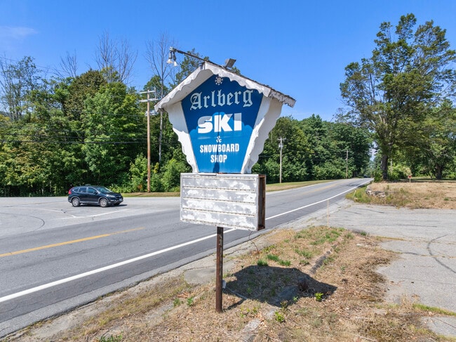
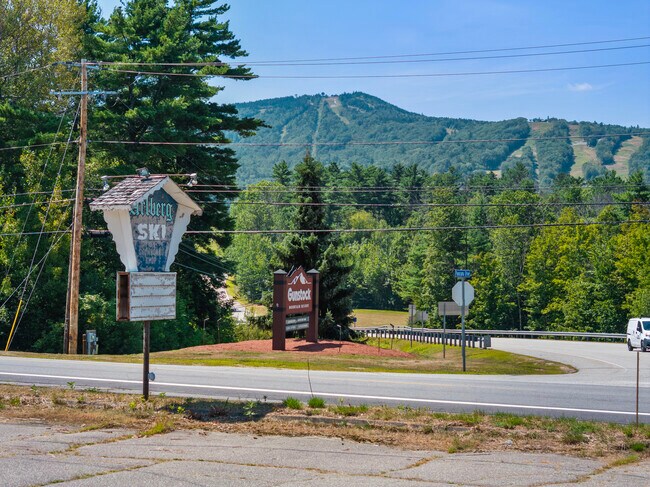
This Property Is For Sale
NEARBY LISTINGS FOR SALE OR LEASE
-
-
View all Gilford listings for sale on LoopNet.com
Property Detail
700 Cherry Valley Rd
GIFL-000254-000072
Belknap
Sfr
New Hampshire
2024
2 AC
2024
Concord/New Hampshire North Area
966403
Other Market Areas
3,208 SF
Laconia, NH
DEMOGRAPHICS near 700 Cherry Valley Rd
1 Mile
3 Mile
5 Mile
2024 Total Population
825
5,502
10,364
2029 Population
848
5,654
10,661
Pop Growth 2024-2029
+ 2.79%
+ 2.76%
+ 2.87%
Average Age
45
48
48
2024 Total Households
336
2,401
4,565
HH Growth 2024-2029
+ 2.68%
+ 2.71%
+ 3.00%
Median Household Inc
$108,433
$113,313
$113,533
Avg Household Size
2.50
2.30
2.20
2024 Avg HH Vehicles
2.00
2.00
2.00
Median Home Value
$406,452
$489,999
$473,167
Median Year Built
1983
1983
1982
Nearby Places
Map Layers
Map Styles
 Street
 Aerial
- Restaurants
- Banks
- Shops
- Fitness
- Groceries
PUBLIC TRANSPORTATION
AIRPORT
Portsmouth International at Pease
DRIVE
WALK
Distance
Portsmouth International at Pease
75 min
48.5 mi
Nearby Properties
Address
Land Use
TOTAL SIZE
Lot Size
Zoning
Address
Land Use
TOTAL SIZE
Lot Size
Zoning
Address
Land Use
TOTAL SIZE
Lot Size
Zoning
26 AC
SFR
Address
Land Use
TOTAL SIZE
Lot Size
Zoning
18.80 AC
SFR
Address
Land Use
TOTAL SIZE
Lot Size
Zoning
85 AC
SFR
Address
Land Use
TOTAL SIZE
Lot Size
Zoning
31 AC
SFR
Address
Land Use
TOTAL SIZE
Lot Size
Zoning
0.92 AC
RC
Address
Land Use
TOTAL SIZE
Lot Size
Zoning
23 AC
SFR
Address
Land Use
TOTAL SIZE
Lot Size
Zoning
99.90 AC
NRR
Address
Land Use
TOTAL SIZE
Lot Size
Zoning
2.50 AC
SFR
Address
Land Use
TOTAL SIZE
Lot Size
Zoning
34 AC
SFR
Address
Land Use
TOTAL SIZE
Lot Size
Zoning
4.50 AC
RC
Address
Land Use
TOTAL SIZE
Lot Size
Zoning
17 AC
RC
Address
Land Use
TOTAL SIZE
Lot Size
Zoning
1 AC
NRR
Address
Land Use
TOTAL SIZE
Lot Size
Zoning
378.13 AC
NRR
Address
Land Use
TOTAL SIZE
Lot Size
Zoning
4.40 AC
SFR
Address
Land Use
TOTAL SIZE
Lot Size
Zoning
5,875 SF
4.80 AC
LR
Address
Land Use
TOTAL SIZE
Lot Size
Zoning
4.81 AC
RC
Address
Land Use
TOTAL SIZE
Lot Size
Zoning
2.65 AC
SFR
Address
Land Use
TOTAL SIZE
Lot Size
Zoning
1,664 SF
6.69 AC
LR-LAK
Address
Land Use
TOTAL SIZE
Lot Size
Zoning
15.13 AC
SFR
Address
Land Use
TOTAL SIZE
Lot Size
Zoning
1.24 AC
SFR
Address
Land Use
TOTAL SIZE
Lot Size
Zoning
0.93 AC
RC
Address
Land Use
TOTAL SIZE
Lot Size
Zoning
0.97 AC
SFR
Address
Land Use
TOTAL SIZE
Lot Size
Zoning
3.19 AC
SFR
Address
Land Use
TOTAL SIZE
Lot Size
Zoning
245.23 AC
RC
Address
Land Use
TOTAL SIZE
Lot Size
Zoning
0.54 AC
RC
Address
Land Use
TOTAL SIZE
Lot Size
Zoning
5.67 AC
RC
Address
Land Use
TOTAL SIZE
Lot Size
Zoning
2,371 SF
1.15 AC
LR-LAK
Address
Land Use
TOTAL SIZE
Lot Size
Zoning
5.56 AC
SFR
Address
Land Use
TOTAL SIZE
Lot Size
Zoning
4,443 SF
0.73 AC
LR-LAK
The World's #1 Commercial Real Estate Marketplace
Connect with us
© 2026 CoStar Group
The information above has been obtained from sources believed reliable. While we do not doubt its accuracy we have not verified it and make no guarantee, warranty or representation about it. It is your responsibility to independently confirm its accuracy and completeness. Any projections, opinions, assumptions, or estimates used are for example only and do not represent the current or future performance of the property. The value of this transaction to you depends on tax and other factors which should be evaluated by your tax, financial, and legal advisors. You and your advisors should conduct a careful, independent investigation of the property to determine to your satisfaction the suitability of the property for your needs.