Property Record
700 Cherry Tree Rd, Upper Chichester, PA 19014
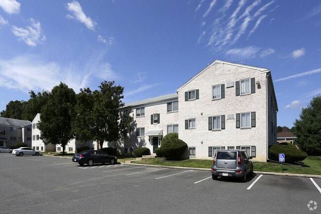


Property Detail
700 Cherry Tree Rd
09-00-00710-06
3-3 STY BLDGS 7.888 ACRES
Apartment
Delaware
B and X Area of moderate flood hazard, usually the area between the limits of the 100-year and 500-year floods.
Pennsylvania
2024
7.89 AC
2025
Lower Delaware County
406801
Philadelphia
23,976 SF
Philadelphia-Camden-Wilmington, PA-NJ-DE-MD
NEARBY LISTINGS FOR SALE OR LEASE
-
-
View all Upper Chichester listings for sale on LoopNet.com
DEMOGRAPHICS near 700 Cherry Tree Rd
1 mile
3 mile
5 mile
2025 Total Population
8,561
74,505
192,686
2030 Population
8,619
75,774
197,081
Pop Growth 2025-2030
+ 0.68%
+ 1.70%
+ 2.28%
Average Age
44
41
42
2025 Total Households
3,419
28,779
74,499
HH Growth 2025-2030
+ 0.76%
+ 1.77%
+ 2.30%
Median Household Inc
$91,893
$84,406
$84,933
Avg Household Size
2.50
2.50
2.50
2025 Avg HH Vehicles
2.00
2.00
2.00
Median Home Value
$338,006
$318,928
$349,720
Median Year Built
1973
1969
1967
Nearby Places
Map Layers
Map Styles
 Street
 Aerial
Transit
 Traffic
 Biking
Places
Listings with unknown addresses are not visible on the map
- Restaurants
- Banks
- Shops
- Fitness
- Groceries
PUBLIC TRANSPORTATION
COMMUTER RAIL
Marcus Hook (R2 - Southeastern Pennsylvania Transportation Authority Regional Rail (SEPTA Regional Rail))
Drive
Walk
Distance
Marcus Hook (R2 - Southeastern Pennsylvania Transportation Authority Regional Rail (SEPTA Regional Rail))
8 min
3.1 mi
Highland Avenue (R2 - Southeastern Pennsylvania Transportation Authority Regional Rail (SEPTA Regional Rail))
Drive
Walk
Distance
Highland Avenue (R2 - Southeastern Pennsylvania Transportation Authority Regional Rail (SEPTA Regional Rail))
8 min
3.5 mi
AIRPORT
Philadelphia International
Drive
Walk
Distance
Philadelphia International
20 min
12.0 mi
Freight Ports
Port of Wilmington, RI
Drive
Walk
Distance
Port of Wilmington, RI
22 min
14.0 mi
Nearby Properties
Address
Land Use
TOTAL SIZE
Lot Size
Zoning
Address
Land Use
TOTAL SIZE
Lot Size
Zoning
141,978 SF
2.11 AC
Address
Land Use
TOTAL SIZE
Lot Size
Zoning
111,606 SF
50 AC
Address
Land Use
TOTAL SIZE
Lot Size
Zoning
36.50 AC
Address
Land Use
TOTAL SIZE
Lot Size
Zoning
164,862 SF
10.70 AC
Address
Land Use
TOTAL SIZE
Lot Size
Zoning
297,333 SF
11.95 AC
NCAP
Address
Land Use
TOTAL SIZE
Lot Size
Zoning
297,108 SF
5.74 AC
NCAP
Address
Land Use
TOTAL SIZE
Lot Size
Zoning
282,932 SF
20.12 AC
NCAP
Address
Land Use
TOTAL SIZE
Lot Size
Zoning
15,880 SF
27.07 AC
Address
Land Use
TOTAL SIZE
Lot Size
Zoning
161,707 SF
56 AC
Address
Land Use
TOTAL SIZE
Lot Size
Zoning
95,760 SF
20 AC
Address
Land Use
TOTAL SIZE
Lot Size
Zoning
22,140 SF
16 AC
Address
Land Use
TOTAL SIZE
Lot Size
Zoning
187,209 SF
13.88 AC
NCAP
Address
Land Use
TOTAL SIZE
Lot Size
Zoning
114,192 SF
7.84 AC
CR
Address
Land Use
TOTAL SIZE
Lot Size
Zoning
73,829 SF
30.64 AC
Address
Land Use
TOTAL SIZE
Lot Size
Zoning
254,414 SF
18.10 AC
Address
Land Use
TOTAL SIZE
Lot Size
Zoning
401,000 SF
10 AC
Address
Land Use
TOTAL SIZE
Lot Size
Zoning
232,890 SF
4.30 AC
NCAP
Address
Land Use
TOTAL SIZE
Lot Size
Zoning
151,153 SF
242.50 AC
Address
Land Use
TOTAL SIZE
Lot Size
Zoning
37,216 SF
7.68 AC
Address
Land Use
TOTAL SIZE
Lot Size
Zoning
191,222 SF
8.44 AC
NCAP
Address
Land Use
TOTAL SIZE
Lot Size
Zoning
10,716 SF
14.34 AC
Address
Land Use
TOTAL SIZE
Lot Size
Zoning
208,352 SF
21 AC
Address
Land Use
TOTAL SIZE
Lot Size
Zoning
90,354 SF
8.92 AC
NCAP
Address
Land Use
TOTAL SIZE
Lot Size
Zoning
5,812 SF
72.63 AC
Address
Land Use
TOTAL SIZE
Lot Size
Zoning
146,900 SF
9.96 AC
Address
Land Use
TOTAL SIZE
Lot Size
Zoning
166,216 SF
5.01 AC
NCAP
Address
Land Use
TOTAL SIZE
Lot Size
Zoning
122,819 SF
21.23 AC
S
Address
Land Use
TOTAL SIZE
Lot Size
Zoning
290,050 SF
21.84 AC
Address
Land Use
TOTAL SIZE
Lot Size
Zoning
81,536 SF
2.21 AC
CR
Address
Land Use
TOTAL SIZE
Lot Size
Zoning
128,467 SF
54.30 AC
The World's #1 Commercial Real Estate Marketplace
Connect with us
© 2026 CoStar Group
The information above has been obtained from sources believed reliable. While we do not doubt its accuracy we have not verified it and make no guarantee, warranty or representation about it. It is your responsibility to independently confirm its accuracy and completeness. Any projections, opinions, assumptions, or estimates used are for example only and do not represent the current or future performance of the property. The value of this transaction to you depends on tax and other factors which should be evaluated by your tax, financial, and legal advisors. You and your advisors should conduct a careful, independent investigation of the property to determine to your satisfaction the suitability of the property for your needs.