Property Record
700 Crown Industrial Ct, Chesterfield, MO 63005
NEARBY LISTINGS FOR SALE OR LEASE
Property Detail
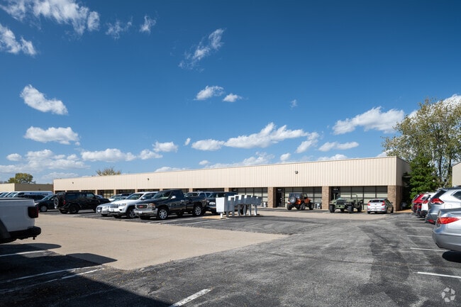
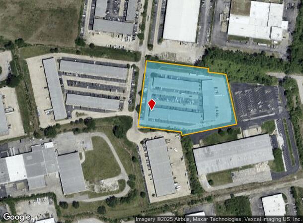
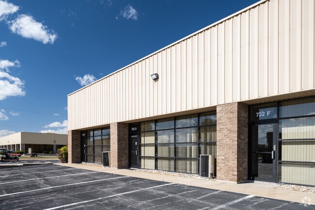
700 Crown Industrial Ct
17V-23-0198
Crown Industrial Park Plat 6
Warehouse
CROWN INDUSTRIAL PARK PLAT 6
AH
St. Louis
29183C0445G
Missouri
2024
4.95 AC
2025
Chesterfield/Hwy-40
221629
St. Louis
47,198 SF
St. Louis, MO-IL
DEMOGRAPHICS near 700 Crown Industrial Ct
1 Mile
3 Mile
5 Mile
2024 Total Population
242
9,266
61,090
2029 Population
242
9,196
61,965
Pop Growth 2024-2029
0.00%
(0.76%)
+ 1.43%
Average Age
37
41
42
2024 Total Households
74
3,006
22,579
HH Growth 2024-2029
0.00%
(0.70%)
+ 1.46%
Median Household Inc
$253,061
$198,103
$136,271
Avg Household Size
3.20
3.10
2.70
2024 Avg HH Vehicles
3.00
2.00
2.00
Median Home Value
$765,957
$703,007
$407,885
Median Year Built
2000
1995
1990
Nearby Places
Map Layers
Map Styles
 Street
 Aerial
- Restaurants
- Banks
- Shops
- Fitness
- Groceries
PUBLIC TRANSPORTATION
AIRPORT
St Louis Lambert International
DRIVE
WALK
Distance
St Louis Lambert International
37 min
26.0 mi
Freight Ports
Tulsa Port of Inola
DRIVE
WALK
Distance
Tulsa Port of Inola
414 min
369.0 mi
SALE & LEASE HISTORY
LISTING DATE
SALE/LEASE

Sep 25, 2016
For Lease
Mar 04, 2019
For Lease
Jul 19, 2018
For Lease
Nearby Properties
Address
Land Use
TOTAL SIZE
Lot Size
Zoning
Address
Land Use
TOTAL SIZE
Lot Size
Zoning
Address
Land Use
TOTAL SIZE
Lot Size
Zoning
351,496 SF
31.73 AC
NU
Address
Land Use
TOTAL SIZE
Lot Size
Zoning
269,687 SF
38.30 AC
105C8
Address
Land Use
TOTAL SIZE
Lot Size
Zoning
363,584 SF
48.15 AC
FPNU
Address
Land Use
TOTAL SIZE
Lot Size
Zoning
197,927 SF
16.61 AC
105C8
Address
Land Use
TOTAL SIZE
Lot Size
Zoning
204,940 SF
16.35 AC
FPNU
Address
Land Use
TOTAL SIZE
Lot Size
Zoning
117,704 SF
9.27 AC
105PI
Address
Land Use
TOTAL SIZE
Lot Size
Zoning
294.04 AC
Address
Land Use
TOTAL SIZE
Lot Size
Zoning
7,860 SF
223.24 AC
105M3
Address
Land Use
TOTAL SIZE
Lot Size
Zoning
84,818 SF
10.11 AC
105M3
Address
Land Use
TOTAL SIZE
Lot Size
Zoning
185.56 AC
105FPNU
Address
Land Use
TOTAL SIZE
Lot Size
Zoning
8.15 AC
105PI
Address
Land Use
TOTAL SIZE
Lot Size
Zoning
89,616 SF
9.07 AC
M3
Address
Land Use
TOTAL SIZE
Lot Size
Zoning
64,172 SF
4.91 AC
105C8
Address
Land Use
TOTAL SIZE
Lot Size
Zoning
74,783 SF
14.31 AC
105M3
Address
Land Use
TOTAL SIZE
Lot Size
Zoning
64,455 SF
4.72 AC
105PC
Address
Land Use
TOTAL SIZE
Lot Size
Zoning
135,305 SF
12.68 AC
105C8
Address
Land Use
TOTAL SIZE
Lot Size
Zoning
148,519 SF
12.76 AC
FPM3
Address
Land Use
TOTAL SIZE
Lot Size
Zoning
52,730 SF
7.12 AC
105C8
Address
Land Use
TOTAL SIZE
Lot Size
Zoning
143,474 SF
15.06 AC
105PC
Address
Land Use
TOTAL SIZE
Lot Size
Zoning
49,400 SF
16.17 AC
M3
Address
Land Use
TOTAL SIZE
Lot Size
Zoning
10.71 AC
105NU
Address
Land Use
TOTAL SIZE
Lot Size
Zoning
163,924 SF
11.56 AC
105M3
Address
Land Use
TOTAL SIZE
Lot Size
Zoning
130,467 SF
10.41 AC
105C8
Address
Land Use
TOTAL SIZE
Lot Size
Zoning
134,313 SF
11.65 AC
105M3
Address
Land Use
TOTAL SIZE
Lot Size
Zoning
78,976 SF
10.24 AC
105M3
Address
Land Use
TOTAL SIZE
Lot Size
Zoning
78,566 SF
6.13 AC
105PI
Address
Land Use
TOTAL SIZE
Lot Size
Zoning
60,655 SF
10.33 AC
FPNU
Address
Land Use
TOTAL SIZE
Lot Size
Zoning
7.12 AC
105PI
Address
Land Use
TOTAL SIZE
Lot Size
Zoning
104,244 SF
10.53 AC
105PC
The World's #1 Commercial Real Estate Marketplace
Connect with us
© 2025 CoStar Group
The information above has been obtained from sources believed reliable. While we do not doubt its accuracy we have not verified it and make no guarantee, warranty or representation about it. It is your responsibility to independently confirm its accuracy and completeness. Any projections, opinions, assumptions, or estimates used are for example only and do not represent the current or future performance of the property. The value of this transaction to you depends on tax and other factors which should be evaluated by your tax, financial, and legal advisors. You and your advisors should conduct a careful, independent investigation of the property to determine to your satisfaction the suitability of the property for your needs.