Property Record
666 W Township Line Rd, Havertown, PA 19083


NEARBY LISTINGS FOR SALE OR LEASE
Property Detail
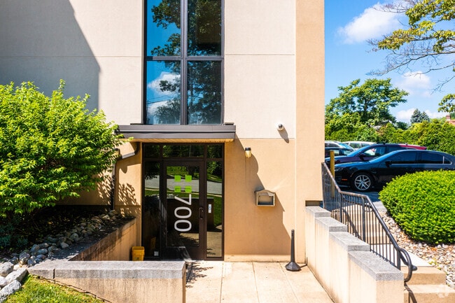
666 W Township Line Rd
22-08-01058-00
2 STY OFFICE BLDG 299 X 24 X 221 IRR
Officebuilding
Delaware
X
Pennsylvania
42091C0431G
0.87 AC
2024
Delaware County
2025
Philadelphia
409200
Philadelphia-Camden-Wilmington, PA-NJ-DE-MD
17,580 SF
DEMOGRAPHICS near 666 W Township Line Rd
1 Mile
3 Mile
5 Mile
2024 Total Population
25,936
264,233
603,680
2029 Population
25,495
260,232
595,162
Pop Growth 2024-2029
(1.70%)
(1.51%)
(1.41%)
Average Age
39
39
38
2024 Total Households
9,399
100,388
233,586
HH Growth 2024-2029
(1.85%)
(1.67%)
(1.55%)
Median Household Inc
$83,312
$64,892
$59,774
Avg Household Size
2.70
2.50
2.40
2024 Avg HH Vehicles
2.00
1.00
1.00
Median Home Value
$233,415
$233,057
$243,920
Median Year Built
1948
1947
1949
Nearby Places
Map Layers
Map Styles
 Street
 Aerial
- Restaurants
- Banks
- Shops
- Fitness
- Groceries
PUBLIC TRANSPORTATION
TRANSIT/SUBWAY
West Overbrook (Norristown High Speed Line - SEPTA, Route 100 - SEPTA)
DRIVE
WALK
Distance
West Overbrook (Norristown High Speed Line - SEPTA, Route 100 - SEPTA)
0 min
1 min
0.1 mi
Penfield (Norristown High Speed Line - SEPTA, Route 100 - SEPTA)
DRIVE
WALK
Distance
Penfield (Norristown High Speed Line - SEPTA, Route 100 - SEPTA)
3 min
12 min
0.6 mi
COMMUTER RAIL
Overbrook (R5 - Southeastern Pennsylvania Transportation Authority Regional Rail (SEPTA Regional Rail))
DRIVE
WALK
Distance
Overbrook (R5 - Southeastern Pennsylvania Transportation Authority Regional Rail (SEPTA Regional Rail))
5 min
2.2 mi
Wynnewood (R5 - Southeastern Pennsylvania Transportation Authority Regional Rail (SEPTA Regional Rail))
DRIVE
WALK
Distance
Wynnewood (R5 - Southeastern Pennsylvania Transportation Authority Regional Rail (SEPTA Regional Rail))
7 min
3.1 mi
AIRPORT
Philadelphia International
DRIVE
WALK
Distance
Philadelphia International
25 min
9.9 mi
Freight Ports
South Jersey Port
DRIVE
WALK
Distance
South Jersey Port
25 min
11.5 mi
SALE & LEASE HISTORY
LISTING DATE
SALE/LEASE

Jul 06, 2021
For Lease
Apr 18, 2018
For Lease
Nearby Properties
Address
Land Use
TOTAL SIZE
Lot Size
Zoning
Address
Land Use
TOTAL SIZE
Lot Size
Zoning
2,178,860 SF
48.65 AC
R3
Address
Land Use
TOTAL SIZE
Lot Size
Zoning
158,496 SF
Address
Land Use
TOTAL SIZE
Lot Size
Zoning
1,600 SF
177.07 AC
SPPOA
Address
Land Use
TOTAL SIZE
Lot Size
Zoning
511,806 SF
1.70 AC
RM4
Address
Land Use
TOTAL SIZE
Lot Size
Zoning
15,660 SF
56.60 AC
Address
Land Use
TOTAL SIZE
Lot Size
Zoning
448,864 SF
32.89 AC
Address
Land Use
TOTAL SIZE
Lot Size
Zoning
479,520 SF
21.26 AC
R1
Address
Land Use
TOTAL SIZE
Lot Size
Zoning
377,851 SF
19.18 AC
R4
Address
Land Use
TOTAL SIZE
Lot Size
Zoning
112,268 SF
28.27 AC
Address
Land Use
TOTAL SIZE
Lot Size
Zoning
281,508 SF
18.93 AC
SPINS
Address
Land Use
TOTAL SIZE
Lot Size
Zoning
530,525 SF
36.29 AC
R3
Address
Land Use
TOTAL SIZE
Lot Size
Zoning
475,984 SF
5.74 AC
ICMX
Address
Land Use
TOTAL SIZE
Lot Size
Zoning
82,153 SF
13.97 AC
Address
Land Use
TOTAL SIZE
Lot Size
Zoning
1.65 AC
CMX3
Address
Land Use
TOTAL SIZE
Lot Size
Zoning
257,405 SF
4.26 AC
C2
Address
Land Use
TOTAL SIZE
Lot Size
Zoning
7.96 AC
Address
Land Use
TOTAL SIZE
Lot Size
Zoning
20,880 SF
27.20 AC
Address
Land Use
TOTAL SIZE
Lot Size
Zoning
321,744 SF
14 AC
C1
Address
Land Use
TOTAL SIZE
Lot Size
Zoning
454,536 SF
26.63 AC
Address
Land Use
TOTAL SIZE
Lot Size
Zoning
93,353 SF
1.03 AC
CMX2.5
Address
Land Use
TOTAL SIZE
Lot Size
Zoning
252,350 SF
0.91 AC
SPINS
Address
Land Use
TOTAL SIZE
Lot Size
Zoning
131,980 SF
9.17 AC
Address
Land Use
TOTAL SIZE
Lot Size
Zoning
131,200 SF
2.19 AC
RM4
Address
Land Use
TOTAL SIZE
Lot Size
Zoning
114,058 SF
3.20 AC
Address
Land Use
TOTAL SIZE
Lot Size
Zoning
746,701 SF
71.71 AC
R3
Address
Land Use
TOTAL SIZE
Lot Size
Zoning
69,420 SF
17.12 AC
Address
Land Use
TOTAL SIZE
Lot Size
Zoning
112,597 SF
6.47 AC
C2
Address
Land Use
TOTAL SIZE
Lot Size
Zoning
338,088 SF
9.82 AC
R7
Address
Land Use
TOTAL SIZE
Lot Size
Zoning
140,820 SF
3.57 AC
RM2
Address
Land Use
TOTAL SIZE
Lot Size
Zoning
86,052 SF
7.63 AC
The World's #1 Commercial Real Estate Marketplace
Connect with us
© 2025 CoStar Group
The information above has been obtained from sources believed reliable. While we do not doubt its accuracy we have not verified it and make no guarantee, warranty or representation about it. It is your responsibility to independently confirm its accuracy and completeness. Any projections, opinions, assumptions, or estimates used are for example only and do not represent the current or future performance of the property. The value of this transaction to you depends on tax and other factors which should be evaluated by your tax, financial, and legal advisors. You and your advisors should conduct a careful, independent investigation of the property to determine to your satisfaction the suitability of the property for your needs.