Property Record
700 High Grove Blvd, Glendale Heights, IL 60139

NEARBY LISTINGS FOR SALE OR LEASE
Property Detail
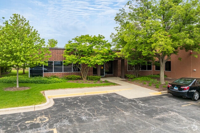
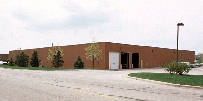
700 High Grove Blvd
Chicago-Naperville-Elgin, IL-IN-WI
Highgrove Center For Business Unit 2
02-26-107-003
HIGHGROVE CENTER FOR BUSINESS UNIT 2 ALL
Industrialgeneral
DuPage
A
Illinois
17043C0062J
16
2024
3.09 AC
2024
North DuPage
840904
Chicago
43,454 SF
DEMOGRAPHICS near 700 High Grove Blvd
1 Mile
3 Mile
5 Mile
2024 Total Population
13,870
84,167
262,095
2029 Population
13,740
82,179
256,337
Pop Growth 2024-2029
(0.94%)
(2.36%)
(2.20%)
Average Age
40
41
40
2024 Total Households
5,191
30,575
93,874
HH Growth 2024-2029
(0.92%)
(2.45%)
(2.32%)
Median Household Inc
$67,092
$87,022
$93,927
Avg Household Size
2.50
2.70
2.70
2024 Avg HH Vehicles
2.00
2.00
2.00
Median Home Value
$233,442
$284,804
$310,364
Median Year Built
1976
1977
1975
Nearby Places
Map Layers
Map Styles
 Street
 Aerial
- Restaurants
- Banks
- Shops
- Fitness
- Groceries
PUBLIC TRANSPORTATION
AIRPORT
Chicago O'Hare International
DRIVE
WALK
Distance
Chicago O'Hare International
28 min
16.3 mi
Chicago Midway International
DRIVE
WALK
Distance
Chicago Midway International
39 min
26.0 mi
SALE & LEASE HISTORY
LISTING DATE
SALE/LEASE

Dec 15, 2021
For Lease
Nearby Properties
Address
Land Use
TOTAL SIZE
Lot Size
Zoning
Address
Land Use
TOTAL SIZE
Lot Size
Zoning
693,153 SF
46.17 AC
Address
Land Use
TOTAL SIZE
Lot Size
Zoning
260,424 SF
16.87 AC
M
Address
Land Use
TOTAL SIZE
Lot Size
Zoning
322,680 SF
19.07 AC
M
Address
Land Use
TOTAL SIZE
Lot Size
Zoning
268,400 SF
15.87 AC
M
Address
Land Use
TOTAL SIZE
Lot Size
Zoning
236,871 SF
12.84 AC
M
Address
Land Use
TOTAL SIZE
Lot Size
Zoning
780,693 SF
42.30 AC
I
Address
Land Use
TOTAL SIZE
Lot Size
Zoning
258,793 SF
16.44 AC
M
Address
Land Use
TOTAL SIZE
Lot Size
Zoning
251,091 SF
32.67 AC
R-4
Address
Land Use
TOTAL SIZE
Lot Size
Zoning
16.91 AC
C
Address
Land Use
TOTAL SIZE
Lot Size
Zoning
459,796 SF
18.15 AC
I
Address
Land Use
TOTAL SIZE
Lot Size
Zoning
204,464 SF
16.53 AC
Address
Land Use
TOTAL SIZE
Lot Size
Zoning
515,497 SF
21.98 AC
I
Address
Land Use
TOTAL SIZE
Lot Size
Zoning
527,079 SF
29.01 AC
I
Address
Land Use
TOTAL SIZE
Lot Size
Zoning
149,460 SF
10.62 AC
M
Address
Land Use
TOTAL SIZE
Lot Size
Zoning
226,069 SF
14.85 AC
Address
Land Use
TOTAL SIZE
Lot Size
Zoning
367,020 SF
26.13 AC
I
Address
Land Use
TOTAL SIZE
Lot Size
Zoning
381,600 SF
24.47 AC
Address
Land Use
TOTAL SIZE
Lot Size
Zoning
304,976 SF
23.98 AC
Address
Land Use
TOTAL SIZE
Lot Size
Zoning
400,032 SF
21.12 AC
I
Address
Land Use
TOTAL SIZE
Lot Size
Zoning
309,864 SF
37.33 AC
I
Address
Land Use
TOTAL SIZE
Lot Size
Zoning
311,052 SF
20.97 AC
M
Address
Land Use
TOTAL SIZE
Lot Size
Zoning
393,516 SF
18.08 AC
I
Address
Land Use
TOTAL SIZE
Lot Size
Zoning
347,400 SF
15.31 AC
I
Address
Land Use
TOTAL SIZE
Lot Size
Zoning
453,152 SF
20.35 AC
I
Address
Land Use
TOTAL SIZE
Lot Size
Zoning
302,986 SF
16.04 AC
Address
Land Use
TOTAL SIZE
Lot Size
Zoning
136,975 SF
1.90 AC
Address
Land Use
TOTAL SIZE
Lot Size
Zoning
275,091 SF
13.38 AC
I
Address
Land Use
TOTAL SIZE
Lot Size
Zoning
334,718 SF
15.95 AC
I
Address
Land Use
TOTAL SIZE
Lot Size
Zoning
327,858 SF
15.10 AC
I
Address
Land Use
TOTAL SIZE
Lot Size
Zoning
360,676 SF
18.86 AC
The World's #1 Commercial Real Estate Marketplace
Connect with us
© 2025 CoStar Group
The information above has been obtained from sources believed reliable. While we do not doubt its accuracy we have not verified it and make no guarantee, warranty or representation about it. It is your responsibility to independently confirm its accuracy and completeness. Any projections, opinions, assumptions, or estimates used are for example only and do not represent the current or future performance of the property. The value of this transaction to you depends on tax and other factors which should be evaluated by your tax, financial, and legal advisors. You and your advisors should conduct a careful, independent investigation of the property to determine to your satisfaction the suitability of the property for your needs.