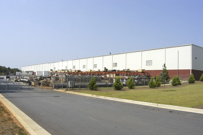
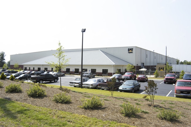
Property Record
700 Hudson Rd, Griffin, GA 30224


Current Lease Availabilities
Property Detail
700 Hudson Rd
221 -03-003
TRACT A-1 PB 25/341
Officebuilding
Spalding
C2
Georgia
B and X Area of moderate flood hazard, usually the area between the limits of the 100-year and 500-year floods.
212
2025
15.21 AC
2025
S Clayton/Henry Cnty
161100
Atlanta
216,242 SF
Atlanta-Sandy Springs-Roswell, GA
NEARBY LISTINGS FOR SALE OR LEASE
DEMOGRAPHICS near 700 Hudson Rd
1 mile
3 mile
5 mile
2025 Total Population
1,549
18,244
43,548
2030 Population
1,604
19,057
45,447
Pop Growth 2025-2030
+ 3.55%
+ 4.46%
+ 4.36%
Average Age
38
39
39
2025 Total Households
591
7,092
16,571
HH Growth 2025-2030
+ 3.38%
+ 4.46%
+ 4.42%
Median Household Inc
$49,204
$56,397
$53,164
Avg Household Size
2.60
2.50
2.60
2025 Avg HH Vehicles
2.00
2.00
2.00
Median Home Value
$153,846
$239,583
$229,631
Median Year Built
1972
1975
1977
Nearby Places
Map Layers
Map Styles
 Street
 Aerial
Layers
 Traffic
 Biking
Places
Listings with unknown addresses are not visible on the map
- Restaurants
- Banks
- Shops
- Fitness
- Groceries
Nearby Properties
Address
Land Use
TOTAL SIZE
Lot Size
Zoning
Address
Land Use
TOTAL SIZE
Lot Size
Zoning
303,594 SF
58.69 AC
PDD
Address
Land Use
TOTAL SIZE
Lot Size
Zoning
210,196 SF
14.92 AC
PCD
Address
Land Use
TOTAL SIZE
Lot Size
Zoning
56,415 SF
0.56 AC
PCD
Address
Land Use
TOTAL SIZE
Lot Size
Zoning
367,793 SF
223.84 AC
C2
Address
Land Use
TOTAL SIZE
Lot Size
Zoning
70,817 SF
0.79 AC
CBD
Address
Land Use
TOTAL SIZE
Lot Size
Zoning
305,123 SF
37 AC
C2
Address
Land Use
TOTAL SIZE
Lot Size
Zoning
13,392 SF
31.70 AC
Address
Land Use
TOTAL SIZE
Lot Size
Zoning
125,587 SF
11.87 AC
HDRA
Address
Land Use
TOTAL SIZE
Lot Size
Zoning
39,105 SF
33.98 AC
PDD
Address
Land Use
TOTAL SIZE
Lot Size
Zoning
16,394 SF
24.32 AC
LDRB
Address
Land Use
TOTAL SIZE
Lot Size
Zoning
48,856 SF
35.46 AC
PDD
Address
Land Use
TOTAL SIZE
Lot Size
Zoning
73.71 AC
AR1
Address
Land Use
TOTAL SIZE
Lot Size
Zoning
92,331 SF
29.84 AC
C2
Address
Land Use
TOTAL SIZE
Lot Size
Zoning
84,105 SF
17 AC
AR1
Address
Land Use
TOTAL SIZE
Lot Size
Zoning
293,260 SF
23.27 AC
C-2
Address
Land Use
TOTAL SIZE
Lot Size
Zoning
303,594 SF
58.69 AC
PDD
Address
Land Use
TOTAL SIZE
Lot Size
Zoning
72,876 SF
16.23 AC
PDD
Address
Land Use
TOTAL SIZE
Lot Size
Zoning
16 AC
PCD
Address
Land Use
TOTAL SIZE
Lot Size
Zoning
54,980 SF
1.09 AC
CBD
Address
Land Use
TOTAL SIZE
Lot Size
Zoning
99,469 SF
28.98 AC
R-2
Address
Land Use
TOTAL SIZE
Lot Size
Zoning
62,748 SF
22 AC
PDD
Address
Land Use
TOTAL SIZE
Lot Size
Zoning
74,412 SF
11.87 AC
HDRA
Address
Land Use
TOTAL SIZE
Lot Size
Zoning
65,058 SF
3.74 AC
Address
Land Use
TOTAL SIZE
Lot Size
Zoning
205,953 SF
17.81 AC
PID
Address
Land Use
TOTAL SIZE
Lot Size
Zoning
65,058 SF
3.74 AC
Address
Land Use
TOTAL SIZE
Lot Size
Zoning
14,680 SF
1.89 AC
PCD
Address
Land Use
TOTAL SIZE
Lot Size
Zoning
59,700 SF
2.20 AC
CBD
Address
Land Use
TOTAL SIZE
Lot Size
Zoning
203,804 SF
10.76 AC
C2
Address
Land Use
TOTAL SIZE
Lot Size
Zoning
39,105 SF
33.98 AC
PDD
The World's #1 Commercial Real Estate Marketplace
Connect with us
© 2026 CoStar Group
The information above has been obtained from sources believed reliable. While we do not doubt its accuracy we have not verified it and make no guarantee, warranty or representation about it. It is your responsibility to independently confirm its accuracy and completeness. Any projections, opinions, assumptions, or estimates used are for example only and do not represent the current or future performance of the property. The value of this transaction to you depends on tax and other factors which should be evaluated by your tax, financial, and legal advisors. You and your advisors should conduct a careful, independent investigation of the property to determine to your satisfaction the suitability of the property for your needs.