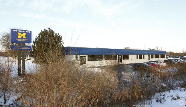
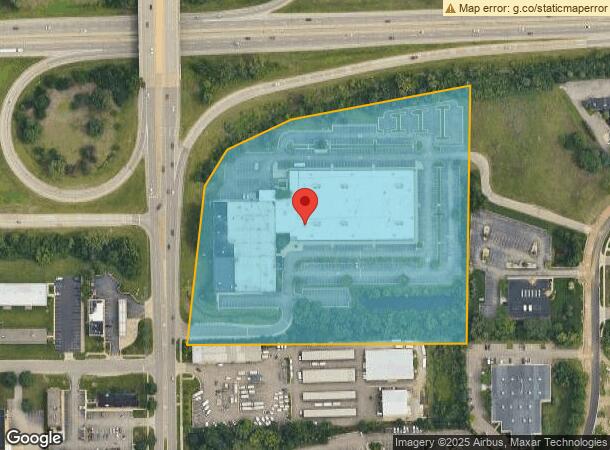
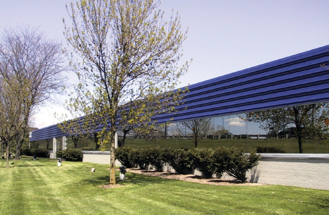
Property Record
700 Kms Pl, Ann Arbor, MI 48108
Current Lease Availabilities
NEARBY LISTINGS FOR SALE OR LEASE
Property Detail
700 Kms Pl
Ann Arbor, MI
Research Park
12-09-300-015
PRT OF SW 1/4 SEC 9 T3S R6E COM AT W 1/4 COR SEC TH S 1 DEG 6 MIN E 798.87 FT TH N 89 DEG 40 MIN 10 SEC E 60 FT FOR POB TH
Commercialnec
Washtenaw
AE
Michigan
26161C0401E
60,462
2025
11.89 AC
2025
Washtenaw W of 23
405600
Detroit
125,740 SF
DEMOGRAPHICS near 700 Kms Pl
1 Mile
3 Mile
5 Mile
2024 Total Population
4,959
77,986
168,145
2029 Population
4,910
77,091
166,206
Pop Growth 2024-2029
(0.99%)
(1.15%)
(1.15%)
Average Age
38
36
37
2024 Total Households
2,597
31,324
69,939
HH Growth 2024-2029
(1.08%)
(1.12%)
(1.17%)
Median Household Inc
$74,759
$78,762
$76,100
Avg Household Size
1.90
2.20
2.20
2024 Avg HH Vehicles
1.00
2.00
2.00
Median Home Value
$329,051
$413,513
$389,349
Median Year Built
1984
1975
1976
Nearby Places
Map Layers
Map Styles
 Street
 Aerial
- Restaurants
- Banks
- Shops
- Fitness
- Groceries
PUBLIC TRANSPORTATION
COMMUTER RAIL
Ann Arbor Amtrak Station (Wolverine - Amtrak)
DRIVE
WALK
Distance
Ann Arbor Amtrak Station (Wolverine - Amtrak)
10 min
3.9 mi
AIRPORT
Detroit Metro Wayne County
DRIVE
WALK
Distance
Detroit Metro Wayne County
28 min
23.2 mi
Freight Ports
Port of Toledo
DRIVE
WALK
Distance
Port of Toledo
72 min
56.4 mi
Nearby Properties
Address
Land Use
TOTAL SIZE
Lot Size
Zoning
Address
Land Use
TOTAL SIZE
Lot Size
Zoning
235,070 SF
0.80 AC
D1
Address
Land Use
TOTAL SIZE
Lot Size
Zoning
212,047 SF
1.15 AC
D2
Address
Land Use
TOTAL SIZE
Lot Size
Zoning
186,029 SF
2.06 AC
D2
Address
Land Use
TOTAL SIZE
Lot Size
Zoning
Address
Land Use
TOTAL SIZE
Lot Size
Zoning
211,670 SF
0.54 AC
D1
Address
Land Use
TOTAL SIZE
Lot Size
Zoning
222,126 SF
0.52 AC
D1
Address
Land Use
TOTAL SIZE
Lot Size
Zoning
315,108 SF
6.57 AC
C1B
Address
Land Use
TOTAL SIZE
Lot Size
Zoning
173,885 SF
0.45 AC
D1
Address
Land Use
TOTAL SIZE
Lot Size
Zoning
334,077 SF
20.41 AC
R4B
Address
Land Use
TOTAL SIZE
Lot Size
Zoning
357,978 SF
19.32 AC
R4B
Address
Land Use
TOTAL SIZE
Lot Size
Zoning
140,670 SF
1.63 AC
C2B
Address
Land Use
TOTAL SIZE
Lot Size
Zoning
112,994 SF
45.12 AC
IH
Address
Land Use
TOTAL SIZE
Lot Size
Zoning
177,763 SF
0.91 AC
D2
Address
Land Use
TOTAL SIZE
Lot Size
Zoning
303,524 SF
19.40 AC
R4B
Address
Land Use
TOTAL SIZE
Lot Size
Zoning
99,982 SF
0.35 AC
D1
Address
Land Use
TOTAL SIZE
Lot Size
Zoning
140,039 SF
Address
Land Use
TOTAL SIZE
Lot Size
Zoning
271,521 SF
15.11 AC
Address
Land Use
TOTAL SIZE
Lot Size
Zoning
127,076 SF
0.39 AC
D1
Address
Land Use
TOTAL SIZE
Lot Size
Zoning
214,559 SF
16.18 AC
PUD
Address
Land Use
TOTAL SIZE
Lot Size
Zoning
268,002 SF
18.34 AC
Address
Land Use
TOTAL SIZE
Lot Size
Zoning
125,073 SF
0.26 AC
D1
Address
Land Use
TOTAL SIZE
Lot Size
Zoning
234,076 SF
24.18 AC
R4A
Address
Land Use
TOTAL SIZE
Lot Size
Zoning
253,702 SF
30.23 AC
Address
Land Use
TOTAL SIZE
Lot Size
Zoning
1.19 AC
R4C
Address
Land Use
TOTAL SIZE
Lot Size
Zoning
116,650 SF
0.32 AC
D1
Address
Land Use
TOTAL SIZE
Lot Size
Zoning
111,435 SF
21.38 AC
R4B
Address
Land Use
TOTAL SIZE
Lot Size
Zoning
175,536 SF
12.98 AC
R4B
Address
Land Use
TOTAL SIZE
Lot Size
Zoning
119,631 SF
7.85 AC
PUD
Address
Land Use
TOTAL SIZE
Lot Size
Zoning
88,460 SF
28.50 AC
DI
Address
Land Use
TOTAL SIZE
Lot Size
Zoning
192,726 SF
6.45 AC
O
The World's #1 Commercial Real Estate Marketplace
Connect with us
© 2025 CoStar Group
The information above has been obtained from sources believed reliable. While we do not doubt its accuracy we have not verified it and make no guarantee, warranty or representation about it. It is your responsibility to independently confirm its accuracy and completeness. Any projections, opinions, assumptions, or estimates used are for example only and do not represent the current or future performance of the property. The value of this transaction to you depends on tax and other factors which should be evaluated by your tax, financial, and legal advisors. You and your advisors should conduct a careful, independent investigation of the property to determine to your satisfaction the suitability of the property for your needs.