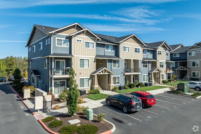
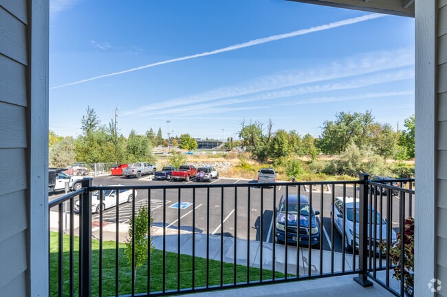
Property Record
700 N Haskell St, Central Point, OR 97502

Property Detail
700 N Haskell St
Multifamilydwelling
Jackson
MMR
Oregon
AE The base floodplain where base flood elevations are provided. AE Zones are now used on new format FIRMs instead of A1-A30 Zones.
4.25 AC
2025
Medford/Grants Pass
2026
Other Market Areas
000902
Medford, OR
1,170 SF
10985727
NEARBY LISTINGS FOR SALE OR LEASE
-
-
View all Central Point listings for sale on LoopNet.com
DEMOGRAPHICS near 700 N Haskell St
1 mile
3 mile
5 mile
2025 Total Population
11,350
31,058
79,374
2030 Population
11,165
30,381
77,619
Pop Growth 2025-2030
(1.63%)
(2.18%)
(2.21%)
Average Age
41
41
41
2025 Total Households
4,409
11,788
30,850
HH Growth 2025-2030
(1.63%)
(2.27%)
(2.33%)
Median Household Inc
$81,877
$74,873
$68,130
Avg Household Size
2.50
2.50
2.50
2025 Avg HH Vehicles
2.00
2.00
2.00
Median Home Value
$372,855
$368,545
$379,322
Median Year Built
1990
1990
1982
Nearby Places
Map Layers
Map Styles
 Street
 Aerial
Layers
 Traffic
 Biking
Places
Listings with unknown addresses are not visible on the map
- Restaurants
- Banks
- Shops
- Fitness
- Groceries
PUBLIC TRANSPORTATION
AIRPORT
Rogue Valley International - Medford
Drive
Walk
Distance
Rogue Valley International - Medford
8 min
3.5 mi
Freight Ports
Port of Coos Bay, OR
Drive
Walk
Distance
Port of Coos Bay, OR
211 min
160.2 mi
Nearby Properties
Address
Land Use
TOTAL SIZE
Lot Size
Zoning
Address
Land Use
TOTAL SIZE
Lot Size
Zoning
290.83 AC
I-L
Address
Land Use
TOTAL SIZE
Lot Size
Zoning
22.07 AC
GI
Address
Land Use
TOTAL SIZE
Lot Size
Zoning
600,000 SF
18.27 AC
M-1
Address
Land Use
TOTAL SIZE
Lot Size
Zoning
31.96 AC
GI
Address
Land Use
TOTAL SIZE
Lot Size
Zoning
11,180 SF
1.58 AC
MFR-20
Address
Land Use
TOTAL SIZE
Lot Size
Zoning
30.87 AC
CIVIC
Address
Land Use
TOTAL SIZE
Lot Size
Zoning
88.67 AC
I-L
Address
Land Use
TOTAL SIZE
Lot Size
Zoning
15.97 AC
GI
Address
Land Use
TOTAL SIZE
Lot Size
Zoning
6,039 SF
5.26 AC
MMR
Address
Land Use
TOTAL SIZE
Lot Size
Zoning
13.49 AC
M-1
Address
Land Use
TOTAL SIZE
Lot Size
Zoning
31,283 SF
2.95 AC
I-L
Address
Land Use
TOTAL SIZE
Lot Size
Zoning
102,184 SF
5.82 AC
I-L
Address
Land Use
TOTAL SIZE
Lot Size
Zoning
98,547 SF
4.36 AC
I-L
Address
Land Use
TOTAL SIZE
Lot Size
Zoning
62.39 AC
GI
Address
Land Use
TOTAL SIZE
Lot Size
Zoning
60,561 SF
2.72 AC
HMR
Address
Land Use
TOTAL SIZE
Lot Size
Zoning
32,614 SF
8.27 AC
M-1
Address
Land Use
TOTAL SIZE
Lot Size
Zoning
32,240 SF
20.24 AC
M-2
Address
Land Use
TOTAL SIZE
Lot Size
Zoning
46,624 SF
3.29 AC
MMR
Address
Land Use
TOTAL SIZE
Lot Size
Zoning
100,000 SF
5.77 AC
I-G
Address
Land Use
TOTAL SIZE
Lot Size
Zoning
56,962 SF
2.71 AC
C-R
Address
Land Use
TOTAL SIZE
Lot Size
Zoning
13.58 AC
CIVIC
Address
Land Use
TOTAL SIZE
Lot Size
Zoning
98,688 SF
5.09 AC
MFR-30
Address
Land Use
TOTAL SIZE
Lot Size
Zoning
92,750 SF
102.77 AC
I-L
Address
Land Use
TOTAL SIZE
Lot Size
Zoning
180,828 SF
4.29 AC
HMR
Address
Land Use
TOTAL SIZE
Lot Size
Zoning
43,706 SF
2.19 AC
R-3
Address
Land Use
TOTAL SIZE
Lot Size
Zoning
207,801 SF
9.92 AC
LI
Address
Land Use
TOTAL SIZE
Lot Size
Zoning
1.72 AC
EC
Address
Land Use
TOTAL SIZE
Lot Size
Zoning
51,536 SF
14.28 AC
I-L
The World's #1 Commercial Real Estate Marketplace
Connect with us
© 2026 CoStar Group
The information above has been obtained from sources believed reliable. While we do not doubt its accuracy we have not verified it and make no guarantee, warranty or representation about it. It is your responsibility to independently confirm its accuracy and completeness. Any projections, opinions, assumptions, or estimates used are for example only and do not represent the current or future performance of the property. The value of this transaction to you depends on tax and other factors which should be evaluated by your tax, financial, and legal advisors. You and your advisors should conduct a careful, independent investigation of the property to determine to your satisfaction the suitability of the property for your needs.