Property Record
700 New Rd, Somers Point, NJ 08244


NEARBY LISTINGS FOR SALE OR LEASE
Property Detail
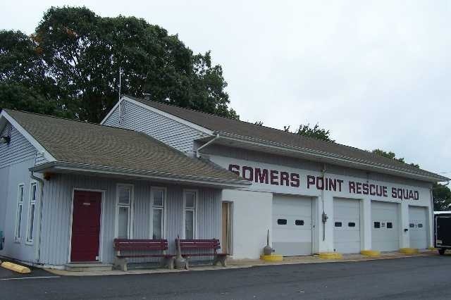
700 New Rd
21-01522-0000-00013
Daniel B Frazier Co
Commercialnec
Atlantic
ARE
New Jersey
34001C0428F
13
2024
0.46 AC
2025
Atlantic City/Hammonton
012802
Philadelphia
3,251 SF
Atlantic City-Hammonton, NJ
DEMOGRAPHICS near 700 New Rd
1 Mile
3 Mile
5 Mile
2024 Total Population
8,409
22,662
63,019
2029 Population
8,377
22,469
63,886
Pop Growth 2024-2029
(0.38%)
(0.85%)
+ 1.38%
Average Age
44
44
45
2024 Total Households
3,749
9,379
26,084
HH Growth 2024-2029
(0.91%)
(1.42%)
+ 1.54%
Median Household Inc
$67,520
$82,580
$88,301
Avg Household Size
2.20
2.30
2.30
2024 Avg HH Vehicles
2.00
2.00
2.00
Median Home Value
$252,649
$279,584
$313,679
Median Year Built
1968
1970
1976
Nearby Places
Map Layers
Map Styles
 Street
 Aerial
- Restaurants
- Banks
- Shops
- Fitness
- Groceries
PUBLIC TRANSPORTATION
COMMUTER RAIL
Absecon (Atlantic City Line - NJ Transit Commuter Rail (NJ Transit))
DRIVE
WALK
Distance
Absecon (Atlantic City Line - NJ Transit Commuter Rail (NJ Transit))
19 min
9.9 mi
AIRPORT
Atlantic City International
DRIVE
WALK
Distance
Atlantic City International
41 min
15.2 mi
Freight Ports
Broadway Terminal - Pier 5
DRIVE
WALK
Distance
Broadway Terminal - Pier 5
72 min
57.1 mi
Nearby Properties
Address
Land Use
TOTAL SIZE
Lot Size
Zoning
Address
Land Use
TOTAL SIZE
Lot Size
Zoning
4.98 AC
SHOS
Address
Land Use
TOTAL SIZE
Lot Size
Zoning
6,000 SF
28.83 AC
INST
Address
Land Use
TOTAL SIZE
Lot Size
Zoning
51.72 AC
GB &
Address
Land Use
TOTAL SIZE
Lot Size
Zoning
16.33 AC
R-MF
Address
Land Use
TOTAL SIZE
Lot Size
Zoning
17.37 AC
REDE
Address
Land Use
TOTAL SIZE
Lot Size
Zoning
1.03 AC
Address
Land Use
TOTAL SIZE
Lot Size
Zoning
15.20 AC
R-MF
Address
Land Use
TOTAL SIZE
Lot Size
Zoning
3.34 AC
R-1
Address
Land Use
TOTAL SIZE
Lot Size
Zoning
6.75 AC
R-1
Address
Land Use
TOTAL SIZE
Lot Size
Zoning
2.21 AC
SHOS
Address
Land Use
TOTAL SIZE
Lot Size
Zoning
8.41 AC
R-MF
Address
Land Use
TOTAL SIZE
Lot Size
Zoning
9.20 AC
GB
Address
Land Use
TOTAL SIZE
Lot Size
Zoning
4.81 AC
R-MF
Address
Land Use
TOTAL SIZE
Lot Size
Zoning
8.56 AC
R-MF
Address
Land Use
TOTAL SIZE
Lot Size
Zoning
5.02 AC
R-MF
Address
Land Use
TOTAL SIZE
Lot Size
Zoning
4.74 AC
INST
Address
Land Use
TOTAL SIZE
Lot Size
Zoning
61,193 SF
6.97 AC
GB
Address
Land Use
TOTAL SIZE
Lot Size
Zoning
3.27 AC
Address
Land Use
TOTAL SIZE
Lot Size
Zoning
4.43 AC
R-MF
Address
Land Use
TOTAL SIZE
Lot Size
Zoning
4.42 AC
TC&F
Address
Land Use
TOTAL SIZE
Lot Size
Zoning
6.72 AC
Address
Land Use
TOTAL SIZE
Lot Size
Zoning
2.98 AC
R-1
Address
Land Use
TOTAL SIZE
Lot Size
Zoning
8.73 AC
RECA
Address
Land Use
TOTAL SIZE
Lot Size
Zoning
6.43 AC
GB
Address
Land Use
TOTAL SIZE
Lot Size
Zoning
2.01 AC
Address
Land Use
TOTAL SIZE
Lot Size
Zoning
52,280 SF
9.96 AC
GB
Address
Land Use
TOTAL SIZE
Lot Size
Zoning
1.21 AC
SHOS
Address
Land Use
TOTAL SIZE
Lot Size
Zoning
38,090 SF
4.73 AC
O-PB
Address
Land Use
TOTAL SIZE
Lot Size
Zoning
14.01 AC
INST
Address
Land Use
TOTAL SIZE
Lot Size
Zoning
2.35 AC
The World's #1 Commercial Real Estate Marketplace
Connect with us
© 2026 CoStar Group
The information above has been obtained from sources believed reliable. While we do not doubt its accuracy we have not verified it and make no guarantee, warranty or representation about it. It is your responsibility to independently confirm its accuracy and completeness. Any projections, opinions, assumptions, or estimates used are for example only and do not represent the current or future performance of the property. The value of this transaction to you depends on tax and other factors which should be evaluated by your tax, financial, and legal advisors. You and your advisors should conduct a careful, independent investigation of the property to determine to your satisfaction the suitability of the property for your needs.