Property Record
700 Northgate Mile, Idaho Falls, ID 83401


Current Lease Availabilities
Property Detail
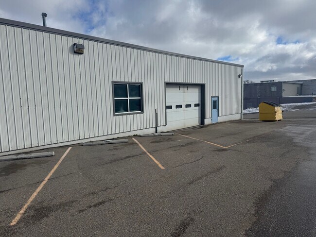
700 Northgate Mile
Idaho Falls, ID
LOTS 1-6, PORTION LOTS 35-38, LOTS 39-48, VACATED ALLEY, BLOCK 5, CAPITOL HILL SE1/4, SEC 18, T 2N, R 38
RPA0420005001C
BONNEVILLE
Vehiclerentalsvehiclesales
Idaho
R2
1-6
2025
1.36 AC
2025
Idaho South Area
970405
Other Market Areas
15,231 SF
NEARBY LISTINGS FOR SALE OR LEASE
DEMOGRAPHICS near 700 Northgate Mile
1 mile
3 mile
5 mile
2025 Total Population
12,832
66,811
114,521
2030 Population
13,462
70,282
120,779
Pop Growth 2025-2030
+ 4.91%
+ 5.20%
+ 5.46%
Average Age
37
38
37
2025 Total Households
5,097
25,216
40,243
HH Growth 2025-2030
+ 5.02%
+ 5.27%
+ 5.54%
Median Household Inc
$46,110
$64,295
$71,351
Avg Household Size
2.30
2.60
2.80
2025 Avg HH Vehicles
2.00
2.00
2.00
Median Home Value
$225,198
$329,051
$367,273
Median Year Built
1956
1977
1990
Nearby Places
Map Layers
Map Styles
 Street
 Aerial
Layers
 Traffic
 Biking
Places
Listings with unknown addresses are not visible on the map
- Restaurants
- Banks
- Shops
- Fitness
- Groceries
PUBLIC TRANSPORTATION
AIRPORT
Idaho Falls Regional
Drive
Walk
Distance
Idaho Falls Regional
9 min
3.9 mi
Freight Ports
Port of Portland
Drive
Walk
Distance
Port of Portland
741 min
711.0 mi
Nearby Properties
Address
Land Use
TOTAL SIZE
Lot Size
Zoning
Address
Land Use
TOTAL SIZE
Lot Size
Zoning
159,026 SF
13.94 AC
R2
Address
Land Use
TOTAL SIZE
Lot Size
Zoning
375,295 SF
26.11 AC
R2
Address
Land Use
TOTAL SIZE
Lot Size
Zoning
37,287 SF
9.46 AC
Address
Land Use
TOTAL SIZE
Lot Size
Zoning
267,740 SF
45.91 AC
Address
Land Use
TOTAL SIZE
Lot Size
Zoning
136,343 SF
10 AC
Address
Land Use
TOTAL SIZE
Lot Size
Zoning
4,363 SF
13.28 AC
Address
Land Use
TOTAL SIZE
Lot Size
Zoning
253,387 SF
18.33 AC
R2
Address
Land Use
TOTAL SIZE
Lot Size
Zoning
10,324 SF
8.73 AC
Address
Land Use
TOTAL SIZE
Lot Size
Zoning
220,179 SF
22.20 AC
R2
Address
Land Use
TOTAL SIZE
Lot Size
Zoning
111,649 SF
8.60 AC
Address
Land Use
TOTAL SIZE
Lot Size
Zoning
106,733 SF
2.99 AC
Address
Land Use
TOTAL SIZE
Lot Size
Zoning
61,948 SF
4.51 AC
Address
Land Use
TOTAL SIZE
Lot Size
Zoning
273,545 SF
15.89 AC
R2
Address
Land Use
TOTAL SIZE
Lot Size
Zoning
210,995 SF
24.15 AC
R2
Address
Land Use
TOTAL SIZE
Lot Size
Zoning
27,084 SF
3.69 AC
Address
Land Use
TOTAL SIZE
Lot Size
Zoning
179,244 SF
16.56 AC
Address
Land Use
TOTAL SIZE
Lot Size
Zoning
7,617 SF
4.65 AC
Address
Land Use
TOTAL SIZE
Lot Size
Zoning
61,715 SF
4.12 AC
Address
Land Use
TOTAL SIZE
Lot Size
Zoning
1,472 SF
4.38 AC
Address
Land Use
TOTAL SIZE
Lot Size
Zoning
25,889 SF
2.91 AC
Address
Land Use
TOTAL SIZE
Lot Size
Zoning
98,476 SF
0.66 AC
R2
Address
Land Use
TOTAL SIZE
Lot Size
Zoning
163,776 SF
9.56 AC
R2
Address
Land Use
TOTAL SIZE
Lot Size
Zoning
152,632 SF
7.49 AC
R2
Address
Land Use
TOTAL SIZE
Lot Size
Zoning
4,074 SF
10.06 AC
R2
Address
Land Use
TOTAL SIZE
Lot Size
Zoning
91,002 SF
2.70 AC
R2
Address
Land Use
TOTAL SIZE
Lot Size
Zoning
93,971 SF
9.38 AC
R2
Address
Land Use
TOTAL SIZE
Lot Size
Zoning
5,584 SF
6.74 AC
Address
Land Use
TOTAL SIZE
Lot Size
Zoning
140,391 SF
17.57 AC
R2
Address
Land Use
TOTAL SIZE
Lot Size
Zoning
59,941 SF
11.99 AC
Address
Land Use
TOTAL SIZE
Lot Size
Zoning
122,067 SF
10.51 AC
The World's #1 Commercial Real Estate Marketplace
Connect with us
© 2026 CoStar Group
The information above has been obtained from sources believed reliable. While we do not doubt its accuracy we have not verified it and make no guarantee, warranty or representation about it. It is your responsibility to independently confirm its accuracy and completeness. Any projections, opinions, assumptions, or estimates used are for example only and do not represent the current or future performance of the property. The value of this transaction to you depends on tax and other factors which should be evaluated by your tax, financial, and legal advisors. You and your advisors should conduct a careful, independent investigation of the property to determine to your satisfaction the suitability of the property for your needs.