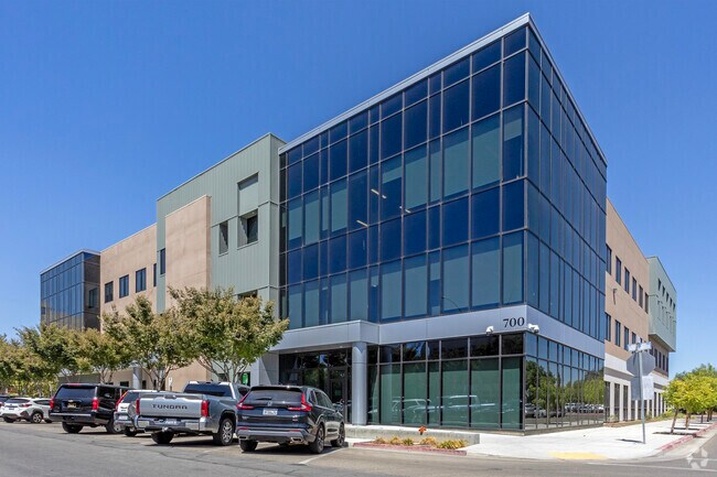
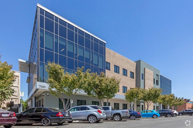
Property Record
700 P St, Fresno, CA 93721

Property Detail
700 P St
468-166-12
POR ABAN ALLEY & POR BLK 142 OF FRESNO CITY BLKS
Officebuilding
Fresno
DTG
California
C and X Area of minimal flood hazard, usually depicted on FIRMs as above the 500-year flood level.
0.67 AC
2025
Downtown Fresno
2025
Fresno
000602
Fresno, CA
68,622 SF
NEARBY LISTINGS FOR SALE OR LEASE
DEMOGRAPHICS near 700 P St
1 mile
3 mile
5 mile
2024 Total Population
17,500
155,885
306,099
2029 Population
17,663
157,045
308,889
Pop Growth 2024-2029
+ 0.93%
+ 0.74%
+ 0.91%
Average Age
35
34
35
2024 Total Households
4,734
45,401
92,482
HH Growth 2024-2029
+ 1.27%
+ 0.82%
+ 0.95%
Median Household Inc
$35,731
$43,296
$51,447
Avg Household Size
3.00
3.20
3.10
2024 Avg HH Vehicles
1.00
2.00
2.00
Median Home Value
$245,962
$247,698
$294,428
Median Year Built
1962
1961
1964
Nearby Places
Map Layers
Map Styles
 Street
 Aerial
Transit
 Traffic
 Biking
Places
Listings with unknown addresses are not visible on the map
- Restaurants
- Banks
- Shops
- Fitness
- Groceries
PUBLIC TRANSPORTATION
COMMUTER RAIL
Drive
Walk
Distance
1 min
5 min
0.3 mi
AIRPORT
Fresno Yosemite International
Drive
Walk
Distance
Fresno Yosemite International
11 min
6.1 mi
SALE & LEASE HISTORY
LISTING DATE
SALE/LEASE

Dec 24, 2018
For Lease
Nearby Properties
Address
Land Use
TOTAL SIZE
Lot Size
Zoning
Address
Land Use
TOTAL SIZE
Lot Size
Zoning
226,597 SF
12.80 AC
M3
Address
Land Use
TOTAL SIZE
Lot Size
Zoning
0.01 AC
P
Address
Land Use
TOTAL SIZE
Lot Size
Zoning
534,993 SF
5.23 AC
CP
Address
Land Use
TOTAL SIZE
Lot Size
Zoning
288,597 SF
1.18 AC
C4
Address
Land Use
TOTAL SIZE
Lot Size
Zoning
147,101 SF
6.31 AC
SPLIT
Address
Land Use
TOTAL SIZE
Lot Size
Zoning
184,130 SF
1.87 AC
PI
Address
Land Use
TOTAL SIZE
Lot Size
Zoning
141,959 SF
35.39 AC
SPLIT
Address
Land Use
TOTAL SIZE
Lot Size
Zoning
176,926 SF
9.79 AC
IH
Address
Land Use
TOTAL SIZE
Lot Size
Zoning
291,527 SF
28.85 AC
M3
Address
Land Use
TOTAL SIZE
Lot Size
Zoning
101,510 SF
3.37 AC
CM
Address
Land Use
TOTAL SIZE
Lot Size
Zoning
193,440 SF
16.82 AC
Address
Land Use
TOTAL SIZE
Lot Size
Zoning
238,160 SF
18.77 AC
M3
Address
Land Use
TOTAL SIZE
Lot Size
Zoning
471,760 SF
1.98 AC
CP
Address
Land Use
TOTAL SIZE
Lot Size
Zoning
116,349 SF
16.56 AC
CP
Address
Land Use
TOTAL SIZE
Lot Size
Zoning
194,109 SF
19.42 AC
C3
Address
Land Use
TOTAL SIZE
Lot Size
Zoning
213,874 SF
4.17 AC
SPLIT
Address
Land Use
TOTAL SIZE
Lot Size
Zoning
206,766 SF
17.11 AC
R2
Address
Land Use
TOTAL SIZE
Lot Size
Zoning
61,575 SF
3.50 AC
SPLIT
Address
Land Use
TOTAL SIZE
Lot Size
Zoning
79,518 SF
2.03 AC
R4
Address
Land Use
TOTAL SIZE
Lot Size
Zoning
409,374 SF
24.73 AC
SPLIT
Address
Land Use
TOTAL SIZE
Lot Size
Zoning
480,570 SF
2.98 AC
P
Address
Land Use
TOTAL SIZE
Lot Size
Zoning
90,500 SF
1.29 AC
CM
Address
Land Use
TOTAL SIZE
Lot Size
Zoning
54,526 SF
5.88 AC
M3
Address
Land Use
TOTAL SIZE
Lot Size
Zoning
314,915 SF
14.12 AC
M2
Address
Land Use
TOTAL SIZE
Lot Size
Zoning
569,220 SF
23.46 AC
SPLIT
Address
Land Use
TOTAL SIZE
Lot Size
Zoning
55,200 SF
14.94 AC
M3
Address
Land Use
TOTAL SIZE
Lot Size
Zoning
96,012 SF
1.33 AC
C4
Address
Land Use
TOTAL SIZE
Lot Size
Zoning
319,790 SF
41.15 AC
R1
Address
Land Use
TOTAL SIZE
Lot Size
Zoning
82,096 SF
0.26 AC
C4
Address
Land Use
TOTAL SIZE
Lot Size
Zoning
104,036 SF
6.73 AC
M3
The World's #1 Commercial Real Estate Marketplace
Connect with us
© 2026 CoStar Group
The information above has been obtained from sources believed reliable. While we do not doubt its accuracy we have not verified it and make no guarantee, warranty or representation about it. It is your responsibility to independently confirm its accuracy and completeness. Any projections, opinions, assumptions, or estimates used are for example only and do not represent the current or future performance of the property. The value of this transaction to you depends on tax and other factors which should be evaluated by your tax, financial, and legal advisors. You and your advisors should conduct a careful, independent investigation of the property to determine to your satisfaction the suitability of the property for your needs.