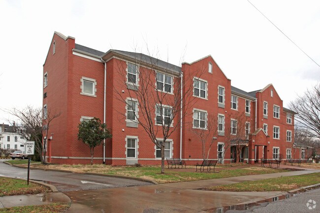
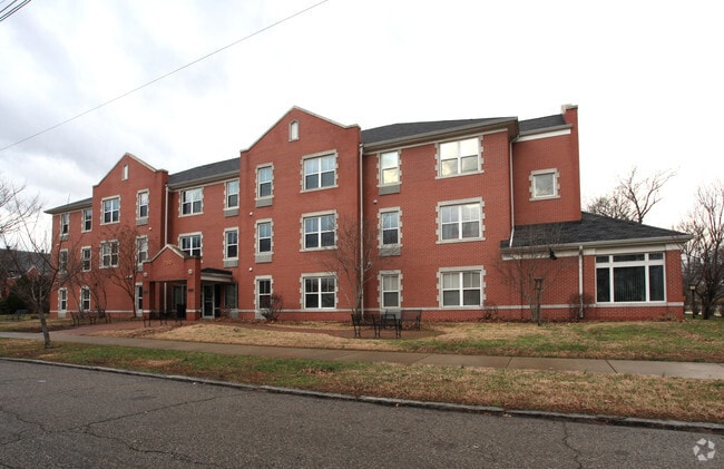
Property Record
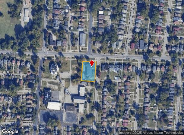
700 S 44Th St, Louisville, KY 40211
NEARBY LISTINGS FOR SALE OR LEASE
Property Detail
700 S 44Th St
043B01220000
TRACT 1 MINOR PLAT DB 7752 X 976, 0.625 AC +/-
Taxexempt
Jefferson
X
Kentucky
21111C0023F
0.63 AC
0
Chickasaw
2025
Louisville
001100
Louisville-Jefferson County, KY-IN
19,555 SF
DEMOGRAPHICS near 700 S 44Th St
1 Mile
3 Mile
5 Mile
2024 Total Population
12,873
68,722
191,900
2029 Population
12,943
69,528
193,457
Pop Growth 2024-2029
+ 0.54%
+ 1.17%
+ 0.81%
Average Age
39
39
38
2024 Total Households
5,253
27,953
81,935
HH Growth 2024-2029
+ 0.42%
+ 1.14%
+ 0.92%
Median Household Inc
$30,189
$33,720
$36,337
Avg Household Size
2.30
2.30
2.20
2024 Avg HH Vehicles
1.00
1.00
1.00
Median Home Value
$77,232
$79,903
$124,255
Median Year Built
1946
1948
1951
Nearby Places
Map Layers
Map Styles
 Street
 Aerial
- Restaurants
- Banks
- Shops
- Fitness
- Groceries
PUBLIC TRANSPORTATION
AIRPORT
Louisville Muhammad Ali International
DRIVE
WALK
Distance
Louisville Muhammad Ali International
20 min
10.8 mi
Freight Ports
Port of Toledo
DRIVE
WALK
Distance
Port of Toledo
361 min
309.4 mi
Nearby Properties
Address
Land Use
TOTAL SIZE
Lot Size
Zoning
Address
Land Use
TOTAL SIZE
Lot Size
Zoning
3,162 SF
23.76 AC
EZ1-ENTERP
Address
Land Use
TOTAL SIZE
Lot Size
Zoning
95,508 SF
3.67 AC
EZ1-ENTERP
Address
Land Use
TOTAL SIZE
Lot Size
Zoning
270 SF
121 AC
M3-INDUSTR
Address
Land Use
TOTAL SIZE
Lot Size
Zoning
139,200 SF
29.50 AC
EZ1-ENTERP
Address
Land Use
TOTAL SIZE
Lot Size
Zoning
8.74 AC
R7-RESIDEN
Address
Land Use
TOTAL SIZE
Lot Size
Zoning
19,000 SF
12.86 AC
EZ1-ENTERP
Address
Land Use
TOTAL SIZE
Lot Size
Zoning
135,832 SF
5.06 AC
EZ1-ENTERP
Address
Land Use
TOTAL SIZE
Lot Size
Zoning
143,700 SF
0.29 AC
Address
Land Use
TOTAL SIZE
Lot Size
Zoning
7.11 AC
R7-RESIDEN
Address
Land Use
TOTAL SIZE
Lot Size
Zoning
1,440 SF
141.94 AC
M3-INDUSTR
Address
Land Use
TOTAL SIZE
Lot Size
Zoning
24,839 SF
25.37 AC
M3-INDUSTR
Address
Land Use
TOTAL SIZE
Lot Size
Zoning
266,400 SF
16.40 AC
EZ1-ENTERP
Address
Land Use
TOTAL SIZE
Lot Size
Zoning
133,829 SF
10.03 AC
EZ1-ENTERP
Address
Land Use
TOTAL SIZE
Lot Size
Zoning
8,100 SF
8.59 AC
EZ1-ENTERP
Address
Land Use
TOTAL SIZE
Lot Size
Zoning
14,355 SF
1.50 AC
C2-COMMERC
Address
Land Use
TOTAL SIZE
Lot Size
Zoning
3,350 SF
8.28 AC
M3-INDUSTR
Address
Land Use
TOTAL SIZE
Lot Size
Zoning
125,842 SF
2.16 AC
EZ1-ENTERP
Address
Land Use
TOTAL SIZE
Lot Size
Zoning
304,575 SF
13.10 AC
M3-INDUSTR
Address
Land Use
TOTAL SIZE
Lot Size
Zoning
Address
Land Use
TOTAL SIZE
Lot Size
Zoning
49,088 SF
0.34 AC
EZ1-ENTERP
Address
Land Use
TOTAL SIZE
Lot Size
Zoning
67,600 SF
6.76 AC
EZ1-ENTERP
Address
Land Use
TOTAL SIZE
Lot Size
Zoning
60,371 SF
1.54 AC
EZ1-ENTERP
Address
Land Use
TOTAL SIZE
Lot Size
Zoning
272 SF
210.55 AC
Address
Land Use
TOTAL SIZE
Lot Size
Zoning
28,416 SF
2.05 AC
CM-COMMERC
Address
Land Use
TOTAL SIZE
Lot Size
Zoning
170,301 SF
9.64 AC
CM-COMMERC
Address
Land Use
TOTAL SIZE
Lot Size
Zoning
302,006 SF
9.67 AC
EZ1-ENTERP
Address
Land Use
TOTAL SIZE
Lot Size
Zoning
26,016 SF
6.62 AC
EZ1-ENTERP
Address
Land Use
TOTAL SIZE
Lot Size
Zoning
100,895 SF
7.92 AC
EZ1-ENTERP
Address
Land Use
TOTAL SIZE
Lot Size
Zoning
44,380 SF
3.85 AC
EZ1-ENTERP
Address
Land Use
TOTAL SIZE
Lot Size
Zoning
20,625 SF
9.81 AC
EZ1-ENTERP
The World's #1 Commercial Real Estate Marketplace
Connect with us
© 2025 CoStar Group
The information above has been obtained from sources believed reliable. While we do not doubt its accuracy we have not verified it and make no guarantee, warranty or representation about it. It is your responsibility to independently confirm its accuracy and completeness. Any projections, opinions, assumptions, or estimates used are for example only and do not represent the current or future performance of the property. The value of this transaction to you depends on tax and other factors which should be evaluated by your tax, financial, and legal advisors. You and your advisors should conduct a careful, independent investigation of the property to determine to your satisfaction the suitability of the property for your needs.