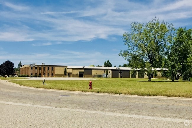
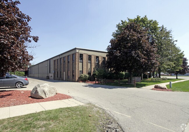
Property Record
700 S Glaspie St, Oxford, MI 48371

NEARBY LISTINGS FOR SALE OR LEASE
Property Detail
700 S Glaspie St
Detroit-Warren-Dearborn, MI
Park
04-26-326-014
T5N, R10E, SEC 26 DRAHNER ROAD INDUSTRIAL PARK SELY 30 FT OF LOT 14 & ALL OF LOT 15
Manufacturinglight
Oakland
X
Michigan
26125C0210F
14-15
2024
2.64 AC
2025
Auburn Hills, Pontiac & Rochester
121500
Detroit
52,208 SF
DEMOGRAPHICS near 700 S Glaspie St
1 Mile
3 Mile
5 Mile
2024 Total Population
5,133
30,764
46,360
2029 Population
5,067
30,602
46,072
Pop Growth 2024-2029
(1.29%)
(0.53%)
(0.62%)
Average Age
40
41
41
2024 Total Households
2,004
11,716
17,494
HH Growth 2024-2029
(1.30%)
(0.55%)
(0.63%)
Median Household Inc
$87,066
$97,344
$100,174
Avg Household Size
2.50
2.60
2.60
2024 Avg HH Vehicles
2.00
2.00
2.00
Median Home Value
$294,332
$328,953
$334,723
Median Year Built
1987
1987
1987
Nearby Places
Map Layers
Map Styles
 Street
 Aerial
- Restaurants
- Banks
- Shops
- Fitness
- Groceries
PUBLIC TRANSPORTATION
AIRPORT
Bishop International
DRIVE
WALK
Distance
Bishop International
63 min
43.1 mi
Freight Ports
Port of Toledo
DRIVE
WALK
Distance
Port of Toledo
125 min
100.4 mi
Nearby Properties
Address
Land Use
TOTAL SIZE
Lot Size
Zoning
Address
Land Use
TOTAL SIZE
Lot Size
Zoning
172,881 SF
16.51 AC
Address
Land Use
TOTAL SIZE
Lot Size
Zoning
148,898 SF
14.55 AC
BI
Address
Land Use
TOTAL SIZE
Lot Size
Zoning
188,367 SF
Address
Land Use
TOTAL SIZE
Lot Size
Zoning
272,879 SF
Address
Land Use
TOTAL SIZE
Lot Size
Zoning
188,367 SF
26.37 AC
Address
Land Use
TOTAL SIZE
Lot Size
Zoning
4,670 SF
81.02 AC
MM
Address
Land Use
TOTAL SIZE
Lot Size
Zoning
207,073 SF
19.74 AC
Address
Land Use
TOTAL SIZE
Lot Size
Zoning
65,459 SF
5.65 AC
BI
Address
Land Use
TOTAL SIZE
Lot Size
Zoning
187,506 SF
19.19 AC
AI
Address
Land Use
TOTAL SIZE
Lot Size
Zoning
81,921 SF
9.08 AC
BI
Address
Land Use
TOTAL SIZE
Lot Size
Zoning
4,717 SF
73 AC
MM
Address
Land Use
TOTAL SIZE
Lot Size
Zoning
53,715 SF
4.28 AC
ME
Address
Land Use
TOTAL SIZE
Lot Size
Zoning
58,009 SF
168.28 AC
BI
Address
Land Use
TOTAL SIZE
Lot Size
Zoning
187,573 SF
12.29 AC
II
Address
Land Use
TOTAL SIZE
Lot Size
Zoning
10,920 SF
494.26 AC
SV
Address
Land Use
TOTAL SIZE
Lot Size
Zoning
34,753 SF
Address
Land Use
TOTAL SIZE
Lot Size
Zoning
39,217 SF
4.39 AC
BI
Address
Land Use
TOTAL SIZE
Lot Size
Zoning
38,468 SF
5.16 AC
BI
Address
Land Use
TOTAL SIZE
Lot Size
Zoning
29,026 SF
2.66 AC
BI
Address
Land Use
TOTAL SIZE
Lot Size
Zoning
39,085 SF
2.47 AC
AI
Address
Land Use
TOTAL SIZE
Lot Size
Zoning
29,520 SF
2.93 AC
AI
Address
Land Use
TOTAL SIZE
Lot Size
Zoning
26,073 SF
63.54 AC
MM
Address
Land Use
TOTAL SIZE
Lot Size
Zoning
11,483 SF
10.56 AC
BI
Address
Land Use
TOTAL SIZE
Lot Size
Zoning
19,392 SF
2.34 AC
BI
Address
Land Use
TOTAL SIZE
Lot Size
Zoning
504 SF
18.16 AC
MM
Address
Land Use
TOTAL SIZE
Lot Size
Zoning
58,082 SF
2.75 AC
II
Address
Land Use
TOTAL SIZE
Lot Size
Zoning
15,048 SF
2.99 AC
BI
The World's #1 Commercial Real Estate Marketplace
Connect with us
© 2026 CoStar Group
The information above has been obtained from sources believed reliable. While we do not doubt its accuracy we have not verified it and make no guarantee, warranty or representation about it. It is your responsibility to independently confirm its accuracy and completeness. Any projections, opinions, assumptions, or estimates used are for example only and do not represent the current or future performance of the property. The value of this transaction to you depends on tax and other factors which should be evaluated by your tax, financial, and legal advisors. You and your advisors should conduct a careful, independent investigation of the property to determine to your satisfaction the suitability of the property for your needs.