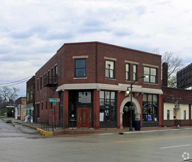
Property Record
700 S Main St, Elkhart, IN 46516

Current Lease Availabilities
NEARBY LISTINGS FOR SALE OR LEASE
Property Detail
700 S Main St
Elkhart-Goshen, IN
Corp Plat Elk City 42X100 Ft
20-06-05-483-001.000-012
CORP PLAT ELK CITY 42X100 FT NW COR OUT LOT 35 (TIF 75)
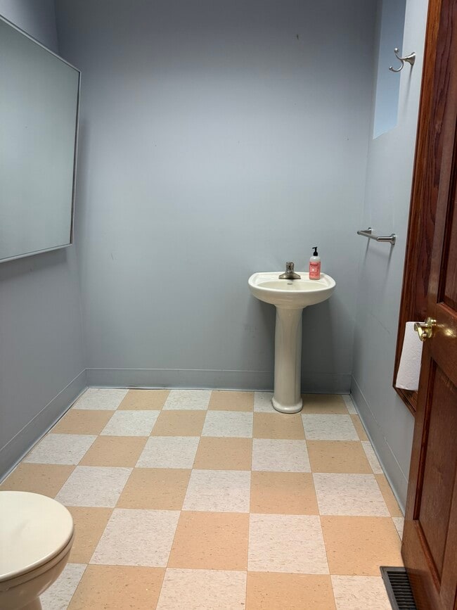
Storebuilding
Elkhart
X
Indiana
18039C0136D
35
2024
0.08 AC
2025
Downtown Elkhart
002900
South Bend/Mishawaka
10,170 SF
DEMOGRAPHICS near 700 S Main St
1 Mile
3 Mile
5 Mile
2024 Total Population
16,214
63,630
100,091
2029 Population
16,544
63,914
100,245
Pop Growth 2024-2029
+ 2.04%
+ 0.45%
+ 0.15%
Average Age
35
37
38
2024 Total Households
5,867
23,833
37,733
HH Growth 2024-2029
+ 2.42%
+ 0.49%
+ 0.18%
Median Household Inc
$37,375
$47,279
$54,136
Avg Household Size
2.60
2.50
2.60
2024 Avg HH Vehicles
1.00
2.00
2.00
Median Home Value
$82,184
$122,557
$152,982
Median Year Built
1949
1964
1973
Nearby Places
Map Layers
Map Styles
 Street
 Aerial
- Restaurants
- Banks
- Shops
- Fitness
- Groceries
PUBLIC TRANSPORTATION
COMMUTER RAIL
DRIVE
WALK
Distance
0 min
3 min
0.1 mi
AIRPORT
South Bend International
DRIVE
WALK
Distance
South Bend International
46 min
29.1 mi
Nearby Properties
Address
Land Use
TOTAL SIZE
Lot Size
Zoning
Address
Land Use
TOTAL SIZE
Lot Size
Zoning
373,218 SF
14.58 AC
ZO01
Address
Land Use
TOTAL SIZE
Lot Size
Zoning
133,214 SF
0.30 AC
ZO01
Address
Land Use
TOTAL SIZE
Lot Size
Zoning
630,852 SF
37.12 AC
ZO01
Address
Land Use
TOTAL SIZE
Lot Size
Zoning
59,994 SF
46.12 AC
ZO01
Address
Land Use
TOTAL SIZE
Lot Size
Zoning
315,130 SF
6.54 AC
ZO01
Address
Land Use
TOTAL SIZE
Lot Size
Zoning
334,473 SF
24.88 AC
ZO01
Address
Land Use
TOTAL SIZE
Lot Size
Zoning
158,688 SF
20.79 AC
ZO01
Address
Land Use
TOTAL SIZE
Lot Size
Zoning
333,124 SF
16.47 AC
ZO01
Address
Land Use
TOTAL SIZE
Lot Size
Zoning
106,029 SF
35.15 AC
ZO01
Address
Land Use
TOTAL SIZE
Lot Size
Zoning
355,938 SF
20.72 AC
Address
Land Use
TOTAL SIZE
Lot Size
Zoning
129,147 SF
3.23 AC
Address
Land Use
TOTAL SIZE
Lot Size
Zoning
70,800 SF
0.92 AC
ZO01
Address
Land Use
TOTAL SIZE
Lot Size
Zoning
289,195 SF
48.88 AC
ZO01
Address
Land Use
TOTAL SIZE
Lot Size
Zoning
128,225 SF
12.56 AC
ZO01
Address
Land Use
TOTAL SIZE
Lot Size
Zoning
277,504 SF
18.61 AC
ZO01
Address
Land Use
TOTAL SIZE
Lot Size
Zoning
203,685 SF
17.74 AC
ZO01
Address
Land Use
TOTAL SIZE
Lot Size
Zoning
78,006 SF
8.10 AC
ZO01
Address
Land Use
TOTAL SIZE
Lot Size
Zoning
301,018 SF
19.68 AC
ZO01
Address
Land Use
TOTAL SIZE
Lot Size
Zoning
284,569 SF
22.37 AC
ZO01
Address
Land Use
TOTAL SIZE
Lot Size
Zoning
204,010 SF
32.52 AC
ZO01
Address
Land Use
TOTAL SIZE
Lot Size
Zoning
56,310 SF
2.85 AC
ZO01
Address
Land Use
TOTAL SIZE
Lot Size
Zoning
199,800 SF
13 AC
ZO01
Address
Land Use
TOTAL SIZE
Lot Size
Zoning
257,024 SF
9.99 AC
ZO01
Address
Land Use
TOTAL SIZE
Lot Size
Zoning
220,827 SF
11.76 AC
Address
Land Use
TOTAL SIZE
Lot Size
Zoning
89,295 SF
4.03 AC
ZO01
Address
Land Use
TOTAL SIZE
Lot Size
Zoning
223,713 SF
14.05 AC
ZO01
Address
Land Use
TOTAL SIZE
Lot Size
Zoning
65,387 SF
7.72 AC
ZO01
Address
Land Use
TOTAL SIZE
Lot Size
Zoning
240,587 SF
12 AC
ZO01
Address
Land Use
TOTAL SIZE
Lot Size
Zoning
425,363 SF
32.52 AC
ZO01
Address
Land Use
TOTAL SIZE
Lot Size
Zoning
217,300 SF
12.55 AC
ZO01
The World's #1 Commercial Real Estate Marketplace
Connect with us
© 2026 CoStar Group
The information above has been obtained from sources believed reliable. While we do not doubt its accuracy we have not verified it and make no guarantee, warranty or representation about it. It is your responsibility to independently confirm its accuracy and completeness. Any projections, opinions, assumptions, or estimates used are for example only and do not represent the current or future performance of the property. The value of this transaction to you depends on tax and other factors which should be evaluated by your tax, financial, and legal advisors. You and your advisors should conduct a careful, independent investigation of the property to determine to your satisfaction the suitability of the property for your needs.