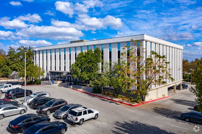
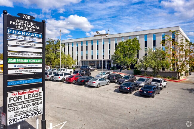
Property Record
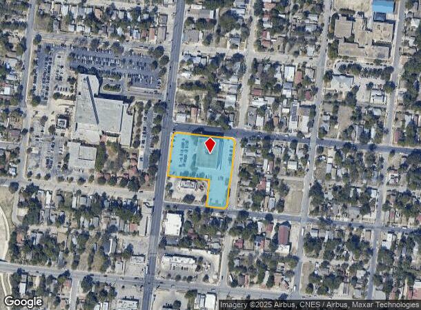
700 S Zarzamora St, San Antonio, TX 78207

NEARBY LISTINGS FOR SALE OR LEASE
Property Detail
700 S Zarzamora St
San Antonio-New Braunfels, TX
Mandel Sub Bl 2427
02427-001-0270
NCB 2427 BLK 1 LOT 27, 29 & N 46 FT OF 7,8,9,10,11,12, 2015 MER PER CR#32932
Medicalbuilding
Bexar
X
Texas
48029C0395G
27
2024
1.81 AC
2025
Northwest
170200
San Antonio
7,488 SF
DEMOGRAPHICS near 700 S Zarzamora St
1 Mile
3 Mile
5 Mile
2024 Total Population
21,920
154,432
365,161
2029 Population
23,295
164,397
388,799
Pop Growth 2024-2029
+ 6.27%
+ 6.45%
+ 6.47%
Average Age
36
39
38
2024 Total Households
7,122
56,187
131,220
HH Growth 2024-2029
+ 6.44%
+ 7.01%
+ 6.88%
Median Household Inc
$29,222
$37,717
$39,889
Avg Household Size
2.90
2.60
2.60
2024 Avg HH Vehicles
1.00
2.00
2.00
Median Home Value
$73,200
$115,586
$135,403
Median Year Built
1952
1955
1957
Nearby Places
Map Layers
Map Styles
 Street
 Aerial
- Restaurants
- Banks
- Shops
- Fitness
- Groceries
PUBLIC TRANSPORTATION
COMMUTER RAIL
DRIVE
WALK
Distance
8 min
3.6 mi
AIRPORT
San Antonio International
DRIVE
WALK
Distance
San Antonio International
17 min
10.2 mi
SALE & LEASE HISTORY
LISTING DATE
SALE/LEASE

Sep 13, 2022
For Lease
Oct 01, 2018
For Sale
Nov 09, 2020
For Lease
May 03, 2024
For Sale
Mar 31, 2020
For Lease
Jun 30, 2023
For Sale
Jul 17, 2023
For Sale
Jan 08, 2019
For Sale
Feb 21, 2018
For Sale
Feb 04, 2019
For Sale
Nearby Properties
Address
Land Use
TOTAL SIZE
Lot Size
Zoning
Address
Land Use
TOTAL SIZE
Lot Size
Zoning
26.51 AC
Address
Land Use
TOTAL SIZE
Lot Size
Zoning
443,000 SF
4.16 AC
Address
Land Use
TOTAL SIZE
Lot Size
Zoning
738,650 SF
2.93 AC
Address
Land Use
TOTAL SIZE
Lot Size
Zoning
1,049,861 SF
1.50 AC
Address
Land Use
TOTAL SIZE
Lot Size
Zoning
922,468 SF
10.78 AC
Address
Land Use
TOTAL SIZE
Lot Size
Zoning
443,560 SF
2.77 AC
Address
Land Use
TOTAL SIZE
Lot Size
Zoning
400,228 SF
0.78 AC
Address
Land Use
TOTAL SIZE
Lot Size
Zoning
290,794 SF
0.62 AC
Address
Land Use
TOTAL SIZE
Lot Size
Zoning
8.10 AC
Address
Land Use
TOTAL SIZE
Lot Size
Zoning
5,106 SF
2.30 AC
Address
Land Use
TOTAL SIZE
Lot Size
Zoning
387,443 SF
0.89 AC
Address
Land Use
TOTAL SIZE
Lot Size
Zoning
254,108 SF
2.40 AC
Address
Land Use
TOTAL SIZE
Lot Size
Zoning
103,425 SF
4.76 AC
Address
Land Use
TOTAL SIZE
Lot Size
Zoning
521,935 SF
2.17 AC
Address
Land Use
TOTAL SIZE
Lot Size
Zoning
495,840 SF
1.20 AC
Address
Land Use
TOTAL SIZE
Lot Size
Zoning
308,878 SF
1.23 AC
Address
Land Use
TOTAL SIZE
Lot Size
Zoning
15,468 SF
4.18 AC
Address
Land Use
TOTAL SIZE
Lot Size
Zoning
262,082 SF
1.60 AC
Address
Land Use
TOTAL SIZE
Lot Size
Zoning
7,018 SF
3.24 AC
Address
Land Use
TOTAL SIZE
Lot Size
Zoning
163,858 SF
0.62 AC
Address
Land Use
TOTAL SIZE
Lot Size
Zoning
481,589 SF
5.29 AC
Address
Land Use
TOTAL SIZE
Lot Size
Zoning
31,334 SF
14.11 AC
Address
Land Use
TOTAL SIZE
Lot Size
Zoning
399,007 SF
22.03 AC
Address
Land Use
TOTAL SIZE
Lot Size
Zoning
360,853 SF
1.18 AC
Address
Land Use
TOTAL SIZE
Lot Size
Zoning
156,480 SF
3.46 AC
Address
Land Use
TOTAL SIZE
Lot Size
Zoning
13,153 SF
2.62 AC
Address
Land Use
TOTAL SIZE
Lot Size
Zoning
50.69 AC
Address
Land Use
TOTAL SIZE
Lot Size
Zoning
349,678 SF
0.83 AC
Address
Land Use
TOTAL SIZE
Lot Size
Zoning
252,105 SF
0.47 AC
Address
Land Use
TOTAL SIZE
Lot Size
Zoning
240,394 SF
0.64 AC
The World's #1 Commercial Real Estate Marketplace
Connect with us
© 2025 CoStar Group
The information above has been obtained from sources believed reliable. While we do not doubt its accuracy we have not verified it and make no guarantee, warranty or representation about it. It is your responsibility to independently confirm its accuracy and completeness. Any projections, opinions, assumptions, or estimates used are for example only and do not represent the current or future performance of the property. The value of this transaction to you depends on tax and other factors which should be evaluated by your tax, financial, and legal advisors. You and your advisors should conduct a careful, independent investigation of the property to determine to your satisfaction the suitability of the property for your needs.