Property Record
700 Schrock Rd, Columbus, OH 43229
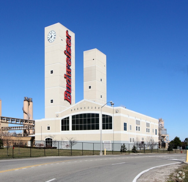


Property Detail
700 Schrock Rd
Columbus, OH
992 SCHROCK RD R18 T2 1/4T1 148.890 ACRES
610-146441
Franklin
Foodprocessing
Ohio
B and X Area of moderate flood hazard, usually the area between the limits of the 100-year and 500-year floods.
2-4
2024
148.89 AC
2025
Worthington
009900
Columbus
NEARBY LISTINGS FOR SALE OR LEASE
DEMOGRAPHICS near 700 Schrock Rd
1 mile
3 mile
5 mile
2025 Total Population
9,629
114,966
295,553
2030 Population
9,738
117,909
304,457
Pop Growth 2025-2030
+ 1.13%
+ 2.56%
+ 3.01%
Average Age
36
38
38
2025 Total Households
3,916
47,701
121,449
HH Growth 2025-2030
+ 1.25%
+ 2.80%
+ 3.18%
Median Household Inc
$51,126
$73,968
$81,573
Avg Household Size
2.40
2.40
2.40
2025 Avg HH Vehicles
2.00
2.00
2.00
Median Home Value
$260,662
$305,975
$329,635
Median Year Built
1972
1977
1978
Nearby Places
Map Layers
Map Styles
 Street
 Aerial
Layers
 Traffic
 Biking
Places
Listings with unknown addresses are not visible on the map
- Restaurants
- Banks
- Shops
- Fitness
- Groceries
PUBLIC TRANSPORTATION
AIRPORT
John Glenn Columbus International
Drive
Walk
Distance
John Glenn Columbus International
24 min
14.6 mi
Rickenbacker International
Drive
Walk
Distance
Rickenbacker International
38 min
24.7 mi
Freight Ports
Port of Toledo
Drive
Walk
Distance
Port of Toledo
175 min
136.1 mi
Nearby Properties
Address
Land Use
TOTAL SIZE
Lot Size
Zoning
Address
Land Use
TOTAL SIZE
Lot Size
Zoning
440,828 SF
13.72 AC
Address
Land Use
TOTAL SIZE
Lot Size
Zoning
635,036 SF
45.24 AC
Address
Land Use
TOTAL SIZE
Lot Size
Zoning
423,799 SF
9 AC
Address
Land Use
TOTAL SIZE
Lot Size
Zoning
2,140,832 SF
89.50 AC
Address
Land Use
TOTAL SIZE
Lot Size
Zoning
153,766 SF
3.98 AC
Address
Land Use
TOTAL SIZE
Lot Size
Zoning
271,562 SF
5.79 AC
Address
Land Use
TOTAL SIZE
Lot Size
Zoning
320,155 SF
84.68 AC
Address
Land Use
TOTAL SIZE
Lot Size
Zoning
206,724 SF
7.60 AC
Address
Land Use
TOTAL SIZE
Lot Size
Zoning
159,315 SF
13.25 AC
Address
Land Use
TOTAL SIZE
Lot Size
Zoning
171,631 SF
17.55 AC
Address
Land Use
TOTAL SIZE
Lot Size
Zoning
356,770 SF
2.65 AC
Address
Land Use
TOTAL SIZE
Lot Size
Zoning
217,722 SF
67.75 AC
Address
Land Use
TOTAL SIZE
Lot Size
Zoning
109,480 SF
17.86 AC
Address
Land Use
TOTAL SIZE
Lot Size
Zoning
62,852 SF
15.56 AC
Address
Land Use
TOTAL SIZE
Lot Size
Zoning
262,768 SF
4.35 AC
Address
Land Use
TOTAL SIZE
Lot Size
Zoning
249,917 SF
19.18 AC
Address
Land Use
TOTAL SIZE
Lot Size
Zoning
151,248 SF
13.30 AC
Address
Land Use
TOTAL SIZE
Lot Size
Zoning
38,976 SF
22.86 AC
Address
Land Use
TOTAL SIZE
Lot Size
Zoning
258,205 SF
5.13 AC
Address
Land Use
TOTAL SIZE
Lot Size
Zoning
266,792 SF
9.03 AC
Address
Land Use
TOTAL SIZE
Lot Size
Zoning
413,781 SF
78.36 AC
Address
Land Use
TOTAL SIZE
Lot Size
Zoning
249,112 SF
5.94 AC
Address
Land Use
TOTAL SIZE
Lot Size
Zoning
428,656 SF
6.42 AC
Address
Land Use
TOTAL SIZE
Lot Size
Zoning
162,728 SF
4.80 AC
Address
Land Use
TOTAL SIZE
Lot Size
Zoning
187,562 SF
8.76 AC
Address
Land Use
TOTAL SIZE
Lot Size
Zoning
62,702 SF
38.69 AC
Address
Land Use
TOTAL SIZE
Lot Size
Zoning
132,804 SF
11.54 AC
Address
Land Use
TOTAL SIZE
Lot Size
Zoning
217,703 SF
8.55 AC
Address
Land Use
TOTAL SIZE
Lot Size
Zoning
98,872 SF
14.54 AC
Address
Land Use
TOTAL SIZE
Lot Size
Zoning
142,998 SF
30.25 AC
The World's #1 Commercial Real Estate Marketplace
Connect with us
© 2026 CoStar Group
The information above has been obtained from sources believed reliable. While we do not doubt its accuracy we have not verified it and make no guarantee, warranty or representation about it. It is your responsibility to independently confirm its accuracy and completeness. Any projections, opinions, assumptions, or estimates used are for example only and do not represent the current or future performance of the property. The value of this transaction to you depends on tax and other factors which should be evaluated by your tax, financial, and legal advisors. You and your advisors should conduct a careful, independent investigation of the property to determine to your satisfaction the suitability of the property for your needs.