Property Record
700 Walnut St, Mckeesport, PA 15132
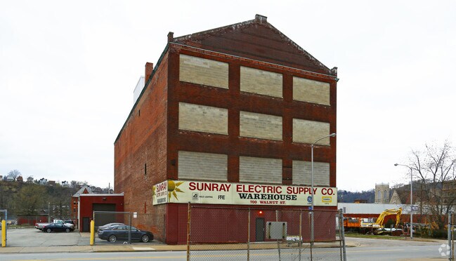

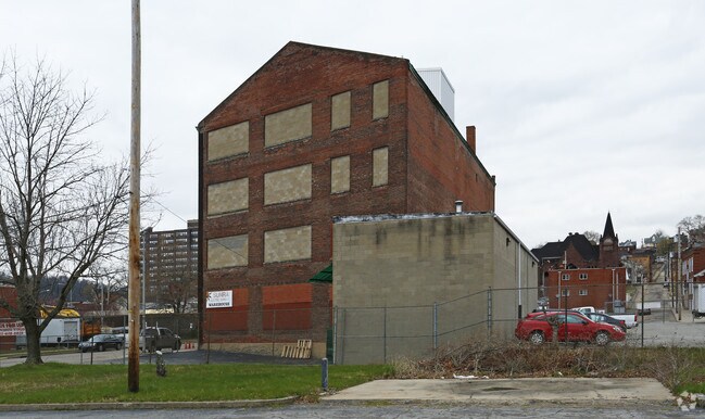
Property Detail
700 Walnut St
Pittsburgh, PA
ORIGINAL PLAN OF MC KEESPORT LOT 223-224 & PTS 225 & PT VAC AY IRREG LOT 140X115X5 WALNUT ST 4 STY BRK GAR
0307-J-00137-0000-00
ALLEGHENY
Warehouse
Pennsylvania
B and X Area of moderate flood hazard, usually the area between the limits of the 100-year and 500-year floods.
137
2026
0.19 AC
2026
Parkway East Corridor
552300
Pittsburgh
NEARBY LISTINGS FOR SALE OR LEASE
DEMOGRAPHICS near 700 Walnut St
1 mile
3 mile
5 mile
2025 Total Population
11,236
61,442
144,822
2030 Population
11,413
61,402
144,747
Pop Growth 2025-2030
+ 1.58%
(0.07%)
(0.05%)
Average Age
43
43
43
2025 Total Households
4,768
27,476
66,039
HH Growth 2025-2030
+ 1.47%
(0.16%)
(0.10%)
Median Household Inc
$34,964
$50,826
$54,219
Avg Household Size
2.20
2.20
2.10
2025 Avg HH Vehicles
1.00
1.00
1.00
Median Home Value
$76,565
$106,728
$126,066
Median Year Built
1948
1951
1953
Nearby Places
Map Layers
Map Styles
 Street
 Aerial
Layers
 Traffic
 Biking
Places
Listings with unknown addresses are not visible on the map
- Restaurants
- Banks
- Shops
- Fitness
- Groceries
PUBLIC TRANSPORTATION
AIRPORT
Arnold Palmer Regional
Drive
Walk
Distance
Arnold Palmer Regional
53 min
28.9 mi
Pittsburgh International
Drive
Walk
Distance
Pittsburgh International
52 min
29.5 mi
SALE & LEASE HISTORY
LISTING DATE
SALE/LEASE

Jun 06, 2017
For Lease
Nearby Properties
Address
Land Use
TOTAL SIZE
Lot Size
Zoning
Address
Land Use
TOTAL SIZE
Lot Size
Zoning
5.98 AC
Address
Land Use
TOTAL SIZE
Lot Size
Zoning
49.22 AC
Address
Land Use
TOTAL SIZE
Lot Size
Zoning
Address
Land Use
TOTAL SIZE
Lot Size
Zoning
Address
Land Use
TOTAL SIZE
Lot Size
Zoning
10.68 AC
Address
Land Use
TOTAL SIZE
Lot Size
Zoning
1.39 AC
Address
Land Use
TOTAL SIZE
Lot Size
Zoning
11.31 AC
Address
Land Use
TOTAL SIZE
Lot Size
Zoning
29.17 AC
Address
Land Use
TOTAL SIZE
Lot Size
Zoning
121.64 AC
Address
Land Use
TOTAL SIZE
Lot Size
Zoning
43.15 AC
Address
Land Use
TOTAL SIZE
Lot Size
Zoning
Address
Land Use
TOTAL SIZE
Lot Size
Zoning
10.93 AC
Address
Land Use
TOTAL SIZE
Lot Size
Zoning
969 SF
80.46 AC
Address
Land Use
TOTAL SIZE
Lot Size
Zoning
Address
Land Use
TOTAL SIZE
Lot Size
Zoning
Address
Land Use
TOTAL SIZE
Lot Size
Zoning
10.13 AC
Address
Land Use
TOTAL SIZE
Lot Size
Zoning
10.01 AC
Address
Land Use
TOTAL SIZE
Lot Size
Zoning
12.56 AC
Address
Land Use
TOTAL SIZE
Lot Size
Zoning
2.10 AC
Address
Land Use
TOTAL SIZE
Lot Size
Zoning
3.50 AC
Address
Land Use
TOTAL SIZE
Lot Size
Zoning
24.85 AC
Address
Land Use
TOTAL SIZE
Lot Size
Zoning
Address
Land Use
TOTAL SIZE
Lot Size
Zoning
4.59 AC
Address
Land Use
TOTAL SIZE
Lot Size
Zoning
15.07 AC
Address
Land Use
TOTAL SIZE
Lot Size
Zoning
0.79 AC
Address
Land Use
TOTAL SIZE
Lot Size
Zoning
460.86 AC
Address
Land Use
TOTAL SIZE
Lot Size
Zoning
16.87 AC
Address
Land Use
TOTAL SIZE
Lot Size
Zoning
24.86 AC
Address
Land Use
TOTAL SIZE
Lot Size
Zoning
14.95 AC
Address
Land Use
TOTAL SIZE
Lot Size
Zoning
1.96 AC
The World's #1 Commercial Real Estate Marketplace
Connect with us
© 2026 CoStar Group
The information above has been obtained from sources believed reliable. While we do not doubt its accuracy we have not verified it and make no guarantee, warranty or representation about it. It is your responsibility to independently confirm its accuracy and completeness. Any projections, opinions, assumptions, or estimates used are for example only and do not represent the current or future performance of the property. The value of this transaction to you depends on tax and other factors which should be evaluated by your tax, financial, and legal advisors. You and your advisors should conduct a careful, independent investigation of the property to determine to your satisfaction the suitability of the property for your needs.