Property Record
7000 Brockport Ct, Montgomery, AL 36117

This Property Is For Sale
NEARBY LISTINGS FOR SALE OR LEASE
Property Detail
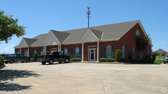
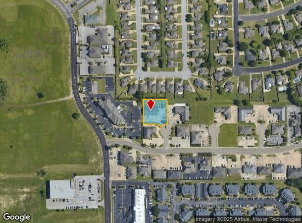
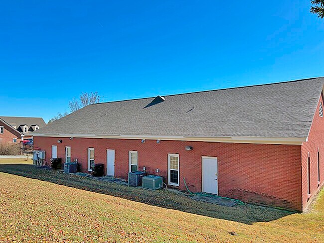
7000 Brockport Ct
Montgomery, AL
Old Federal Office Park 1
09-09-29-1-000-001.019
ALSO A 40FT STRIP ON N SIDE 0909291000001019
Officebuilding
Montgomery
X
Alabama
01101C0233H
4
2025
0.61 AC
2025
North Montgomery
005412
Montgomery
4,713 SF
DEMOGRAPHICS near 7000 Brockport Ct
1 Mile
3 Mile
5 Mile
2024 Total Population
6,187
42,751
96,484
2029 Population
5,810
41,153
93,078
Pop Growth 2024-2029
(6.09%)
(3.74%)
(3.53%)
Average Age
41
39
38
2024 Total Households
2,831
18,656
40,804
HH Growth 2024-2029
(6.32%)
(3.90%)
(3.63%)
Median Household Inc
$81,329
$73,306
$62,528
Avg Household Size
2.20
2.20
2.30
2024 Avg HH Vehicles
2.00
2.00
2.00
Median Home Value
$253,480
$240,191
$183,097
Median Year Built
1995
1995
1990
Nearby Places
- Restaurants
- Banks
- Shops
- Fitness
- Groceries
PUBLIC TRANSPORTATION
AIRPORT
Montgomery Regional (Dannelly Field)
DRIVE
WALK
Distance
Montgomery Regional (Dannelly Field)
34 min
18.2 mi
Nearby Properties
Address
Land Use
TOTAL SIZE
Lot Size
Zoning
Address
Land Use
TOTAL SIZE
Lot Size
Zoning
117,161 SF
12.07 AC
INST
Address
Land Use
TOTAL SIZE
Lot Size
Zoning
4,998 SF
27.50 AC
R-65-M
Address
Land Use
TOTAL SIZE
Lot Size
Zoning
5,118 SF
22.75 AC
R-65-M
Address
Land Use
TOTAL SIZE
Lot Size
Zoning
16,400 SF
28.35 AC
R-65-M
Address
Land Use
TOTAL SIZE
Lot Size
Zoning
160,604 SF
35.85 AC
B-2
Address
Land Use
TOTAL SIZE
Lot Size
Zoning
4,142 SF
25.96 AC
PUD
Address
Land Use
TOTAL SIZE
Lot Size
Zoning
4,597 SF
12.36 AC
PUD
Address
Land Use
TOTAL SIZE
Lot Size
Zoning
129,776 SF
6.13 AC
PUD
Address
Land Use
TOTAL SIZE
Lot Size
Zoning
15,932 SF
25.50 AC
R-60-M
Address
Land Use
TOTAL SIZE
Lot Size
Zoning
1,996 SF
15.81 AC
PUD
Address
Land Use
TOTAL SIZE
Lot Size
Zoning
47,292 SF
63.99 AC
Address
Land Use
TOTAL SIZE
Lot Size
Zoning
76,996 SF
15.51 AC
B-3
Address
Land Use
TOTAL SIZE
Lot Size
Zoning
38,646 SF
12.26 AC
PUD
Address
Land Use
TOTAL SIZE
Lot Size
Zoning
6,605 SF
6 AC
PUD
Address
Land Use
TOTAL SIZE
Lot Size
Zoning
57,408 SF
24.61 AC
Address
Land Use
TOTAL SIZE
Lot Size
Zoning
180,684 SF
21.94 AC
PUD
Address
Land Use
TOTAL SIZE
Lot Size
Zoning
1,554 SF
18.26 AC
R-75-M
Address
Land Use
TOTAL SIZE
Lot Size
Zoning
10,317 SF
16.70 AC
AGR-1
Address
Land Use
TOTAL SIZE
Lot Size
Zoning
127,082 SF
7.81 AC
PUD
Address
Land Use
TOTAL SIZE
Lot Size
Zoning
2,885 SF
14 AC
R-75-M
Address
Land Use
TOTAL SIZE
Lot Size
Zoning
92,200 SF
9.74 AC
O-1
Address
Land Use
TOTAL SIZE
Lot Size
Zoning
7,040 SF
11.70 AC
R-65-M
Address
Land Use
TOTAL SIZE
Lot Size
Zoning
217,723 SF
23.90 AC
B-2
Address
Land Use
TOTAL SIZE
Lot Size
Zoning
201,515 SF
4.46 AC
Address
Land Use
TOTAL SIZE
Lot Size
Zoning
24,360 SF
26.59 AC
R-65-M
Address
Land Use
TOTAL SIZE
Lot Size
Zoning
30.36 AC
PUD
Address
Land Use
TOTAL SIZE
Lot Size
Zoning
223,000 SF
26 AC
O-1
Address
Land Use
TOTAL SIZE
Lot Size
Zoning
30,536 SF
18.06 AC
AGR-1
Address
Land Use
TOTAL SIZE
Lot Size
Zoning
1,964 SF
13.40 AC
R-75-M
Address
Land Use
TOTAL SIZE
Lot Size
Zoning
56,446 SF
18.67 AC
PUD
The World's #1 Commercial Real Estate Marketplace
Connect with us
© 2025 CoStar Group
The information above has been obtained from sources believed reliable. While we do not doubt its accuracy we have not verified it and make no guarantee, warranty or representation about it. It is your responsibility to independently confirm its accuracy and completeness. Any projections, opinions, assumptions, or estimates used are for example only and do not represent the current or future performance of the property. The value of this transaction to you depends on tax and other factors which should be evaluated by your tax, financial, and legal advisors. You and your advisors should conduct a careful, independent investigation of the property to determine to your satisfaction the suitability of the property for your needs.