Property Record
2630 S Kolb Rd, Tucson, AZ 85730
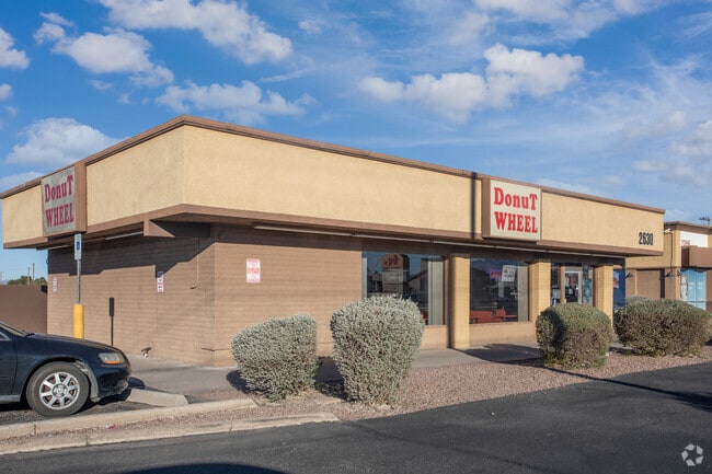


Property Detail
2630 S Kolb Rd
Tucson, AZ
KOLB AND GOLF LINKS SQ20231580423 LOT 6
136-24-4640
Pima
Regionalshoppingcenterormallwithanchorstore
Arizona
B and X Area of moderate flood hazard, usually the area between the limits of the 100-year and 500-year floods.
6
2025
0.61 AC
2026
Southeast Tucson
004033
Tucson
2,282 SF
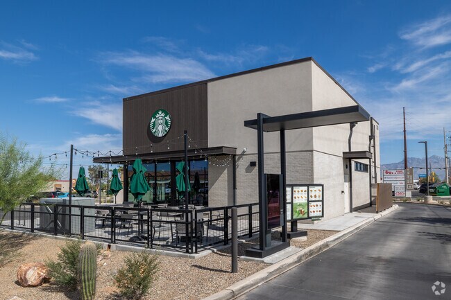
NEARBY LISTINGS FOR SALE OR LEASE
DEMOGRAPHICS near 2630 S Kolb Rd
1 mile
3 mile
5 mile
2025 Total Population
18,149
99,810
213,133
2030 Population
18,416
102,092
218,090
Pop Growth 2025-2030
+ 1.47%
+ 2.29%
+ 2.33%
Average Age
39
40
41
2025 Total Households
7,235
42,572
92,970
HH Growth 2025-2030
+ 1.58%
+ 2.37%
+ 2.38%
Median Household Inc
$57,410
$55,628
$60,710
Avg Household Size
2.40
2.20
2.20
2025 Avg HH Vehicles
2.00
2.00
2.00
Median Home Value
$264,022
$263,178
$295,467
Median Year Built
1973
1975
1976
Nearby Places
Map Layers
Map Styles
 Street
 Aerial
Layers
 Traffic
 Biking
Places
Listings with unknown addresses are not visible on the map
- Restaurants
- Banks
- Shops
- Fitness
- Groceries
PUBLIC TRANSPORTATION
COMMUTER RAIL
Tucson Amtrak Station (Sunset Limited - Amtrak, Texas Eagle - Amtrak)
Drive
Walk
Distance
Tucson Amtrak Station (Sunset Limited - Amtrak, Texas Eagle - Amtrak)
15 min
8.6 mi
AIRPORT
Tucson International
Drive
Walk
Distance
Tucson International
19 min
10.6 mi
Freight Ports
Port of San Diego
Drive
Walk
Distance
Port of San Diego
449 min
417.0 mi
SALE & LEASE HISTORY
LISTING DATE
SALE/LEASE

Aug 15, 2024
For Sale
Nearby Properties
Address
Land Use
TOTAL SIZE
Lot Size
Zoning
Address
Land Use
TOTAL SIZE
Lot Size
Zoning
2,315,205 SF
628.02 AC
I1
Address
Land Use
TOTAL SIZE
Lot Size
Zoning
53,431 SF
9.98 AC
Address
Land Use
TOTAL SIZE
Lot Size
Zoning
2,041,946 SF
640 AC
I1
Address
Land Use
TOTAL SIZE
Lot Size
Zoning
684,356 SF
19.65 AC
PAD13
Address
Land Use
TOTAL SIZE
Lot Size
Zoning
473,573 SF
22.65 AC
C3
Address
Land Use
TOTAL SIZE
Lot Size
Zoning
41,486 SF
0.93 AC
C2
Address
Land Use
TOTAL SIZE
Lot Size
Zoning
157,473 SF
56.40 AC
SR
Address
Land Use
TOTAL SIZE
Lot Size
Zoning
504,584 SF
18.17 AC
O3
Address
Land Use
TOTAL SIZE
Lot Size
Zoning
137,890 SF
8.28 AC
PAD1
Address
Land Use
TOTAL SIZE
Lot Size
Zoning
26,554 SF
5.08 AC
I1
Address
Land Use
TOTAL SIZE
Lot Size
Zoning
209,980 SF
6.16 AC
C2
Address
Land Use
TOTAL SIZE
Lot Size
Zoning
109,335 SF
7.83 AC
PAD13
Address
Land Use
TOTAL SIZE
Lot Size
Zoning
1,804 SF
8.29 AC
R3
Address
Land Use
TOTAL SIZE
Lot Size
Zoning
162,473 SF
6.08 AC
C3
Address
Land Use
TOTAL SIZE
Lot Size
Zoning
264,788 SF
12.63 AC
R3
Address
Land Use
TOTAL SIZE
Lot Size
Zoning
318,290 SF
32 AC
R1
Address
Land Use
TOTAL SIZE
Lot Size
Zoning
273,640 SF
21.20 AC
O3
Address
Land Use
TOTAL SIZE
Lot Size
Zoning
217,152 SF
5.37 AC
PAD1
Address
Land Use
TOTAL SIZE
Lot Size
Zoning
188,350 SF
10.81 AC
Address
Land Use
TOTAL SIZE
Lot Size
Zoning
286,164 SF
5.80 AC
C3
Address
Land Use
TOTAL SIZE
Lot Size
Zoning
118,655 SF
8.74 AC
C1
Address
Land Use
TOTAL SIZE
Lot Size
Zoning
268,026 SF
16 AC
R3
Address
Land Use
TOTAL SIZE
Lot Size
Zoning
259,360 SF
45 AC
R1
Address
Land Use
TOTAL SIZE
Lot Size
Zoning
171,301 SF
6.36 AC
C3
Address
Land Use
TOTAL SIZE
Lot Size
Zoning
83,067 SF
37.84 AC
RX1
Address
Land Use
TOTAL SIZE
Lot Size
Zoning
15,893 SF
2.86 AC
I1
Address
Land Use
TOTAL SIZE
Lot Size
Zoning
124,097 SF
6.22 AC
Address
Land Use
TOTAL SIZE
Lot Size
Zoning
7.09 AC
Address
Land Use
TOTAL SIZE
Lot Size
Zoning
165,096 SF
13.04 AC
C2
Address
Land Use
TOTAL SIZE
Lot Size
Zoning
97,407 SF
4.35 AC
C3
The World's #1 Commercial Real Estate Marketplace
Connect with us
© 2026 CoStar Group
The information above has been obtained from sources believed reliable. While we do not doubt its accuracy we have not verified it and make no guarantee, warranty or representation about it. It is your responsibility to independently confirm its accuracy and completeness. Any projections, opinions, assumptions, or estimates used are for example only and do not represent the current or future performance of the property. The value of this transaction to you depends on tax and other factors which should be evaluated by your tax, financial, and legal advisors. You and your advisors should conduct a careful, independent investigation of the property to determine to your satisfaction the suitability of the property for your needs.