Property Record
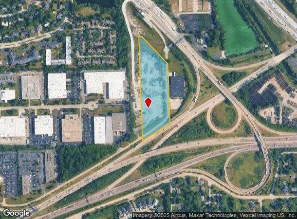
7000 N Frontage Rd, Burr Ridge, IL 60527


NEARBY LISTINGS FOR SALE OR LEASE
Property Detail
7000 N Frontage Rd
18-19-301-005-0000
Cook
Taxexempt
Illinois
X
13.74 AC
17043C0193J
Eastern East/West Corr
2021
Chicago
2024
Chicago-Naperville-Elgin, IL-IN-WI
820101
DEMOGRAPHICS near 7000 N Frontage Rd
1 Mile
3 Mile
5 Mile
2024 Total Population
6,261
68,017
212,419
2029 Population
6,170
66,978
209,348
Pop Growth 2024-2029
(1.45%)
(1.53%)
(1.45%)
Average Age
50
44
42
2024 Total Households
2,686
26,628
80,633
HH Growth 2024-2029
(1.97%)
(1.78%)
(1.62%)
Median Household Inc
$109,157
$111,505
$99,918
Avg Household Size
2.30
2.50
2.60
2024 Avg HH Vehicles
2.00
2.00
2.00
Median Home Value
$436,198
$463,244
$406,370
Median Year Built
1984
1976
1974
Nearby Places
Map Layers
Map Styles
 Street
 Aerial
- Restaurants
- Banks
- Shops
- Fitness
- Groceries
PUBLIC TRANSPORTATION
COMMUTER RAIL
Highlands Station (Burlington Northern-Santa Fe Railway Line - Northeast Illinois Regional Commuter Railroad (Metra))
DRIVE
WALK
Distance
Highlands Station (Burlington Northern-Santa Fe Railway Line - Northeast Illinois Regional Commuter Railroad (Metra))
12 min
4.2 mi
Hinsdale Station (Burlington Northern-Santa Fe Railway Line - Northeast Illinois Regional Commuter Railroad (Metra))
DRIVE
WALK
Distance
Hinsdale Station (Burlington Northern-Santa Fe Railway Line - Northeast Illinois Regional Commuter Railroad (Metra))
11 min
4.2 mi
AIRPORT
Chicago Midway International
DRIVE
WALK
Distance
Chicago Midway International
25 min
11.8 mi
Chicago O'Hare International
DRIVE
WALK
Distance
Chicago O'Hare International
52 min
22.7 mi
Nearby Properties
Address
Land Use
TOTAL SIZE
Lot Size
Zoning
Address
Land Use
TOTAL SIZE
Lot Size
Zoning
96.60 AC
Address
Land Use
TOTAL SIZE
Lot Size
Zoning
183,080 SF
20.86 AC
C
Address
Land Use
TOTAL SIZE
Lot Size
Zoning
68.06 AC
Address
Land Use
TOTAL SIZE
Lot Size
Zoning
274,406 SF
17.67 AC
M
Address
Land Use
TOTAL SIZE
Lot Size
Zoning
436,456 SF
59.11 AC
I
Address
Land Use
TOTAL SIZE
Lot Size
Zoning
182,295 SF
21.84 AC
C
Address
Land Use
TOTAL SIZE
Lot Size
Zoning
230,187 SF
15.38 AC
M
Address
Land Use
TOTAL SIZE
Lot Size
Zoning
202,562 SF
16.17 AC
M
Address
Land Use
TOTAL SIZE
Lot Size
Zoning
104,912 SF
6.91 AC
Address
Land Use
TOTAL SIZE
Lot Size
Zoning
94,064 SF
8.55 AC
Address
Land Use
TOTAL SIZE
Lot Size
Zoning
110,584 SF
5.57 AC
Address
Land Use
TOTAL SIZE
Lot Size
Zoning
146,856 SF
7.18 AC
A
Address
Land Use
TOTAL SIZE
Lot Size
Zoning
111,892 SF
8.69 AC
I
Address
Land Use
TOTAL SIZE
Lot Size
Zoning
113,961 SF
6.94 AC
M
Address
Land Use
TOTAL SIZE
Lot Size
Zoning
195,000 SF
10.18 AC
Address
Land Use
TOTAL SIZE
Lot Size
Zoning
49,503 SF
1.47 AC
Address
Land Use
TOTAL SIZE
Lot Size
Zoning
274,900 SF
13.14 AC
Address
Land Use
TOTAL SIZE
Lot Size
Zoning
215,631 SF
23.94 AC
I
Address
Land Use
TOTAL SIZE
Lot Size
Zoning
84,944 SF
6.82 AC
C
Address
Land Use
TOTAL SIZE
Lot Size
Zoning
289,314 SF
2.79 AC
Address
Land Use
TOTAL SIZE
Lot Size
Zoning
128,283 SF
6.89 AC
C
Address
Land Use
TOTAL SIZE
Lot Size
Zoning
52,887 SF
4.64 AC
C
Address
Land Use
TOTAL SIZE
Lot Size
Zoning
144,840 SF
3.42 AC
Address
Land Use
TOTAL SIZE
Lot Size
Zoning
70,031 SF
3.87 AC
C
Address
Land Use
TOTAL SIZE
Lot Size
Zoning
Address
Land Use
TOTAL SIZE
Lot Size
Zoning
129,195 SF
10.71 AC
Address
Land Use
TOTAL SIZE
Lot Size
Zoning
Address
Land Use
TOTAL SIZE
Lot Size
Zoning
134,235 SF
7.96 AC
Address
Land Use
TOTAL SIZE
Lot Size
Zoning
44,863 SF
9.87 AC
COM-2
Address
Land Use
TOTAL SIZE
Lot Size
Zoning
11.53 AC
The World's #1 Commercial Real Estate Marketplace
Connect with us
© 2025 CoStar Group
The information above has been obtained from sources believed reliable. While we do not doubt its accuracy we have not verified it and make no guarantee, warranty or representation about it. It is your responsibility to independently confirm its accuracy and completeness. Any projections, opinions, assumptions, or estimates used are for example only and do not represent the current or future performance of the property. The value of this transaction to you depends on tax and other factors which should be evaluated by your tax, financial, and legal advisors. You and your advisors should conduct a careful, independent investigation of the property to determine to your satisfaction the suitability of the property for your needs.