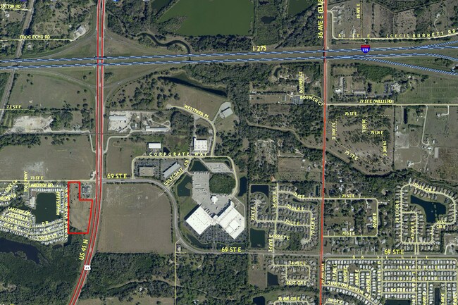
Property Record
73Rd St E, Palmetto, FL 34221


NEARBY LISTINGS FOR SALE OR LEASE
Property Detail
73Rd St E
6767-0015-9
THAT PORTION OF THE E1/2 OF THE NE1/4 OF THE SW1/4, LYING WEST OF HWY #41, LYING AND BEING IN SEC 30, TWN 33S, RNG 18E, LESS THE S 395.13 FT, CONT 3.04 AC (1700/7466), ALSO
Commercialacreage
Manatee
AE
Florida
12081C0158F
7.61 AC
2023
Manatee
2025
Tampa/St Petersburg
001501
North Port-Bradenton-Sarasota, FL
DEMOGRAPHICS near 73Rd St E
1 Mile
3 Mile
5 Mile
2024 Total Population
5,620
31,877
73,546
2029 Population
6,725
37,520
86,584
Pop Growth 2024-2029
+ 19.66%
+ 17.70%
+ 17.73%
Average Age
46
44
45
2024 Total Households
2,068
11,730
28,842
HH Growth 2024-2029
+ 19.34%
+ 17.03%
+ 17.03%
Median Household Inc
$53,974
$69,148
$63,056
Avg Household Size
2.30
2.50
2.40
2024 Avg HH Vehicles
2.00
2.00
2.00
Median Home Value
$230,994
$255,949
$248,975
Median Year Built
1996
1999
1995
Nearby Places
Map Layers
Map Styles
 Street
 Aerial
- Restaurants
- Banks
- Shops
- Fitness
- Groceries
PUBLIC TRANSPORTATION
AIRPORT
Sarasota/Bradenton International
DRIVE
WALK
Distance
Sarasota/Bradenton International
27 min
15.0 mi
St Pete-Clearwater International
DRIVE
WALK
Distance
St Pete-Clearwater International
47 min
32.6 mi
Tampa International
DRIVE
WALK
Distance
Tampa International
54 min
40.5 mi
Freight Ports
Port Manatee
DRIVE
WALK
Distance
Port Manatee
11 min
5.3 mi
SALE & LEASE HISTORY
LISTING DATE
SALE/LEASE

Sep 24, 2016
For Sale
Feb 22, 2022
For Sale
Nearby Properties
Address
Land Use
TOTAL SIZE
Lot Size
Zoning
Address
Land Use
TOTAL SIZE
Lot Size
Zoning
406,811 SF
34.95 AC
PD-EZ
Address
Land Use
TOTAL SIZE
Lot Size
Zoning
294,300 SF
10.33 AC
PD-MU
Address
Land Use
TOTAL SIZE
Lot Size
Zoning
359,418 SF
16.36 AC
PD-C
Address
Land Use
TOTAL SIZE
Lot Size
Zoning
30,717 SF
79.79 AC
A-1 SUBURB
Address
Land Use
TOTAL SIZE
Lot Size
Zoning
25,161 SF
94.96 AC
PD-RV
Address
Land Use
TOTAL SIZE
Lot Size
Zoning
184,048 SF
21.11 AC
PD-MU
Address
Land Use
TOTAL SIZE
Lot Size
Zoning
608,665 SF
30 AC
PD-MU
Address
Land Use
TOTAL SIZE
Lot Size
Zoning
456,317 SF
46.75 AC
PD-R
Address
Land Use
TOTAL SIZE
Lot Size
Zoning
208,893 SF
12.17 AC
PD-MU
Address
Land Use
TOTAL SIZE
Lot Size
Zoning
124,400 SF
4.05 AC
PD-MU
Address
Land Use
TOTAL SIZE
Lot Size
Zoning
172,875 SF
9.12 AC
A-1,NC-M,R
Address
Land Use
TOTAL SIZE
Lot Size
Zoning
118,152 SF
30.66 AC
A-1 SUBURB
Address
Land Use
TOTAL SIZE
Lot Size
Zoning
6,552 SF
30.06 AC
RVP
Address
Land Use
TOTAL SIZE
Lot Size
Zoning
137,104 SF
10 AC
PD-EZ
Address
Land Use
TOTAL SIZE
Lot Size
Zoning
3.09 AC
PD-R
Address
Land Use
TOTAL SIZE
Lot Size
Zoning
75,001 SF
18.15 AC
PD-C
Address
Land Use
TOTAL SIZE
Lot Size
Zoning
98,574 SF
5.60 AC
PD-MU
Address
Land Use
TOTAL SIZE
Lot Size
Zoning
127,606 SF
18.02 AC
LM LIGHT M
Address
Land Use
TOTAL SIZE
Lot Size
Zoning
3,800 SF
17.63 AC
PD-RV
Address
Land Use
TOTAL SIZE
Lot Size
Zoning
107.99 AC
Address
Land Use
TOTAL SIZE
Lot Size
Zoning
4,454 SF
1,348.39 AC
PD-R
Address
Land Use
TOTAL SIZE
Lot Size
Zoning
1,890 SF
20.42 AC
PD-RV
Address
Land Use
TOTAL SIZE
Lot Size
Zoning
117,873 SF
19.10 AC
RSF-4.5 RE
Address
Land Use
TOTAL SIZE
Lot Size
Zoning
47,330 SF
5.92 AC
PD-MU
Address
Land Use
TOTAL SIZE
Lot Size
Zoning
39,943 SF
9.03 AC
A-1 SUBURB
Address
Land Use
TOTAL SIZE
Lot Size
Zoning
65,310 SF
3.94 AC
PD-MU
Address
Land Use
TOTAL SIZE
Lot Size
Zoning
38,770 SF
4.72 AC
GC GENERA
Address
Land Use
TOTAL SIZE
Lot Size
Zoning
2,192 SF
16.90 AC
PD-RV
Address
Land Use
TOTAL SIZE
Lot Size
Zoning
53,450 SF
4.12 AC
PD-MU
Address
Land Use
TOTAL SIZE
Lot Size
Zoning
68,051 SF
5.80 AC
HC HEAVY C
The World's #1 Commercial Real Estate Marketplace
Connect with us
© 2026 CoStar Group
The information above has been obtained from sources believed reliable. While we do not doubt its accuracy we have not verified it and make no guarantee, warranty or representation about it. It is your responsibility to independently confirm its accuracy and completeness. Any projections, opinions, assumptions, or estimates used are for example only and do not represent the current or future performance of the property. The value of this transaction to you depends on tax and other factors which should be evaluated by your tax, financial, and legal advisors. You and your advisors should conduct a careful, independent investigation of the property to determine to your satisfaction the suitability of the property for your needs.