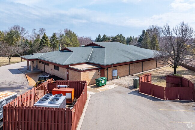
Property Record
7007 N Range Line Rd, Milwaukee, WI 53209


NEARBY LISTINGS FOR SALE OR LEASE
Property Detail
7007 N Range Line Rd
Milwaukee-Waukesha, WI
Certified Surv Map 4684
124-8006-000
MAP 4684 SILDE 1825 PL 469-472 DOC 5872017
Commercialnec
Milwaukee
X
Wisconsin
55089C0265G
2
2024
2.52 AC
2024
Milwaukee NW
060102
Milwaukee/Madison
11,965 SF
DEMOGRAPHICS near 7007 N Range Line Rd
1 mile
3 mile
5 mile
2024 Total Population
7,989
75,286
237,442
2029 Population
7,787
73,718
233,904
Pop Growth 2024-2029
(2.53%)
(2.08%)
(1.49%)
Average Age
40
38
38
2024 Total Households
3,350
29,991
93,515
HH Growth 2024-2029
(2.63%)
(2.20%)
(1.60%)
Median Household Inc
$61,609
$58,040
$51,129
Avg Household Size
2.40
2.40
2.50
2024 Avg HH Vehicles
2.00
1.00
1.00
Median Home Value
$295,733
$211,167
$178,247
Median Year Built
1966
1957
1956
Nearby Places
Map Layers
Map Styles
 Street
 Aerial
Transit
 Traffic
 Biking
Places
Listings with unknown addresses are not visible on the map
- Restaurants
- Banks
- Shops
- Fitness
- Groceries
PUBLIC TRANSPORTATION
AIRPORT
General Mitchell International
Drive
Walk
Distance
General Mitchell International
28 min
16.7 mi
Freight Ports
Port Milwaukee
Drive
Walk
Distance
Port Milwaukee
21 min
12.6 mi
SALE & LEASE HISTORY
LISTING DATE
SALE/LEASE

Mar 17, 2022
For Lease
Dec 14, 2023
For Sale
Nearby Properties
Address
Land Use
TOTAL SIZE
Lot Size
Zoning
Address
Land Use
TOTAL SIZE
Lot Size
Zoning
305,573 SF
3.20 AC
Address
Land Use
TOTAL SIZE
Lot Size
Zoning
527,776 SF
33.23 AC
Address
Land Use
TOTAL SIZE
Lot Size
Zoning
19.64 AC
Address
Land Use
TOTAL SIZE
Lot Size
Zoning
Address
Land Use
TOTAL SIZE
Lot Size
Zoning
Address
Land Use
TOTAL SIZE
Lot Size
Zoning
145,218 SF
10.23 AC
Address
Land Use
TOTAL SIZE
Lot Size
Zoning
72,824 SF
11.57 AC
Address
Land Use
TOTAL SIZE
Lot Size
Zoning
Address
Land Use
TOTAL SIZE
Lot Size
Zoning
Address
Land Use
TOTAL SIZE
Lot Size
Zoning
294,553 SF
6.19 AC
Address
Land Use
TOTAL SIZE
Lot Size
Zoning
235,364 SF
7.20 AC
Address
Land Use
TOTAL SIZE
Lot Size
Zoning
90,714 SF
4.18 AC
Address
Land Use
TOTAL SIZE
Lot Size
Zoning
195,507 SF
1.92 AC
Address
Land Use
TOTAL SIZE
Lot Size
Zoning
298,666 SF
5.09 AC
PD
Address
Land Use
TOTAL SIZE
Lot Size
Zoning
72,676 SF
6.22 AC
Address
Land Use
TOTAL SIZE
Lot Size
Zoning
104,365 SF
9.85 AC
PD
Address
Land Use
TOTAL SIZE
Lot Size
Zoning
66.42 AC
IL1
Address
Land Use
TOTAL SIZE
Lot Size
Zoning
4.26 AC
Address
Land Use
TOTAL SIZE
Lot Size
Zoning
74,526 SF
5.42 AC
Address
Land Use
TOTAL SIZE
Lot Size
Zoning
48,540 SF
4.28 AC
Address
Land Use
TOTAL SIZE
Lot Size
Zoning
127,584 SF
3.28 AC
Address
Land Use
TOTAL SIZE
Lot Size
Zoning
Address
Land Use
TOTAL SIZE
Lot Size
Zoning
18.54 AC
RS6
Address
Land Use
TOTAL SIZE
Lot Size
Zoning
61,910 SF
7.84 AC
Address
Land Use
TOTAL SIZE
Lot Size
Zoning
36,755 SF
6.44 AC
Address
Land Use
TOTAL SIZE
Lot Size
Zoning
81,300 SF
0.71 AC
Address
Land Use
TOTAL SIZE
Lot Size
Zoning
333,971 SF
16.93 AC
IL1
Address
Land Use
TOTAL SIZE
Lot Size
Zoning
166,245 SF
55 AC
PD
Address
Land Use
TOTAL SIZE
Lot Size
Zoning
28.12 AC
RM1
Address
Land Use
TOTAL SIZE
Lot Size
Zoning
The World's #1 Commercial Real Estate Marketplace
Connect with us
© 2026 CoStar Group
The information above has been obtained from sources believed reliable. While we do not doubt its accuracy we have not verified it and make no guarantee, warranty or representation about it. It is your responsibility to independently confirm its accuracy and completeness. Any projections, opinions, assumptions, or estimates used are for example only and do not represent the current or future performance of the property. The value of this transaction to you depends on tax and other factors which should be evaluated by your tax, financial, and legal advisors. You and your advisors should conduct a careful, independent investigation of the property to determine to your satisfaction the suitability of the property for your needs.