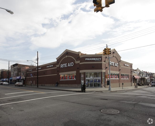
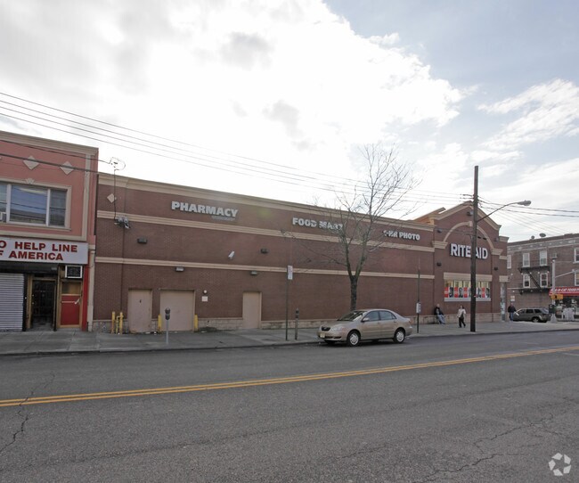
Property Record
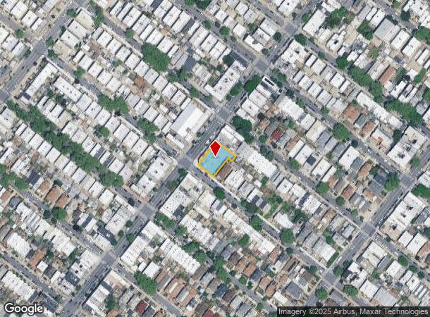
7009-7023 13Th Ave, Brooklyn, NY 11228

NEARBY LISTINGS FOR SALE OR LEASE
Property Detail
7009-7023 13Th Ave
06167-0001
DOCID-2018103100670001
Storebuilding
Kings
X
New York
3604970332F
1
2024
0.24 AC
2025
South Brooklyn
014800
Long Island (New York)
10,550 SF
New York-Jersey City-White Plains, NY-NJ
DEMOGRAPHICS near 7009-7023 13Th Ave
1 Mile
3 Mile
5 Mile
2024 Total Population
123,319
795,842
1,709,553
2029 Population
111,162
737,788
1,602,793
Pop Growth 2024-2029
(9.86%)
(7.29%)
(6.24%)
Average Age
38
39
40
2024 Total Households
37,603
266,090
623,968
HH Growth 2024-2029
(10.56%)
(7.63%)
(6.48%)
Median Household Inc
$60,027
$66,008
$72,454
Avg Household Size
3.10
2.90
2.60
2024 Avg HH Vehicles
1.00
1.00
1.00
Median Home Value
$1,002,771
$917,266
$820,079
Median Year Built
1946
1947
1948
Nearby Places
Map Layers
Map Styles
 Street
 Aerial
- Restaurants
- Banks
- Shops
- Fitness
- Groceries
PUBLIC TRANSPORTATION
TRANSIT/SUBWAY
71 Street (D - New York MTA Subway (The Subway), M - New York MTA Subway (The Subway))
DRIVE
WALK
Distance
71 Street (D - New York MTA Subway (The Subway), M - New York MTA Subway (The Subway))
2 min
8 min
0.4 mi
New Utrecht Avenue (N - New York MTA Subway (The Subway))
DRIVE
WALK
Distance
New Utrecht Avenue (N - New York MTA Subway (The Subway))
2 min
12 min
0.6 mi
62 Street (D - New York MTA Subway (The Subway), M - New York MTA Subway (The Subway))
DRIVE
WALK
Distance
62 Street (D - New York MTA Subway (The Subway), M - New York MTA Subway (The Subway))
2 min
13 min
0.7 mi
79 Street (D,M Line) (D - New York MTA Subway (The Subway), M - New York MTA Subway (The Subway))
DRIVE
WALK
Distance
79 Street (D,M Line) (D - New York MTA Subway (The Subway), M - New York MTA Subway (The Subway))
3 min
15 min
0.8 mi
Fort Hamilton Parkway (N Line) (N - New York MTA Subway (The Subway))
DRIVE
WALK
Distance
Fort Hamilton Parkway (N Line) (N - New York MTA Subway (The Subway))
3 min
17 min
0.8 mi
COMMUTER RAIL
Grasmere (Staten Island Railway - New York MTA Subway (The Subway))
DRIVE
WALK
Distance
Grasmere (Staten Island Railway - New York MTA Subway (The Subway))
13 min
5.8 mi
Clifton (Staten Island Railway - New York MTA Subway (The Subway))
DRIVE
WALK
Distance
Clifton (Staten Island Railway - New York MTA Subway (The Subway))
13 min
6.3 mi
AIRPORT
John F Kennedy International
DRIVE
WALK
Distance
John F Kennedy International
28 min
14.8 mi
LaGuardia
DRIVE
WALK
Distance
LaGuardia
30 min
16.9 mi
Newark Liberty International
DRIVE
WALK
Distance
Newark Liberty International
34 min
21.0 mi
Freight Ports
NY - Red Hook Container Terminal
DRIVE
WALK
Distance
NY - Red Hook Container Terminal
11 min
5.8 mi
Nearby Properties
Address
Land Use
TOTAL SIZE
Lot Size
Zoning
Address
Land Use
TOTAL SIZE
Lot Size
Zoning
92,440 SF
466.23 AC
R5
Address
Land Use
TOTAL SIZE
Lot Size
Zoning
1,524,659 SF
170.96 AC
R4
Address
Land Use
TOTAL SIZE
Lot Size
Zoning
902,000 SF
6.44 AC
M3-1
Address
Land Use
TOTAL SIZE
Lot Size
Zoning
965,600 SF
6.65 AC
R5
Address
Land Use
TOTAL SIZE
Lot Size
Zoning
460,000 SF
3.21 AC
R6
Address
Land Use
TOTAL SIZE
Lot Size
Zoning
1,073,920 SF
16.53 AC
R6
Address
Land Use
TOTAL SIZE
Lot Size
Zoning
335,800 SF
1.51 AC
R6
Address
Land Use
TOTAL SIZE
Lot Size
Zoning
54.78 AC
PARK
Address
Land Use
TOTAL SIZE
Lot Size
Zoning
785,450 SF
14.22 AC
R6
Address
Land Use
TOTAL SIZE
Lot Size
Zoning
1,324,592 SF
5.13 AC
M3-1
Address
Land Use
TOTAL SIZE
Lot Size
Zoning
397,354 SF
0.61 AC
C5-2
Address
Land Use
TOTAL SIZE
Lot Size
Zoning
236,591 SF
207.66 AC
R3-2
Address
Land Use
TOTAL SIZE
Lot Size
Zoning
393,092 SF
1.07 AC
R8A
Address
Land Use
TOTAL SIZE
Lot Size
Zoning
371,139 SF
3.22 AC
R5
Address
Land Use
TOTAL SIZE
Lot Size
Zoning
5,359,400 SF
59.07 AC
M2-1
Address
Land Use
TOTAL SIZE
Lot Size
Zoning
286,000 SF
12.63 AC
PARK
Address
Land Use
TOTAL SIZE
Lot Size
Zoning
3,970,000 SF
91.14 AC
M3-1
Address
Land Use
TOTAL SIZE
Lot Size
Zoning
689,850 SF
3.08 AC
M3-1
Address
Land Use
TOTAL SIZE
Lot Size
Zoning
301,400 SF
22.27 AC
M3-1
Address
Land Use
TOTAL SIZE
Lot Size
Zoning
673,895 SF
3.22 AC
M3-1
Address
Land Use
TOTAL SIZE
Lot Size
Zoning
1,112,855 SF
3.52 AC
M3-1
Address
Land Use
TOTAL SIZE
Lot Size
Zoning
139,557 SF
11.47 AC
M1-1
Address
Land Use
TOTAL SIZE
Lot Size
Zoning
623,117 SF
4.16 AC
M3-1
Address
Land Use
TOTAL SIZE
Lot Size
Zoning
218,840 SF
2.52 AC
R6B
Address
Land Use
TOTAL SIZE
Lot Size
Zoning
171,591 SF
0.14 AC
C5-2
Address
Land Use
TOTAL SIZE
Lot Size
Zoning
846,056 SF
20.71 AC
R5
Address
Land Use
TOTAL SIZE
Lot Size
Zoning
581,250 SF
3.22 AC
M3-1
Address
Land Use
TOTAL SIZE
Lot Size
Zoning
292,528 SF
1.05 AC
R6
Address
Land Use
TOTAL SIZE
Lot Size
Zoning
61,215 SF
0.32 AC
C64M
Address
Land Use
TOTAL SIZE
Lot Size
Zoning
287,761 SF
1.10 AC
M3-1
The World's #1 Commercial Real Estate Marketplace
Connect with us
© 2026 CoStar Group
The information above has been obtained from sources believed reliable. While we do not doubt its accuracy we have not verified it and make no guarantee, warranty or representation about it. It is your responsibility to independently confirm its accuracy and completeness. Any projections, opinions, assumptions, or estimates used are for example only and do not represent the current or future performance of the property. The value of this transaction to you depends on tax and other factors which should be evaluated by your tax, financial, and legal advisors. You and your advisors should conduct a careful, independent investigation of the property to determine to your satisfaction the suitability of the property for your needs.