Property Record
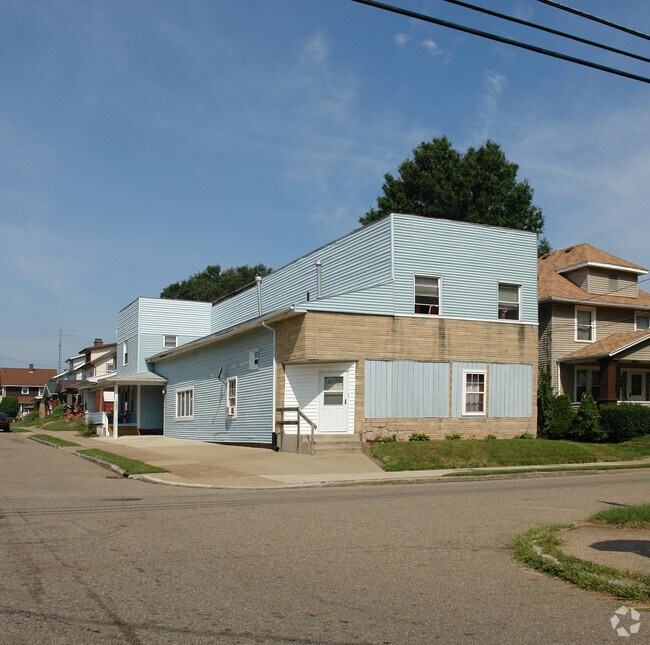
701 Arlington Ave Nw, Canton, OH 44708


Property Detail
701 Arlington Ave Nw
00226576
18466 WH
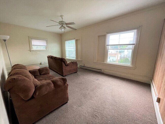
Apartment
Stark
B and X Area of moderate flood hazard, usually the area between the limits of the 100-year and 500-year floods.
Ohio
0
0.12 AC
2025
Northwest
701000
Cleveland
5,933 SF
Canton-Massillon, OH
NEARBY LISTINGS FOR SALE OR LEASE
DEMOGRAPHICS near 701 Arlington Ave Nw
1 mile
3 mile
5 mile
2024 Total Population
15,204
80,491
152,215
2029 Population
15,130
80,267
152,416
Pop Growth 2024-2029
(0.49%)
(0.28%)
+ 0.13%
Average Age
38
40
42
2024 Total Households
6,170
35,007
65,466
HH Growth 2024-2029
(0.50%)
(0.34%)
+ 0.12%
Median Household Inc
$41,914
$47,500
$54,350
Avg Household Size
2.30
2.20
2.20
2024 Avg HH Vehicles
2.00
2.00
2.00
Median Home Value
$84,675
$125,363
$159,162
Median Year Built
1946
1951
1958
Nearby Places
Map Layers
Map Styles
 Street
 Aerial
Transit
 Traffic
 Biking
Places
Listings with unknown addresses are not visible on the map
- Restaurants
- Banks
- Shops
- Fitness
- Groceries
PUBLIC TRANSPORTATION
AIRPORT
Akron-Canton Regional
Drive
Walk
Distance
Akron-Canton Regional
15 min
9.9 mi
SALE & LEASE HISTORY
LISTING DATE
SALE/LEASE

Jun 28, 2023
For Sale
Nearby Properties
Address
Land Use
TOTAL SIZE
Lot Size
Zoning
Address
Land Use
TOTAL SIZE
Lot Size
Zoning
86,994 SF
35.20 AC
Address
Land Use
TOTAL SIZE
Lot Size
Zoning
551,338 SF
7.26 AC
Address
Land Use
TOTAL SIZE
Lot Size
Zoning
397,897 SF
3.76 AC
Address
Land Use
TOTAL SIZE
Lot Size
Zoning
521,112 SF
14.28 AC
Address
Land Use
TOTAL SIZE
Lot Size
Zoning
356,172 SF
4.06 AC
Address
Land Use
TOTAL SIZE
Lot Size
Zoning
194,249 SF
10.90 AC
Address
Land Use
TOTAL SIZE
Lot Size
Zoning
330,693 SF
14.29 AC
Address
Land Use
TOTAL SIZE
Lot Size
Zoning
180,000 SF
Address
Land Use
TOTAL SIZE
Lot Size
Zoning
272,888 SF
27.61 AC
Address
Land Use
TOTAL SIZE
Lot Size
Zoning
327,119 SF
50.74 AC
Address
Land Use
TOTAL SIZE
Lot Size
Zoning
194,249 SF
10.86 AC
Address
Land Use
TOTAL SIZE
Lot Size
Zoning
345,570 SF
29.76 AC
Address
Land Use
TOTAL SIZE
Lot Size
Zoning
168,731 SF
57.06 AC
Address
Land Use
TOTAL SIZE
Lot Size
Zoning
108,197 SF
8.19 AC
Address
Land Use
TOTAL SIZE
Lot Size
Zoning
96,596 SF
18.44 AC
Address
Land Use
TOTAL SIZE
Lot Size
Zoning
118,619 SF
2.14 AC
Address
Land Use
TOTAL SIZE
Lot Size
Zoning
117,601 SF
7.93 AC
Address
Land Use
TOTAL SIZE
Lot Size
Zoning
124,918 SF
12.85 AC
Address
Land Use
TOTAL SIZE
Lot Size
Zoning
107,248 SF
0.09 AC
Address
Land Use
TOTAL SIZE
Lot Size
Zoning
423,783 SF
26.11 AC
Address
Land Use
TOTAL SIZE
Lot Size
Zoning
316,099 SF
8.47 AC
Address
Land Use
TOTAL SIZE
Lot Size
Zoning
102,436 SF
4.95 AC
Address
Land Use
TOTAL SIZE
Lot Size
Zoning
82,950 SF
Address
Land Use
TOTAL SIZE
Lot Size
Zoning
158,390 SF
0.92 AC
Address
Land Use
TOTAL SIZE
Lot Size
Zoning
300,347 SF
14.78 AC
Address
Land Use
TOTAL SIZE
Lot Size
Zoning
61,884 SF
2.18 AC
Address
Land Use
TOTAL SIZE
Lot Size
Zoning
93,216 SF
4.93 AC
Address
Land Use
TOTAL SIZE
Lot Size
Zoning
0.35 AC
Address
Land Use
TOTAL SIZE
Lot Size
Zoning
89,344 SF
3.77 AC
Address
Land Use
TOTAL SIZE
Lot Size
Zoning
The World's #1 Commercial Real Estate Marketplace
Connect with us
© 2026 CoStar Group
The information above has been obtained from sources believed reliable. While we do not doubt its accuracy we have not verified it and make no guarantee, warranty or representation about it. It is your responsibility to independently confirm its accuracy and completeness. Any projections, opinions, assumptions, or estimates used are for example only and do not represent the current or future performance of the property. The value of this transaction to you depends on tax and other factors which should be evaluated by your tax, financial, and legal advisors. You and your advisors should conduct a careful, independent investigation of the property to determine to your satisfaction the suitability of the property for your needs.