Property Record
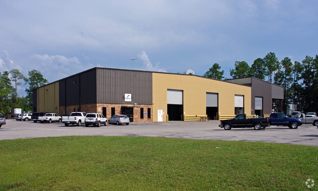
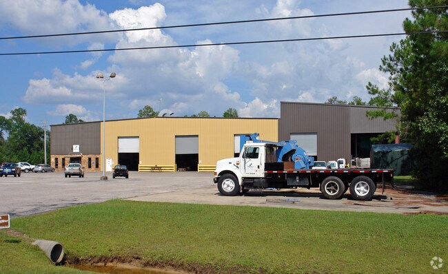
701 Bill Myles Dr, Saraland, AL 36571
Property Detail
701 Bill Myles Dr
Mobile, AL
E T SMITH SERVICES OF ALA INC AS LESSEE THAT PORTION OF LOT 1 JACINTOPORT UNIT 1 SEC A RESUB OF BLK 4 MBK 38 P 119 LYING IN
22-02-03-3-000-005
Mobile
Manufacturinglight
Alabama
B and X Area of moderate flood hazard, usually the area between the limits of the 100-year and 500-year floods.
1
2025
2.40 AC
2025
Northeast Mobile
003800
Mobile
16,800 SF
NEARBY LISTINGS FOR SALE OR LEASE
DEMOGRAPHICS near 701 Bill Myles Dr
1 mile
3 mile
5 mile
2025 Total Population
3,052
14,872
35,924
2030 Population
3,036
14,698
35,963
Pop Growth 2025-2030
(0.52%)
(1.17%)
+ 0.11%
Average Age
38
39
40
2025 Total Households
1,252
5,966
14,069
HH Growth 2025-2030
(0.48%)
(1.16%)
+ 0.11%
Median Household Inc
$41,081
$53,623
$48,789
Avg Household Size
2.40
2.50
2.50
2025 Avg HH Vehicles
2.00
2.00
2.00
Median Home Value
$193,918
$195,995
$173,932
Median Year Built
1976
1972
1972
Nearby Places
Map Layers
Map Styles
 Street
 Aerial
Layers
 Traffic
 Biking
Places
Listings with unknown addresses are not visible on the map
- Restaurants
- Banks
- Shops
- Fitness
- Groceries
PUBLIC TRANSPORTATION
AIRPORT
Mobile International
Drive
Walk
Distance
Mobile International
25 min
14.5 mi
Nearby Properties
Address
Land Use
TOTAL SIZE
Lot Size
Zoning
Address
Land Use
TOTAL SIZE
Lot Size
Zoning
66,138 SF
35.24 AC
Address
Land Use
TOTAL SIZE
Lot Size
Zoning
9,100 SF
34.07 AC
Address
Land Use
TOTAL SIZE
Lot Size
Zoning
35,775 SF
22.48 AC
Address
Land Use
TOTAL SIZE
Lot Size
Zoning
187,257 SF
33.10 AC
Address
Land Use
TOTAL SIZE
Lot Size
Zoning
21,700 SF
6.98 AC
Address
Land Use
TOTAL SIZE
Lot Size
Zoning
197,471 SF
15.90 AC
Address
Land Use
TOTAL SIZE
Lot Size
Zoning
66,678 SF
2.29 AC
Address
Land Use
TOTAL SIZE
Lot Size
Zoning
57,084 SF
1.97 AC
Address
Land Use
TOTAL SIZE
Lot Size
Zoning
116,512 SF
9.60 AC
Address
Land Use
TOTAL SIZE
Lot Size
Zoning
1,104 SF
6.01 AC
Address
Land Use
TOTAL SIZE
Lot Size
Zoning
45,980 SF
10.72 AC
Address
Land Use
TOTAL SIZE
Lot Size
Zoning
125,239 SF
11.20 AC
Address
Land Use
TOTAL SIZE
Lot Size
Zoning
35,952 SF
5.37 AC
Address
Land Use
TOTAL SIZE
Lot Size
Zoning
54,965 SF
1.97 AC
Address
Land Use
TOTAL SIZE
Lot Size
Zoning
294,193 SF
7.06 AC
Address
Land Use
TOTAL SIZE
Lot Size
Zoning
86,174 SF
9.30 AC
Address
Land Use
TOTAL SIZE
Lot Size
Zoning
18,818 SF
6.21 AC
Address
Land Use
TOTAL SIZE
Lot Size
Zoning
142,692 SF
11.60 AC
Address
Land Use
TOTAL SIZE
Lot Size
Zoning
114,942 SF
29 AC
Address
Land Use
TOTAL SIZE
Lot Size
Zoning
128,250 SF
13.83 AC
Address
Land Use
TOTAL SIZE
Lot Size
Zoning
73,680 SF
27 AC
Address
Land Use
TOTAL SIZE
Lot Size
Zoning
40,245 SF
1.99 AC
Address
Land Use
TOTAL SIZE
Lot Size
Zoning
48,304 SF
3.28 AC
Address
Land Use
TOTAL SIZE
Lot Size
Zoning
76,682 SF
9.62 AC
Address
Land Use
TOTAL SIZE
Lot Size
Zoning
21,800 SF
6 AC
Address
Land Use
TOTAL SIZE
Lot Size
Zoning
122,776 SF
14.32 AC
Address
Land Use
TOTAL SIZE
Lot Size
Zoning
50,740 SF
1.57 AC
Address
Land Use
TOTAL SIZE
Lot Size
Zoning
31,420 SF
3.54 AC
Address
Land Use
TOTAL SIZE
Lot Size
Zoning
55,927 SF
5.87 AC
Address
Land Use
TOTAL SIZE
Lot Size
Zoning
200,000 SF
The World's #1 Commercial Real Estate Marketplace
Connect with us
© 2026 CoStar Group
The information above has been obtained from sources believed reliable. While we do not doubt its accuracy we have not verified it and make no guarantee, warranty or representation about it. It is your responsibility to independently confirm its accuracy and completeness. Any projections, opinions, assumptions, or estimates used are for example only and do not represent the current or future performance of the property. The value of this transaction to you depends on tax and other factors which should be evaluated by your tax, financial, and legal advisors. You and your advisors should conduct a careful, independent investigation of the property to determine to your satisfaction the suitability of the property for your needs.