Property Record
701 Butler St, Chesapeake, VA 23323


NEARBY LISTINGS FOR SALE OR LEASE
Property Detail
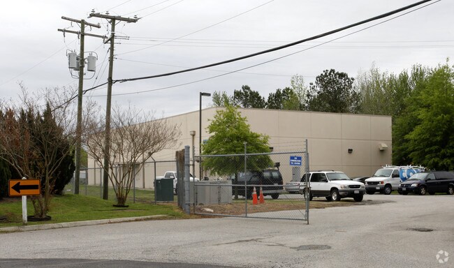
701 Butler St
0252011000302
South Mil Geo Wash Corridor
Officebuilding
PAR C & FUTURE STREET RESERVATION PROP OF W W REASOR ET AL 7.21668AC
X
Chesapeake
5100340023D
Virginia
2024
7.22 AC
2025
Southern Chesapeake
021402
Hampton Roads
624 SF
Virginia Beach-Norfolk-Newport News, VA-NC
DEMOGRAPHICS near 701 Butler St
1 Mile
3 Mile
5 Mile
2024 Total Population
10,247
57,307
156,396
2029 Population
10,581
58,725
159,511
Pop Growth 2024-2029
+ 3.26%
+ 2.47%
+ 1.99%
Average Age
38
38
38
2024 Total Households
3,728
20,349
59,118
HH Growth 2024-2029
+ 3.41%
+ 2.44%
+ 1.95%
Median Household Inc
$62,650
$69,096
$62,939
Avg Household Size
2.70
2.70
2.60
2024 Avg HH Vehicles
2.00
2.00
2.00
Median Home Value
$226,385
$246,478
$237,514
Median Year Built
1976
1977
1977
Nearby Places
Map Layers
Map Styles
 Street
 Aerial
- Restaurants
- Banks
- Shops
- Fitness
- Groceries
PUBLIC TRANSPORTATION
COMMUTER RAIL
DRIVE
WALK
Distance
15 min
7.3 mi
AIRPORT
Norfolk International
DRIVE
WALK
Distance
Norfolk International
27 min
14.9 mi
Newport News/Williamsburg International
DRIVE
WALK
Distance
Newport News/Williamsburg International
49 min
35.2 mi
Freight Ports
Virginia Port Authority - Portsmouth
DRIVE
WALK
Distance
Virginia Port Authority - Portsmouth
18 min
7.9 mi
Nearby Properties
Address
Land Use
TOTAL SIZE
Lot Size
Zoning
Address
Land Use
TOTAL SIZE
Lot Size
Zoning
250,000 SF
38 AC
MUH
Address
Land Use
TOTAL SIZE
Lot Size
Zoning
482.38 AC
MULTI: MUL
Address
Land Use
TOTAL SIZE
Lot Size
Zoning
120,471 SF
10.32 AC
M1: LIGHT
Address
Land Use
TOTAL SIZE
Lot Size
Zoning
295,000 SF
27.89 AC
M1: LIGHT
Address
Land Use
TOTAL SIZE
Lot Size
Zoning
178,068 SF
14.72 AC
M1: LIGHT
Address
Land Use
TOTAL SIZE
Lot Size
Zoning
195,637 SF
96.05 AC
RE1: RESID
Address
Land Use
TOTAL SIZE
Lot Size
Zoning
264,975 SF
50.36 AC
R10S: RESI
Address
Land Use
TOTAL SIZE
Lot Size
Zoning
241,397 SF
50.65 AC
M1: LIGHT
Address
Land Use
TOTAL SIZE
Lot Size
Zoning
28,253 SF
32.34 AC
M3: WATERF
Address
Land Use
TOTAL SIZE
Lot Size
Zoning
148,905 SF
7.32 AC
PUD: PLANN
Address
Land Use
TOTAL SIZE
Lot Size
Zoning
195,550 SF
8.58 AC
M1: LIGHT
Address
Land Use
TOTAL SIZE
Lot Size
Zoning
181,723 SF
41.87 AC
M1: LIGHT
Address
Land Use
TOTAL SIZE
Lot Size
Zoning
143,220 SF
44.78 AC
M1: LIGHT
Address
Land Use
TOTAL SIZE
Lot Size
Zoning
130,510 SF
33.74 AC
M1: LIGHT
Address
Land Use
TOTAL SIZE
Lot Size
Zoning
2,434 SF
39.25 AC
B2: GENERA
Address
Land Use
TOTAL SIZE
Lot Size
Zoning
85,266 SF
10.10 AC
M1: LIGHT
Address
Land Use
TOTAL SIZE
Lot Size
Zoning
1,352 SF
86 AC
MULTI: MUL
Address
Land Use
TOTAL SIZE
Lot Size
Zoning
387,092 SF
55.92 AC
URM
Address
Land Use
TOTAL SIZE
Lot Size
Zoning
126,250 SF
31.69 AC
R10S: RESI
Address
Land Use
TOTAL SIZE
Lot Size
Zoning
193,534 SF
17.99 AC
M1: LIGHT
Address
Land Use
TOTAL SIZE
Lot Size
Zoning
167,400 SF
10.74 AC
M1: LIGHT
Address
Land Use
TOTAL SIZE
Lot Size
Zoning
197,533 SF
15 AC
M1: LIGHT
Address
Land Use
TOTAL SIZE
Lot Size
Zoning
98,715 SF
20.64 AC
UR
Address
Land Use
TOTAL SIZE
Lot Size
Zoning
155,750 SF
12.01 AC
URM
Address
Land Use
TOTAL SIZE
Lot Size
Zoning
152,906 SF
16.93 AC
M2: GENERA
Address
Land Use
TOTAL SIZE
Lot Size
Zoning
50,486 SF
11.50 AC
M1: LIGHT
Address
Land Use
TOTAL SIZE
Lot Size
Zoning
48,511 SF
20.71 AC
M1: LIGHT
Address
Land Use
TOTAL SIZE
Lot Size
Zoning
187,158 SF
14.50 AC
URM
Address
Land Use
TOTAL SIZE
Lot Size
Zoning
98.15 AC
M3: WATERF
Address
Land Use
TOTAL SIZE
Lot Size
Zoning
62,936 SF
15 AC
UR
The World's #1 Commercial Real Estate Marketplace
Connect with us
© 2025 CoStar Group
The information above has been obtained from sources believed reliable. While we do not doubt its accuracy we have not verified it and make no guarantee, warranty or representation about it. It is your responsibility to independently confirm its accuracy and completeness. Any projections, opinions, assumptions, or estimates used are for example only and do not represent the current or future performance of the property. The value of this transaction to you depends on tax and other factors which should be evaluated by your tax, financial, and legal advisors. You and your advisors should conduct a careful, independent investigation of the property to determine to your satisfaction the suitability of the property for your needs.