Property Record
701 Carbondale Dr, Dacono, CO 80514


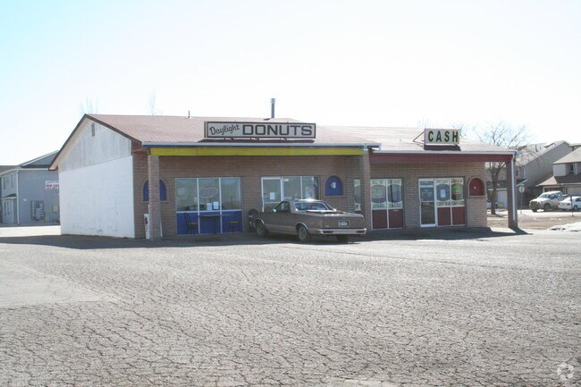
Property Detail
701 Carbondale Dr
Greeley, CO
L1 AMENDED REPLAT BLK 1 CARBON VALLEY PUD EXC E 170X 9.3 M/L
R8957004
Weld
Religious
Colorado
AE The base floodplain where base flood elevations are provided. AE Zones are now used on new format FIRMs instead of A1-A30 Zones.
1
0
1.49 AC
2025
Greeley
002004
Denver
6,900 SF
NEARBY LISTINGS FOR SALE OR LEASE
DEMOGRAPHICS near 701 Carbondale Dr
1 mile
3 mile
5 mile
2024 Total Population
8,671
19,574
39,417
2029 Population
9,498
21,543
43,342
Pop Growth 2024-2029
+ 9.54%
+ 10.06%
+ 9.96%
Average Age
38
38
38
2024 Total Households
3,069
6,758
13,086
HH Growth 2024-2029
+ 9.91%
+ 10.34%
+ 10.25%
Median Household Inc
$94,610
$104,804
$122,708
Avg Household Size
2.80
2.90
3.00
2024 Avg HH Vehicles
2.00
2.00
3.00
Median Home Value
$456,557
$504,889
$622,294
Median Year Built
2003
2006
2007
Nearby Places
Map Layers
Map Styles
 Street
 Aerial
Transit
 Traffic
 Biking
Places
Listings with unknown addresses are not visible on the map
- Restaurants
- Banks
- Shops
- Fitness
- Groceries
PUBLIC TRANSPORTATION
AIRPORT
Denver International
Drive
Walk
Distance
Denver International
40 min
30.5 mi
Nearby Properties
Address
Land Use
TOTAL SIZE
Lot Size
Zoning
Address
Land Use
TOTAL SIZE
Lot Size
Zoning
328,541 SF
19.97 AC
Address
Land Use
TOTAL SIZE
Lot Size
Zoning
207,946 SF
28.52 AC
Address
Land Use
TOTAL SIZE
Lot Size
Zoning
69,399 SF
18.43 AC
Address
Land Use
TOTAL SIZE
Lot Size
Zoning
55,378 SF
9.60 AC
Address
Land Use
TOTAL SIZE
Lot Size
Zoning
109,252 SF
8.70 AC
Address
Land Use
TOTAL SIZE
Lot Size
Zoning
139,480 SF
6.76 AC
Address
Land Use
TOTAL SIZE
Lot Size
Zoning
45,909 SF
20.52 AC
Address
Land Use
TOTAL SIZE
Lot Size
Zoning
51,010 SF
14.66 AC
Address
Land Use
TOTAL SIZE
Lot Size
Zoning
105,027 SF
86.37 AC
Address
Land Use
TOTAL SIZE
Lot Size
Zoning
41,870 SF
7.60 AC
Address
Land Use
TOTAL SIZE
Lot Size
Zoning
50,046 SF
4.32 AC
Address
Land Use
TOTAL SIZE
Lot Size
Zoning
46,956 SF
1.08 AC
Address
Land Use
TOTAL SIZE
Lot Size
Zoning
36,375 SF
0.69 AC
Address
Land Use
TOTAL SIZE
Lot Size
Zoning
65,308 SF
2.38 AC
Address
Land Use
TOTAL SIZE
Lot Size
Zoning
129,209 SF
19.35 AC
Address
Land Use
TOTAL SIZE
Lot Size
Zoning
56,766 SF
5.94 AC
Address
Land Use
TOTAL SIZE
Lot Size
Zoning
123,722 SF
10.94 AC
Address
Land Use
TOTAL SIZE
Lot Size
Zoning
43,919 SF
3.54 AC
Address
Land Use
TOTAL SIZE
Lot Size
Zoning
42,920 SF
3.24 AC
Address
Land Use
TOTAL SIZE
Lot Size
Zoning
81,827 SF
6.27 AC
Address
Land Use
TOTAL SIZE
Lot Size
Zoning
42,288 SF
2 AC
Address
Land Use
TOTAL SIZE
Lot Size
Zoning
36,891 SF
4.05 AC
Address
Land Use
TOTAL SIZE
Lot Size
Zoning
22,204 SF
5.61 AC
Address
Land Use
TOTAL SIZE
Lot Size
Zoning
38,129 SF
2.73 AC
Address
Land Use
TOTAL SIZE
Lot Size
Zoning
20,616 SF
4.20 AC
Address
Land Use
TOTAL SIZE
Lot Size
Zoning
34,670 SF
3.59 AC
Address
Land Use
TOTAL SIZE
Lot Size
Zoning
35,656 SF
2.36 AC
Address
Land Use
TOTAL SIZE
Lot Size
Zoning
39,373 SF
20.52 AC
Address
Land Use
TOTAL SIZE
Lot Size
Zoning
41,522 SF
6.75 AC
Address
Land Use
TOTAL SIZE
Lot Size
Zoning
15,306 SF
2.15 AC
The World's #1 Commercial Real Estate Marketplace
Connect with us
© 2026 CoStar Group
The information above has been obtained from sources believed reliable. While we do not doubt its accuracy we have not verified it and make no guarantee, warranty or representation about it. It is your responsibility to independently confirm its accuracy and completeness. Any projections, opinions, assumptions, or estimates used are for example only and do not represent the current or future performance of the property. The value of this transaction to you depends on tax and other factors which should be evaluated by your tax, financial, and legal advisors. You and your advisors should conduct a careful, independent investigation of the property to determine to your satisfaction the suitability of the property for your needs.