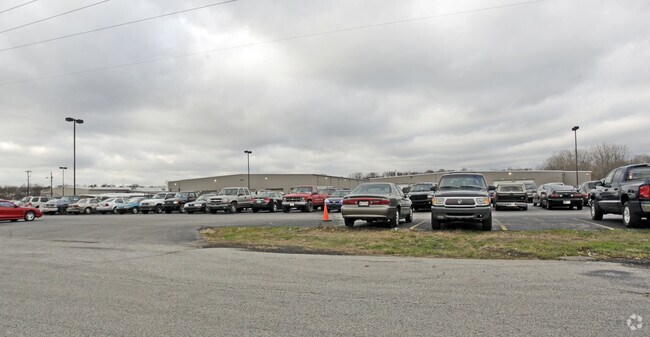
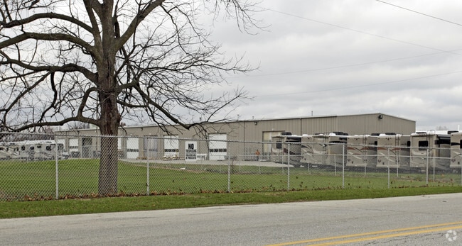
Property Record
701 County Road 15, Elkhart, IN 46516
NEARBY LISTINGS FOR SALE OR LEASE
Property Detail
701 County Road 15
20-06-02-426-008.000-011
1346.68X591.82X1096.97FTX 250.58FTX248.92FTX833FT- 755FT N SE COR SE1/4 EX ETC EX 1.26A SEC 2 2.126A
Lightindustrial
Elkhart
X
Indiana
18039C0141D
11.18 AC
2024
Outlying Elkhart County
2025
South Bend/Mishawaka
001902
Elkhart-Goshen, IN
238,198 SF
DEMOGRAPHICS near 701 County Road 15
1 Mile
3 Mile
5 Mile
2024 Total Population
2,283
39,152
89,522
2029 Population
2,277
39,282
89,677
Pop Growth 2024-2029
(0.26%)
+ 0.33%
+ 0.17%
Average Age
40
39
38
2024 Total Households
857
15,049
33,571
HH Growth 2024-2029
(0.23%)
+ 0.41%
+ 0.21%
Median Household Inc
$59,438
$57,150
$54,279
Avg Household Size
2.70
2.50
2.60
2024 Avg HH Vehicles
2.00
2.00
2.00
Median Home Value
$179,698
$164,962
$155,720
Median Year Built
1972
1976
1973
Nearby Places
Map Layers
Map Styles
 Street
 Aerial
- Restaurants
- Banks
- Shops
- Fitness
- Groceries
PUBLIC TRANSPORTATION
COMMUTER RAIL
DRIVE
WALK
Distance
9 min
3.9 mi
AIRPORT
South Bend International
DRIVE
WALK
Distance
South Bend International
48 min
30.4 mi
Nearby Properties
Address
Land Use
TOTAL SIZE
Lot Size
Zoning
Address
Land Use
TOTAL SIZE
Lot Size
Zoning
133,214 SF
0.30 AC
ZO01
Address
Land Use
TOTAL SIZE
Lot Size
Zoning
863,219 SF
25.67 AC
M-2
Address
Land Use
TOTAL SIZE
Lot Size
Zoning
59,994 SF
46.12 AC
ZO01
Address
Land Use
TOTAL SIZE
Lot Size
Zoning
351,795 SF
82.33 AC
ZO01
Address
Land Use
TOTAL SIZE
Lot Size
Zoning
316,104 SF
71.01 AC
ZO01
Address
Land Use
TOTAL SIZE
Lot Size
Zoning
504,647 SF
21.55 AC
ZO01
Address
Land Use
TOTAL SIZE
Lot Size
Zoning
162,380 SF
20.94 AC
ZO01
Address
Land Use
TOTAL SIZE
Lot Size
Zoning
349,560 SF
31.17 AC
Address
Land Use
TOTAL SIZE
Lot Size
Zoning
338,388 SF
36.41 AC
ZO01
Address
Land Use
TOTAL SIZE
Lot Size
Zoning
315,130 SF
6.54 AC
ZO01
Address
Land Use
TOTAL SIZE
Lot Size
Zoning
276,377 SF
29.49 AC
ZO01
Address
Land Use
TOTAL SIZE
Lot Size
Zoning
276,920 SF
18.45 AC
ZO01
Address
Land Use
TOTAL SIZE
Lot Size
Zoning
173,088 SF
26.34 AC
ZO01
Address
Land Use
TOTAL SIZE
Lot Size
Zoning
355,938 SF
20.72 AC
Address
Land Use
TOTAL SIZE
Lot Size
Zoning
129,147 SF
3.23 AC
Address
Land Use
TOTAL SIZE
Lot Size
Zoning
289,195 SF
48.88 AC
ZO01
Address
Land Use
TOTAL SIZE
Lot Size
Zoning
81,272 SF
32.51 AC
ZO01
Address
Land Use
TOTAL SIZE
Lot Size
Zoning
244,703 SF
25.03 AC
ZO01
Address
Land Use
TOTAL SIZE
Lot Size
Zoning
356,836 SF
27.94 AC
Address
Land Use
TOTAL SIZE
Lot Size
Zoning
284,569 SF
22.37 AC
ZO01
Address
Land Use
TOTAL SIZE
Lot Size
Zoning
227,288 SF
11.12 AC
Address
Land Use
TOTAL SIZE
Lot Size
Zoning
279,045 SF
12.76 AC
ZO01
Address
Land Use
TOTAL SIZE
Lot Size
Zoning
207,360 SF
12.27 AC
ZO01
Address
Land Use
TOTAL SIZE
Lot Size
Zoning
135,000 SF
21.30 AC
ZO01
Address
Land Use
TOTAL SIZE
Lot Size
Zoning
173,015 SF
15.41 AC
ZO01
Address
Land Use
TOTAL SIZE
Lot Size
Zoning
212,960 SF
10 AC
ZO01
Address
Land Use
TOTAL SIZE
Lot Size
Zoning
199,800 SF
13 AC
ZO01
Address
Land Use
TOTAL SIZE
Lot Size
Zoning
257,024 SF
9.99 AC
ZO01
Address
Land Use
TOTAL SIZE
Lot Size
Zoning
220,827 SF
11.76 AC
The World's #1 Commercial Real Estate Marketplace
Connect with us
© 2026 CoStar Group
The information above has been obtained from sources believed reliable. While we do not doubt its accuracy we have not verified it and make no guarantee, warranty or representation about it. It is your responsibility to independently confirm its accuracy and completeness. Any projections, opinions, assumptions, or estimates used are for example only and do not represent the current or future performance of the property. The value of this transaction to you depends on tax and other factors which should be evaluated by your tax, financial, and legal advisors. You and your advisors should conduct a careful, independent investigation of the property to determine to your satisfaction the suitability of the property for your needs.