Property Record
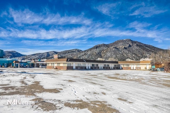
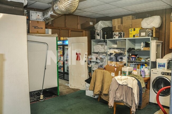
701 E Aultman St, Ely, NV 89301
Save to a Folder
{{folder.Name}}
{{folder.ListingIds.length}} Properties
{{folder.ListingIds.length}} Property
Create a New Folder
Property Detail
701 E Aultman St
002-053-07
ALL OF LOTS 6-8 AND THE EAST 1/2 OF LOT 5, AND ALL OF LOTS 29-31 AND THE EAST 1/2 OF LOT 32 ALONG WITH THE ADJOINING ALLEY, INCLUDING ALL OF LOTS 9 & 10 AND 1/2 THE ADJOINING ALLEY, BLOCK 32, INCLUDES A PORTION OF STREET E ABANDONMENT 40X137.50 PER D
Hotel
WHITE PINE
B and X Area of moderate flood hazard, usually the area between the limits of the 100-year and 500-year floods.
Nevada
2024
6-8,5
2025
0.70 AC
970300
Carson City/Nevada Area
4,224 SF
Other Market Areas
NEARBY LISTINGS FOR SALE OR LEASE
-
-
View all Ely listings for sale on LoopNet.com
DEMOGRAPHICS near 701 E Aultman St
1 mile
3 mile
5 mile
2025 Total Population
3,580
5,395
5,727
2030 Population
3,606
5,416
5,714
Pop Growth 2025-2030
+ 0.73%
+ 0.39%
(0.23%)
Average Age
41
41
41
2025 Total Households
1,499
2,241
2,361
HH Growth 2025-2030
0.00%
(0.36%)
(0.76%)
Median Household Inc
$80,580
$74,393
$74,731
Avg Household Size
2.40
2.40
2.40
2025 Avg HH Vehicles
2.00
2.00
2.00
Median Home Value
$195,793
$202,239
$204,419
Median Year Built
1968
1969
1971
Nearby Places
Map Layers
Map Styles
 Street
 Aerial
Layers
 Traffic
 Biking
Places
Listings with unknown addresses are not visible on the map
- Restaurants
- Banks
- Shops
- Fitness
- Groceries
SALE & LEASE HISTORY
LISTING DATE
SALE/LEASE

May 03, 2022
For Sale
Jan 24, 2019
For Sale
Nearby Properties
Address
Land Use
TOTAL SIZE
Lot Size
Zoning
Address
Land Use
TOTAL SIZE
Lot Size
Zoning
104,483 SF
50.99 AC
Address
Land Use
TOTAL SIZE
Lot Size
Zoning
56,692 SF
5.72 AC
Address
Land Use
TOTAL SIZE
Lot Size
Zoning
60,984 SF
1.70 AC
Address
Land Use
TOTAL SIZE
Lot Size
Zoning
70,722 SF
8.43 AC
Address
Land Use
TOTAL SIZE
Lot Size
Zoning
12,393 SF
7.85 AC
Address
Land Use
TOTAL SIZE
Lot Size
Zoning
43,715 SF
1.37 AC
Address
Land Use
TOTAL SIZE
Lot Size
Zoning
Address
Land Use
TOTAL SIZE
Lot Size
Zoning
49,216 SF
7.68 AC
Address
Land Use
TOTAL SIZE
Lot Size
Zoning
40,534 SF
5.20 AC
Address
Land Use
TOTAL SIZE
Lot Size
Zoning
20,070 SF
4.65 AC
Address
Land Use
TOTAL SIZE
Lot Size
Zoning
45,717 SF
3.48 AC
Address
Land Use
TOTAL SIZE
Lot Size
Zoning
27,404 SF
261.70 AC
Address
Land Use
TOTAL SIZE
Lot Size
Zoning
77,231 SF
1.26 AC
Address
Land Use
TOTAL SIZE
Lot Size
Zoning
51,408 SF
7.39 AC
Address
Land Use
TOTAL SIZE
Lot Size
Zoning
16,996 SF
6.55 AC
Address
Land Use
TOTAL SIZE
Lot Size
Zoning
5,036 SF
6.74 AC
Address
Land Use
TOTAL SIZE
Lot Size
Zoning
14,894 SF
1.99 AC
Address
Land Use
TOTAL SIZE
Lot Size
Zoning
16,002 SF
3.01 AC
Address
Land Use
TOTAL SIZE
Lot Size
Zoning
14,372 SF
2.18 AC
Address
Land Use
TOTAL SIZE
Lot Size
Zoning
21,537 SF
5.49 AC
Address
Land Use
TOTAL SIZE
Lot Size
Zoning
37,125 SF
0.40 AC
Address
Land Use
TOTAL SIZE
Lot Size
Zoning
14,918 SF
123.77 AC
Address
Land Use
TOTAL SIZE
Lot Size
Zoning
27,086 SF
14 AC
Address
Land Use
TOTAL SIZE
Lot Size
Zoning
37,700 SF
18.45 AC
Address
Land Use
TOTAL SIZE
Lot Size
Zoning
5,268 SF
27.02 AC
Address
Land Use
TOTAL SIZE
Lot Size
Zoning
24,157 SF
1.71 AC
Address
Land Use
TOTAL SIZE
Lot Size
Zoning
8,846 SF
3.34 AC
Address
Land Use
TOTAL SIZE
Lot Size
Zoning
17,579 SF
0.57 AC
Address
Land Use
TOTAL SIZE
Lot Size
Zoning
13,990 SF
1.06 AC
Address
Land Use
TOTAL SIZE
Lot Size
Zoning
7,728 SF
5.08 AC
The World's #1 Commercial Real Estate Marketplace
Connect with us
© 2026 CoStar Group
The information above has been obtained from sources believed reliable. While we do not doubt its accuracy we have not verified it and make no guarantee, warranty or representation about it. It is your responsibility to independently confirm its accuracy and completeness. Any projections, opinions, assumptions, or estimates used are for example only and do not represent the current or future performance of the property. The value of this transaction to you depends on tax and other factors which should be evaluated by your tax, financial, and legal advisors. You and your advisors should conduct a careful, independent investigation of the property to determine to your satisfaction the suitability of the property for your needs.