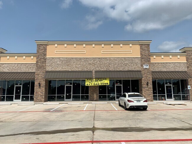
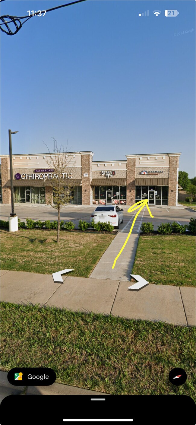
Property Record
701 E Debbie Ln, Mansfield, TX 76063

Property Detail
701 E Debbie Ln
Dallas-Fort Worth-Arlington, TX
NATIONWIDE ADDN BLOCK 1 LOT 1
41604369
Tarrant
Commercialnec
Texas
B and X Area of moderate flood hazard, usually the area between the limits of the 100-year and 500-year floods.
1
2024
0.98 AC
2025
SE Outlying Tarrant
111551
Dallas/Ft Worth
6,714 SF
NEARBY LISTINGS FOR SALE OR LEASE
DEMOGRAPHICS near 701 E Debbie Ln
1 mile
3 mile
5 mile
2025 Total Population
14,877
98,030
221,679
2030 Population
15,476
103,384
234,102
Pop Growth 2025-2030
+ 4.03%
+ 5.46%
+ 5.60%
Average Age
39
38
37
2025 Total Households
4,910
31,476
72,299
HH Growth 2025-2030
+ 4.18%
+ 5.72%
+ 5.78%
Median Household Inc
$117,991
$109,720
$105,428
Avg Household Size
3.00
3.00
3.00
2025 Avg HH Vehicles
3.00
2.00
2.00
Median Home Value
$375,071
$369,486
$365,585
Median Year Built
2000
2002
2000
Nearby Places
Map Layers
Map Styles
 Street
 Aerial
Transit
 Traffic
 Biking
Places
Listings with unknown addresses are not visible on the map
- Restaurants
- Banks
- Shops
- Fitness
- Groceries
PUBLIC TRANSPORTATION
AIRPORT
Dallas-Fort Worth International
Drive
Walk
Distance
Dallas-Fort Worth International
37 min
25.4 mi
Dallas Love Field
Drive
Walk
Distance
Dallas Love Field
48 min
34.0 mi
SALE & LEASE HISTORY
LISTING DATE
SALE/LEASE

Sep 02, 2025
For Lease
Mar 11, 2020
For Lease
Nearby Properties
Address
Land Use
TOTAL SIZE
Lot Size
Zoning
Address
Land Use
TOTAL SIZE
Lot Size
Zoning
565,115 SF
27.71 AC
Address
Land Use
TOTAL SIZE
Lot Size
Zoning
512,471 SF
69.41 AC
Address
Land Use
TOTAL SIZE
Lot Size
Zoning
426,667 SF
12.87 AC
Address
Land Use
TOTAL SIZE
Lot Size
Zoning
352,649 SF
17.16 AC
Address
Land Use
TOTAL SIZE
Lot Size
Zoning
348,951 SF
18.66 AC
Address
Land Use
TOTAL SIZE
Lot Size
Zoning
419,875 SF
108.14 AC
Address
Land Use
TOTAL SIZE
Lot Size
Zoning
317,142 SF
11.40 AC
Address
Land Use
TOTAL SIZE
Lot Size
Zoning
160,000 SF
26.90 AC
Address
Land Use
TOTAL SIZE
Lot Size
Zoning
413,000 SF
19.16 AC
Address
Land Use
TOTAL SIZE
Lot Size
Zoning
298,988 SF
7.16 AC
Address
Land Use
TOTAL SIZE
Lot Size
Zoning
273,381 SF
8.32 AC
Address
Land Use
TOTAL SIZE
Lot Size
Zoning
276,467 SF
7.61 AC
Address
Land Use
TOTAL SIZE
Lot Size
Zoning
246,204 SF
15.16 AC
Address
Land Use
TOTAL SIZE
Lot Size
Zoning
258,908 SF
22.41 AC
Address
Land Use
TOTAL SIZE
Lot Size
Zoning
249,922 SF
17.26 AC
Address
Land Use
TOTAL SIZE
Lot Size
Zoning
255,134 SF
21.62 AC
Address
Land Use
TOTAL SIZE
Lot Size
Zoning
209,307 SF
15.34 AC
Address
Land Use
TOTAL SIZE
Lot Size
Zoning
170,082 SF
36.49 AC
Address
Land Use
TOTAL SIZE
Lot Size
Zoning
724,286 SF
48.41 AC
Address
Land Use
TOTAL SIZE
Lot Size
Zoning
208,630 SF
8.62 AC
Address
Land Use
TOTAL SIZE
Lot Size
Zoning
231,551 SF
25.69 AC
Address
Land Use
TOTAL SIZE
Lot Size
Zoning
171,820 SF
59.63 AC
Address
Land Use
TOTAL SIZE
Lot Size
Zoning
98,664 SF
5.47 AC
Address
Land Use
TOTAL SIZE
Lot Size
Zoning
234,580 SF
65.82 AC
Address
Land Use
TOTAL SIZE
Lot Size
Zoning
177,384 SF
28.68 AC
Address
Land Use
TOTAL SIZE
Lot Size
Zoning
229,168 SF
6.13 AC
Address
Land Use
TOTAL SIZE
Lot Size
Zoning
399,496 SF
23.29 AC
Address
Land Use
TOTAL SIZE
Lot Size
Zoning
149,494 SF
3.73 AC
Address
Land Use
TOTAL SIZE
Lot Size
Zoning
125,000 SF
18.37 AC
Address
Land Use
TOTAL SIZE
Lot Size
Zoning
663,733 SF
7.77 AC
The World's #1 Commercial Real Estate Marketplace
Connect with us
© 2026 CoStar Group
The information above has been obtained from sources believed reliable. While we do not doubt its accuracy we have not verified it and make no guarantee, warranty or representation about it. It is your responsibility to independently confirm its accuracy and completeness. Any projections, opinions, assumptions, or estimates used are for example only and do not represent the current or future performance of the property. The value of this transaction to you depends on tax and other factors which should be evaluated by your tax, financial, and legal advisors. You and your advisors should conduct a careful, independent investigation of the property to determine to your satisfaction the suitability of the property for your needs.