Property Record
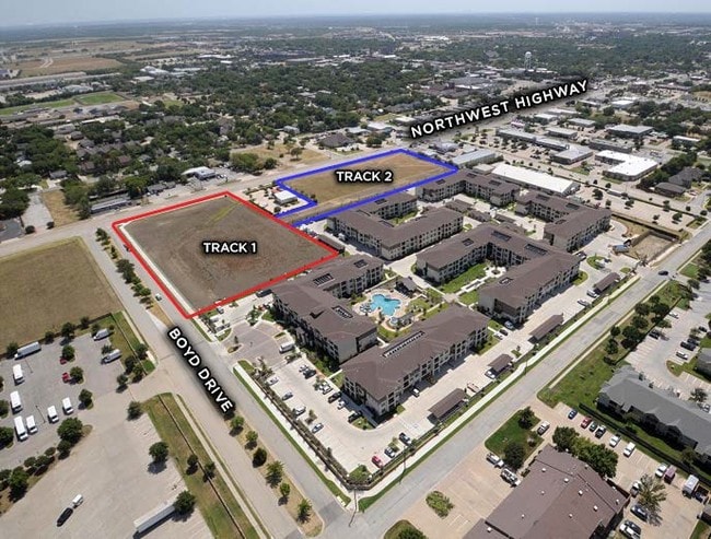
701 E Northwest Hwy, Grapevine, TX 76051

Property Detail
701 E Northwest Hwy
Dallas-Fort Worth-Arlington, TX
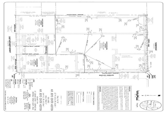
BOYD, W R CENTER BLOCK 1 LOT 3R1B LOT 3R1-B2A
42328339
Tarrant
Commercialnec
Texas
B and X Area of moderate flood hazard, usually the area between the limits of the 100-year and 500-year floods.
3
2024
1.43 AC
2025
Westlake/Grapevine
113716
Dallas/Ft Worth
2,650 SF
NEARBY LISTINGS FOR SALE OR LEASE
DEMOGRAPHICS near 701 E Northwest Hwy
1 mile
3 mile
5 mile
2025 Total Population
9,791
35,564
117,256
2030 Population
10,337
37,518
124,175
Pop Growth 2025-2030
+ 5.58%
+ 5.49%
+ 5.90%
Average Age
41
39
40
2025 Total Households
4,437
15,124
44,032
HH Growth 2025-2030
+ 5.68%
+ 5.35%
+ 5.95%
Median Household Inc
$100,365
$100,712
$133,735
Avg Household Size
2.20
2.30
2.60
2025 Avg HH Vehicles
2.00
2.00
2.00
Median Home Value
$496,142
$491,850
$657,837
Median Year Built
1996
1989
1995
Nearby Places
Map Layers
Map Styles
 Street
 Aerial
Transit
 Traffic
 Biking
Places
Listings with unknown addresses are not visible on the map
- Restaurants
- Banks
- Shops
- Fitness
- Groceries
PUBLIC TRANSPORTATION
COMMUTER RAIL
Drive
Walk
Distance
17 min
9.7 mi
Drive
Walk
Distance
17 min
9.8 mi
AIRPORT
Dallas-Fort Worth International
Drive
Walk
Distance
Dallas-Fort Worth International
11 min
5.8 mi
Dallas Love Field
Drive
Walk
Distance
Dallas Love Field
30 min
19.6 mi
Nearby Properties
Address
Land Use
TOTAL SIZE
Lot Size
Zoning
Address
Land Use
TOTAL SIZE
Lot Size
Zoning
7,321,782 SF
0.01 AC
Z392
Address
Land Use
TOTAL SIZE
Lot Size
Zoning
3,233,905 SF
51.24 AC
Address
Land Use
TOTAL SIZE
Lot Size
Zoning
2,545,604 SF
123.01 AC
Z402
Address
Land Use
TOTAL SIZE
Lot Size
Zoning
1,325,709 SF
124.50 AC
Address
Land Use
TOTAL SIZE
Lot Size
Zoning
680,063 SF
36.51 AC
Address
Land Use
TOTAL SIZE
Lot Size
Zoning
432,986 SF
10.57 AC
Address
Land Use
TOTAL SIZE
Lot Size
Zoning
500,000 SF
99.10 AC
Address
Land Use
TOTAL SIZE
Lot Size
Zoning
768,494 SF
10.42 AC
Address
Land Use
TOTAL SIZE
Lot Size
Zoning
332,665 SF
9.83 AC
Address
Land Use
TOTAL SIZE
Lot Size
Zoning
190,223 SF
0.03 AC
Z392
Address
Land Use
TOTAL SIZE
Lot Size
Zoning
630,765 SF
321.80 AC
Address
Land Use
TOTAL SIZE
Lot Size
Zoning
397,272 SF
12.35 AC
Address
Land Use
TOTAL SIZE
Lot Size
Zoning
457,738 SF
28.49 AC
Address
Land Use
TOTAL SIZE
Lot Size
Zoning
360,898 SF
5.51 AC
Address
Land Use
TOTAL SIZE
Lot Size
Zoning
464,476 SF
5.08 AC
Address
Land Use
TOTAL SIZE
Lot Size
Zoning
389,286 SF
21.86 AC
Address
Land Use
TOTAL SIZE
Lot Size
Zoning
397,935 SF
10.65 AC
Address
Land Use
TOTAL SIZE
Lot Size
Zoning
321,993 SF
18.20 AC
Address
Land Use
TOTAL SIZE
Lot Size
Zoning
295,408 SF
10.33 AC
Address
Land Use
TOTAL SIZE
Lot Size
Zoning
263,119 SF
11.01 AC
Address
Land Use
TOTAL SIZE
Lot Size
Zoning
264,000 SF
15.06 AC
Address
Land Use
TOTAL SIZE
Lot Size
Zoning
329,353 SF
7.90 AC
Address
Land Use
TOTAL SIZE
Lot Size
Zoning
234,200 SF
274.75 AC
Address
Land Use
TOTAL SIZE
Lot Size
Zoning
270,453 SF
17.48 AC
Address
Land Use
TOTAL SIZE
Lot Size
Zoning
297,500 SF
99.10 AC
Address
Land Use
TOTAL SIZE
Lot Size
Zoning
320.42 AC
Address
Land Use
TOTAL SIZE
Lot Size
Zoning
235,902 SF
16.20 AC
Address
Land Use
TOTAL SIZE
Lot Size
Zoning
305,047 SF
10.16 AC
Address
Land Use
TOTAL SIZE
Lot Size
Zoning
77.10 AC
Z402
Address
Land Use
TOTAL SIZE
Lot Size
Zoning
150,510 SF
6.35 AC
The World's #1 Commercial Real Estate Marketplace
Connect with us
© 2026 CoStar Group
The information above has been obtained from sources believed reliable. While we do not doubt its accuracy we have not verified it and make no guarantee, warranty or representation about it. It is your responsibility to independently confirm its accuracy and completeness. Any projections, opinions, assumptions, or estimates used are for example only and do not represent the current or future performance of the property. The value of this transaction to you depends on tax and other factors which should be evaluated by your tax, financial, and legal advisors. You and your advisors should conduct a careful, independent investigation of the property to determine to your satisfaction the suitability of the property for your needs.