Property Record
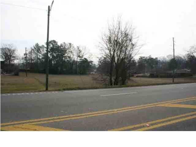
701 Hamric Dr W, Oxford, AL 36203


NEARBY LISTINGS FOR SALE OR LEASE
Property Detail
701 Hamric Dr W
22-07-25-0-006-065.000
SEC 25 TSP 16S R 7E BEG 799 NE OF SE INT WOODLAND DR & HWY 78 TH SE 173.5 SW 73.7 SE 221.2 SW 45 W 75.5 SW 250 SE 7 E 676 S 5
Officebuilding
Calhoun
X
Alabama
01015C0401E
24 AC
2025
Gadsden/Anniston Area
2025
Other Market Areas
001202
Anniston-Oxford, AL
15,080 SF
DEMOGRAPHICS near 701 Hamric Dr W
1 Mile
3 Mile
5 Mile
2024 Total Population
2,699
15,706
40,885
2029 Population
2,636
15,393
40,412
Pop Growth 2024-2029
(2.33%)
(1.99%)
(1.16%)
Average Age
40
40
42
2024 Total Households
1,035
6,168
16,650
HH Growth 2024-2029
(2.51%)
(2.16%)
(1.20%)
Median Household Inc
$41,884
$50,770
$48,339
Avg Household Size
2.40
2.40
2.30
2024 Avg HH Vehicles
2.00
2.00
2.00
Median Home Value
$139,344
$146,267
$138,706
Median Year Built
1973
1978
1975
Nearby Places
Map Layers
Map Styles
 Street
 Aerial
- Restaurants
- Banks
- Shops
- Fitness
- Groceries
PUBLIC TRANSPORTATION
COMMUTER RAIL
Anniston Amtrak Station (Crescent - Amtrak)
DRIVE
WALK
Distance
Anniston Amtrak Station (Crescent - Amtrak)
7 min
4.1 mi
Freight Ports
Port of Panama City
DRIVE
WALK
Distance
Port of Panama City
358 min
289.8 mi
SALE & LEASE HISTORY
LISTING DATE
SALE/LEASE

Apr 11, 2017
For Sale
Nearby Properties
Address
Land Use
TOTAL SIZE
Lot Size
Zoning
Address
Land Use
TOTAL SIZE
Lot Size
Zoning
128,399 SF
17 AC
Address
Land Use
TOTAL SIZE
Lot Size
Zoning
5.32 AC
Address
Land Use
TOTAL SIZE
Lot Size
Zoning
7,752 SF
182 AC
Address
Land Use
TOTAL SIZE
Lot Size
Zoning
1,972 SF
22.80 AC
Address
Land Use
TOTAL SIZE
Lot Size
Zoning
87,750 SF
25 AC
Address
Land Use
TOTAL SIZE
Lot Size
Zoning
341,374 SF
15.88 AC
Address
Land Use
TOTAL SIZE
Lot Size
Zoning
201,670 SF
27.50 AC
Address
Land Use
TOTAL SIZE
Lot Size
Zoning
14,015 SF
8.50 AC
Address
Land Use
TOTAL SIZE
Lot Size
Zoning
12,695 SF
0.75 AC
Address
Land Use
TOTAL SIZE
Lot Size
Zoning
31,104 SF
36 AC
Address
Land Use
TOTAL SIZE
Lot Size
Zoning
4,118 SF
15.74 AC
Address
Land Use
TOTAL SIZE
Lot Size
Zoning
6,400 SF
12.24 AC
Address
Land Use
TOTAL SIZE
Lot Size
Zoning
128,064 SF
7.70 AC
Address
Land Use
TOTAL SIZE
Lot Size
Zoning
194,310 SF
9.11 AC
Address
Land Use
TOTAL SIZE
Lot Size
Zoning
82,787 SF
8.55 AC
Address
Land Use
TOTAL SIZE
Lot Size
Zoning
10,479 SF
9.56 AC
Address
Land Use
TOTAL SIZE
Lot Size
Zoning
3.50 AC
Address
Land Use
TOTAL SIZE
Lot Size
Zoning
23,307 SF
4.51 AC
Address
Land Use
TOTAL SIZE
Lot Size
Zoning
85,305 SF
1.11 AC
Address
Land Use
TOTAL SIZE
Lot Size
Zoning
31,522 SF
4.23 AC
Address
Land Use
TOTAL SIZE
Lot Size
Zoning
81,250 SF
18 AC
Address
Land Use
TOTAL SIZE
Lot Size
Zoning
171,881 SF
29 AC
Address
Land Use
TOTAL SIZE
Lot Size
Zoning
8,032 SF
10.30 AC
Address
Land Use
TOTAL SIZE
Lot Size
Zoning
19,902 SF
1.40 AC
Address
Land Use
TOTAL SIZE
Lot Size
Zoning
19,016 SF
4 AC
Address
Land Use
TOTAL SIZE
Lot Size
Zoning
24,700 SF
2.32 AC
Address
Land Use
TOTAL SIZE
Lot Size
Zoning
81,920 SF
10 AC
Address
Land Use
TOTAL SIZE
Lot Size
Zoning
100,000 SF
4.83 AC
Address
Land Use
TOTAL SIZE
Lot Size
Zoning
52,340 SF
1.80 AC
The World's #1 Commercial Real Estate Marketplace
Connect with us
© 2026 CoStar Group
The information above has been obtained from sources believed reliable. While we do not doubt its accuracy we have not verified it and make no guarantee, warranty or representation about it. It is your responsibility to independently confirm its accuracy and completeness. Any projections, opinions, assumptions, or estimates used are for example only and do not represent the current or future performance of the property. The value of this transaction to you depends on tax and other factors which should be evaluated by your tax, financial, and legal advisors. You and your advisors should conduct a careful, independent investigation of the property to determine to your satisfaction the suitability of the property for your needs.