Property Record
701 Hopewell Dr, Heath, OH 43056


NEARBY LISTINGS FOR SALE OR LEASE
Property Detail
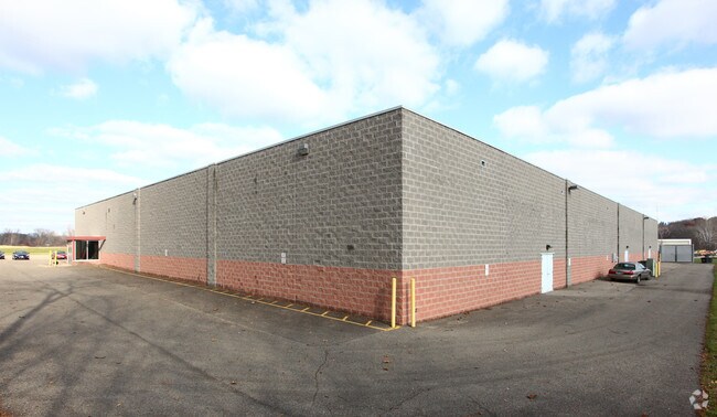
701 Hopewell Dr
030-088554-00.000
5.225 AC LOT 5 R12 T2 Q4
Bowlingalley
Licking
X
Ohio
39089C0341H
5
2024
5.22 AC
2024
Licking County
752802
Columbus
40,890 SF
Columbus, OH
DEMOGRAPHICS near 701 Hopewell Dr
1 Mile
3 Mile
5 Mile
2024 Total Population
4,602
46,490
70,616
2029 Population
4,802
48,680
73,927
Pop Growth 2024-2029
+ 4.35%
+ 4.71%
+ 4.69%
Average Age
43
40
41
2024 Total Households
2,128
19,351
28,991
HH Growth 2024-2029
+ 4.28%
+ 4.72%
+ 4.71%
Median Household Inc
$55,482
$54,174
$58,087
Avg Household Size
2.10
2.30
2.30
2024 Avg HH Vehicles
2.00
2.00
2.00
Median Home Value
$129,814
$143,561
$158,003
Median Year Built
1968
1962
1967
Nearby Places
Map Layers
Map Styles
 Street
 Aerial
- Restaurants
- Banks
- Shops
- Fitness
- Groceries
PUBLIC TRANSPORTATION
AIRPORT
John Glenn Columbus International
DRIVE
WALK
Distance
John Glenn Columbus International
44 min
33.7 mi
Freight Ports
Port of Toledo
DRIVE
WALK
Distance
Port of Toledo
198 min
162.4 mi
SALE & LEASE HISTORY
LISTING DATE
SALE/LEASE

Sep 23, 2016
For Sale
Nearby Properties
Address
Land Use
TOTAL SIZE
Lot Size
Zoning
Address
Land Use
TOTAL SIZE
Lot Size
Zoning
212,744 SF
19.16 AC
Address
Land Use
TOTAL SIZE
Lot Size
Zoning
54,600 SF
101.38 AC
Address
Land Use
TOTAL SIZE
Lot Size
Zoning
750,000 SF
50.61 AC
Address
Land Use
TOTAL SIZE
Lot Size
Zoning
87,785 SF
37.26 AC
Address
Land Use
TOTAL SIZE
Lot Size
Zoning
69,244 SF
38 AC
Address
Land Use
TOTAL SIZE
Lot Size
Zoning
67,824 SF
16.26 AC
Address
Land Use
TOTAL SIZE
Lot Size
Zoning
143,636 SF
7.25 AC
Address
Land Use
TOTAL SIZE
Lot Size
Zoning
3,108 SF
19.22 AC
Address
Land Use
TOTAL SIZE
Lot Size
Zoning
69,782 SF
2.41 AC
Address
Land Use
TOTAL SIZE
Lot Size
Zoning
223,436 SF
19.22 AC
Address
Land Use
TOTAL SIZE
Lot Size
Zoning
4,018,110 SF
19.93 AC
Address
Land Use
TOTAL SIZE
Lot Size
Zoning
19,200 SF
14.56 AC
Address
Land Use
TOTAL SIZE
Lot Size
Zoning
73,269 SF
15.64 AC
Address
Land Use
TOTAL SIZE
Lot Size
Zoning
3,552 SF
5.23 AC
Address
Land Use
TOTAL SIZE
Lot Size
Zoning
31,271 SF
20.10 AC
Address
Land Use
TOTAL SIZE
Lot Size
Zoning
150,000 SF
11.18 AC
Address
Land Use
TOTAL SIZE
Lot Size
Zoning
4,080 SF
12.84 AC
Address
Land Use
TOTAL SIZE
Lot Size
Zoning
57,280 SF
4.04 AC
Address
Land Use
TOTAL SIZE
Lot Size
Zoning
50,482 SF
13.91 AC
Address
Land Use
TOTAL SIZE
Lot Size
Zoning
33,492 SF
1.07 AC
Address
Land Use
TOTAL SIZE
Lot Size
Zoning
22,974 SF
1.64 AC
Address
Land Use
TOTAL SIZE
Lot Size
Zoning
79,454 SF
19.13 AC
Address
Land Use
TOTAL SIZE
Lot Size
Zoning
78,000 SF
25 AC
Address
Land Use
TOTAL SIZE
Lot Size
Zoning
63,635 SF
7.91 AC
Address
Land Use
TOTAL SIZE
Lot Size
Zoning
570,284 SF
56.17 AC
Address
Land Use
TOTAL SIZE
Lot Size
Zoning
135,148 SF
14.94 AC
Address
Land Use
TOTAL SIZE
Lot Size
Zoning
65,860 SF
3.35 AC
Address
Land Use
TOTAL SIZE
Lot Size
Zoning
1,165 SF
141.30 AC
Address
Land Use
TOTAL SIZE
Lot Size
Zoning
316,800 SF
10.74 AC
Address
Land Use
TOTAL SIZE
Lot Size
Zoning
60,060 SF
18 AC
The World's #1 Commercial Real Estate Marketplace
Connect with us
© 2026 CoStar Group
The information above has been obtained from sources believed reliable. While we do not doubt its accuracy we have not verified it and make no guarantee, warranty or representation about it. It is your responsibility to independently confirm its accuracy and completeness. Any projections, opinions, assumptions, or estimates used are for example only and do not represent the current or future performance of the property. The value of this transaction to you depends on tax and other factors which should be evaluated by your tax, financial, and legal advisors. You and your advisors should conduct a careful, independent investigation of the property to determine to your satisfaction the suitability of the property for your needs.