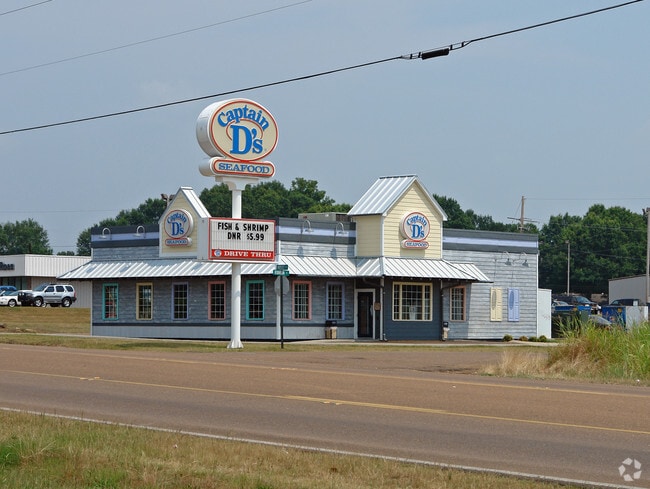
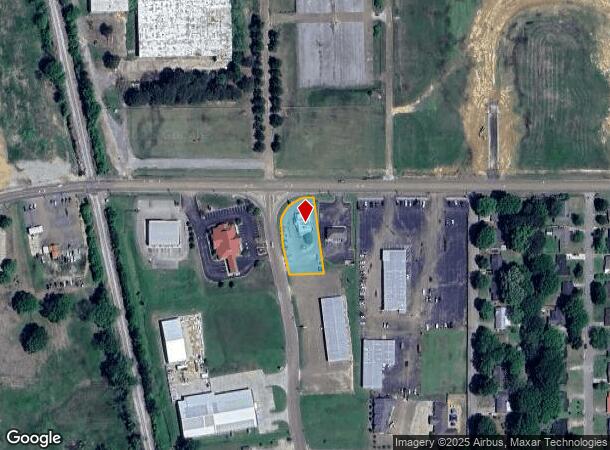
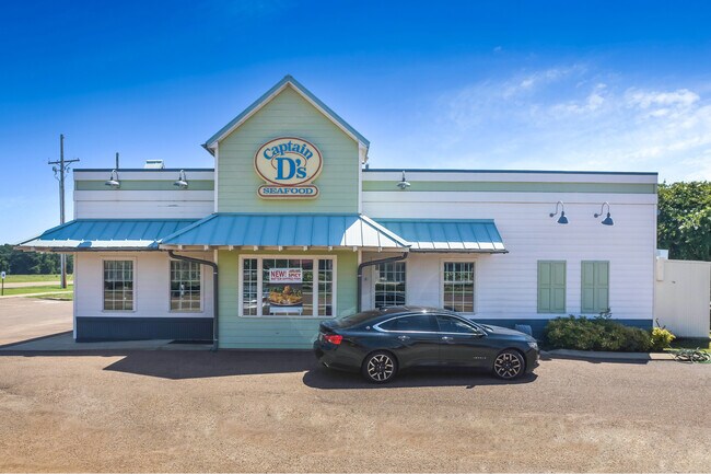
Property Record
701 N Robinson St, Senatobia, MS 38668
NEARBY LISTINGS FOR SALE OR LEASE
Property Detail
701 N Robinson St
094Q-03-0000105
PT S1/2 SW1/4 S OF QUALITY LANE-701 ROBINSON
Restaurantbuilding
Tate
X
Mississippi
28137C0189D
0.76 AC
2025
Tate County
2025
Memphis
950400
Memphis, TN-MS-AR
2,477 SF
DEMOGRAPHICS near 701 N Robinson St
1 Mile
3 Mile
5 Mile
2024 Total Population
3,213
8,728
13,416
2029 Population
3,308
8,963
13,749
Pop Growth 2024-2029
+ 2.96%
+ 2.69%
+ 2.48%
Average Age
34
36
38
2024 Total Households
1,052
2,918
4,647
HH Growth 2024-2029
+ 3.23%
+ 2.95%
+ 2.67%
Median Household Inc
$57,150
$58,712
$60,839
Avg Household Size
2.40
2.50
2.60
2024 Avg HH Vehicles
2.00
2.00
2.00
Median Home Value
$165,301
$168,169
$170,550
Median Year Built
1979
1988
1989
Nearby Places
Map Layers
Map Styles
 Street
 Aerial
- Restaurants
- Banks
- Shops
- Fitness
- Groceries
PUBLIC TRANSPORTATION
AIRPORT
Memphis International
DRIVE
WALK
Distance
Memphis International
40 min
33.4 mi
Freight Ports
Port of Shreveport
DRIVE
WALK
Distance
Port of Shreveport
420 min
357.0 mi
SALE & LEASE HISTORY
LISTING DATE
SALE/LEASE

Aug 10, 2022
For Sale
Nearby Properties
Address
Land Use
TOTAL SIZE
Lot Size
Zoning
Address
Land Use
TOTAL SIZE
Lot Size
Zoning
Address
Land Use
TOTAL SIZE
Lot Size
Zoning
45,153 SF
6.75 AC
Address
Land Use
TOTAL SIZE
Lot Size
Zoning
157,088 SF
23.10 AC
Address
Land Use
TOTAL SIZE
Lot Size
Zoning
543,588 SF
52 AC
Address
Land Use
TOTAL SIZE
Lot Size
Zoning
64,750 SF
38.60 AC
Address
Land Use
TOTAL SIZE
Lot Size
Zoning
5,565 SF
18.70 AC
Address
Land Use
TOTAL SIZE
Lot Size
Zoning
4,250 SF
21.40 AC
Address
Land Use
TOTAL SIZE
Lot Size
Zoning
67,200 SF
166 AC
Address
Land Use
TOTAL SIZE
Lot Size
Zoning
1,756 SF
7 AC
Address
Land Use
TOTAL SIZE
Lot Size
Zoning
3,103 SF
3.40 AC
Address
Land Use
TOTAL SIZE
Lot Size
Zoning
53,235 SF
5.10 AC
Address
Land Use
TOTAL SIZE
Lot Size
Zoning
43,851 SF
3 AC
Address
Land Use
TOTAL SIZE
Lot Size
Zoning
62,963 SF
10 AC
Address
Land Use
TOTAL SIZE
Lot Size
Zoning
25,032 SF
8 AC
Address
Land Use
TOTAL SIZE
Lot Size
Zoning
10,603 SF
6.10 AC
Address
Land Use
TOTAL SIZE
Lot Size
Zoning
38,891 SF
4.05 AC
Address
Land Use
TOTAL SIZE
Lot Size
Zoning
1,866 SF
0.64 AC
Address
Land Use
TOTAL SIZE
Lot Size
Zoning
86,995 SF
6.45 AC
Address
Land Use
TOTAL SIZE
Lot Size
Zoning
19,194 SF
3.80 AC
Address
Land Use
TOTAL SIZE
Lot Size
Zoning
20,098 SF
1.20 AC
Address
Land Use
TOTAL SIZE
Lot Size
Zoning
13,472 SF
1.80 AC
Address
Land Use
TOTAL SIZE
Lot Size
Zoning
11,002 SF
2.03 AC
Address
Land Use
TOTAL SIZE
Lot Size
Zoning
9,859 SF
1.76 AC
Address
Land Use
TOTAL SIZE
Lot Size
Zoning
6,238 SF
38.20 AC
Address
Land Use
TOTAL SIZE
Lot Size
Zoning
14,721 SF
3.30 AC
Address
Land Use
TOTAL SIZE
Lot Size
Zoning
9,744 SF
1.04 AC
Address
Land Use
TOTAL SIZE
Lot Size
Zoning
Address
Land Use
TOTAL SIZE
Lot Size
Zoning
2,724 SF
8 AC
The World's #1 Commercial Real Estate Marketplace
Connect with us
© 2025 CoStar Group
The information above has been obtained from sources believed reliable. While we do not doubt its accuracy we have not verified it and make no guarantee, warranty or representation about it. It is your responsibility to independently confirm its accuracy and completeness. Any projections, opinions, assumptions, or estimates used are for example only and do not represent the current or future performance of the property. The value of this transaction to you depends on tax and other factors which should be evaluated by your tax, financial, and legal advisors. You and your advisors should conduct a careful, independent investigation of the property to determine to your satisfaction the suitability of the property for your needs.