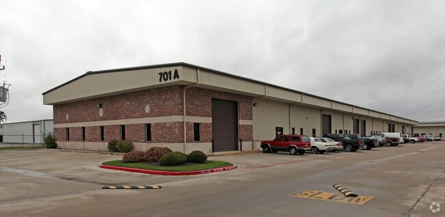
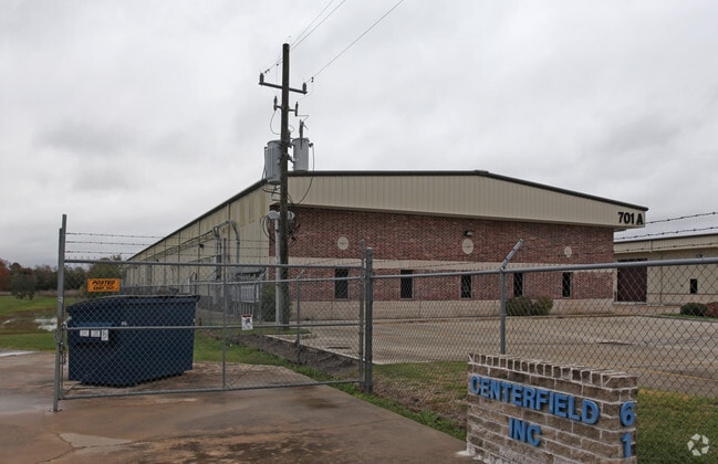
Property Record
701 S Persimmon St, Tomball, TX 77375

Property Detail
701 S Persimmon St
Houston-Pasadena-The Woodlands, TX
LT 332 TOMBALL OUTLOTS
0352900000392
HARRIS
Warehouse
Texas
B and X Area of moderate flood hazard, usually the area between the limits of the 100-year and 500-year floods.
332
2025
5 AC
2025
North Fwy/Tomball Pky
555401
Houston
63,380 SF
NEARBY LISTINGS FOR SALE OR LEASE
DEMOGRAPHICS near 701 S Persimmon St
1 mile
3 mile
5 mile
2025 Total Population
3,167
43,354
146,828
2030 Population
3,474
46,935
159,136
Pop Growth 2025-2030
+ 9.69%
+ 8.26%
+ 8.38%
Average Age
39
37
37
2025 Total Households
1,144
15,204
49,049
HH Growth 2025-2030
+ 9.88%
+ 8.54%
+ 8.64%
Median Household Inc
$95,222
$96,935
$113,100
Avg Household Size
2.70
2.80
2.90
2025 Avg HH Vehicles
2.00
2.00
2.00
Median Home Value
$413,756
$364,427
$364,929
Median Year Built
2009
2008
2008
Nearby Places
Map Layers
Map Styles
 Street
 Aerial
Layers
 Traffic
 Biking
Places
Listings with unknown addresses are not visible on the map
- Restaurants
- Banks
- Shops
- Fitness
- Groceries
PUBLIC TRANSPORTATION
AIRPORT
George Bush Intcntl/Houston
Drive
Walk
Distance
George Bush Intcntl/Houston
36 min
28.0 mi
Freight Ports
Port of Houston
Drive
Walk
Distance
Port of Houston
59 min
43.7 mi
Nearby Properties
Address
Land Use
TOTAL SIZE
Lot Size
Zoning
Address
Land Use
TOTAL SIZE
Lot Size
Zoning
722,325 SF
27.72 AC
Address
Land Use
TOTAL SIZE
Lot Size
Zoning
398,856 SF
12.76 AC
Address
Land Use
TOTAL SIZE
Lot Size
Zoning
294,931 SF
10.94 AC
Address
Land Use
TOTAL SIZE
Lot Size
Zoning
249,950 SF
15.92 AC
Address
Land Use
TOTAL SIZE
Lot Size
Zoning
393,751 SF
17.08 AC
Address
Land Use
TOTAL SIZE
Lot Size
Zoning
148,105 SF
19.73 AC
Address
Land Use
TOTAL SIZE
Lot Size
Zoning
451,840 SF
44.47 AC
Address
Land Use
TOTAL SIZE
Lot Size
Zoning
207,662 SF
11.32 AC
Address
Land Use
TOTAL SIZE
Lot Size
Zoning
331,691 SF
17.95 AC
Address
Land Use
TOTAL SIZE
Lot Size
Zoning
253,800 SF
43.72 AC
Address
Land Use
TOTAL SIZE
Lot Size
Zoning
233,293 SF
13.20 AC
Address
Land Use
TOTAL SIZE
Lot Size
Zoning
123,937 SF
5.52 AC
Address
Land Use
TOTAL SIZE
Lot Size
Zoning
155,960 SF
25.96 AC
Address
Land Use
TOTAL SIZE
Lot Size
Zoning
179,083 SF
8.29 AC
Address
Land Use
TOTAL SIZE
Lot Size
Zoning
230,612 SF
28.42 AC
Address
Land Use
TOTAL SIZE
Lot Size
Zoning
142,427 SF
12.02 AC
Address
Land Use
TOTAL SIZE
Lot Size
Zoning
110,553 SF
10.34 AC
Address
Land Use
TOTAL SIZE
Lot Size
Zoning
87,936 SF
3.92 AC
Address
Land Use
TOTAL SIZE
Lot Size
Zoning
176,180 SF
7.28 AC
Address
Land Use
TOTAL SIZE
Lot Size
Zoning
77,804 SF
5.73 AC
Address
Land Use
TOTAL SIZE
Lot Size
Zoning
146,605 SF
12.99 AC
Address
Land Use
TOTAL SIZE
Lot Size
Zoning
146,990 SF
7.02 AC
Address
Land Use
TOTAL SIZE
Lot Size
Zoning
59,119 SF
6.26 AC
Address
Land Use
TOTAL SIZE
Lot Size
Zoning
153,224 SF
5.04 AC
Address
Land Use
TOTAL SIZE
Lot Size
Zoning
112,854 SF
5.80 AC
Address
Land Use
TOTAL SIZE
Lot Size
Zoning
118,004 SF
5.55 AC
Address
Land Use
TOTAL SIZE
Lot Size
Zoning
194,195 SF
Address
Land Use
TOTAL SIZE
Lot Size
Zoning
55,008 SF
4.76 AC
Address
Land Use
TOTAL SIZE
Lot Size
Zoning
65,564 SF
10.06 AC
The World's #1 Commercial Real Estate Marketplace
Connect with us
© 2026 CoStar Group
The information above has been obtained from sources believed reliable. While we do not doubt its accuracy we have not verified it and make no guarantee, warranty or representation about it. It is your responsibility to independently confirm its accuracy and completeness. Any projections, opinions, assumptions, or estimates used are for example only and do not represent the current or future performance of the property. The value of this transaction to you depends on tax and other factors which should be evaluated by your tax, financial, and legal advisors. You and your advisors should conduct a careful, independent investigation of the property to determine to your satisfaction the suitability of the property for your needs.