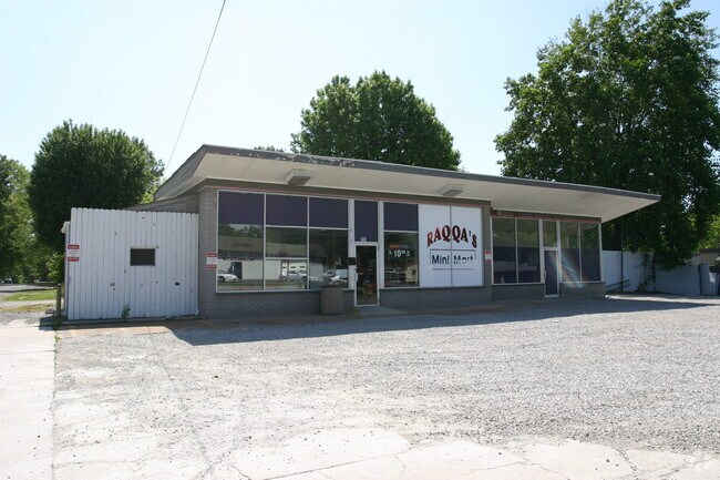
Property Record
701 Sherman St, Belleville, IL 62221


NEARBY LISTINGS FOR SALE OR LEASE
Property Detail
701 Sherman St
St. Louis
Jefferson Heights
St. Louis, MO-IL
JEFFERSON HEIGHTS LOT/SEC-33-BLK/RG-5 LOTS 33 34 & 35 A02818094
08-15.0-427-065
St. Clair
Conveniencestore
Illinois
2024
33
2024
0.21 AC
501801
Metro East Illinois
1,255 SF
DEMOGRAPHICS near 701 Sherman St
1 Mile
3 Mile
5 Mile
2024 Total Population
9,277
58,011
99,508
2029 Population
8,985
56,271
96,126
Pop Growth 2024-2029
(3.15%)
(3.00%)
(3.40%)
Average Age
41
40
41
2024 Total Households
4,083
24,200
42,061
HH Growth 2024-2029
(3.11%)
(3.01%)
(3.39%)
Median Household Inc
$66,426
$69,840
$73,198
Avg Household Size
2.20
2.30
2.30
2024 Avg HH Vehicles
2.00
2.00
2.00
Median Home Value
$119,953
$150,572
$163,035
Median Year Built
1962
1973
1978
Nearby Places
Map Layers
Map Styles
 Street
 Aerial
- Restaurants
- Banks
- Shops
- Fitness
- Groceries
PUBLIC TRANSPORTATION
TRANSIT/SUBWAY
Belleville (Lambert Airport Shiloh-Scott - St. Louis MetroLink (MetroLink))
DRIVE
WALK
Distance
Belleville (Lambert Airport Shiloh-Scott - St. Louis MetroLink (MetroLink))
3 min
17 min
0.9 mi
COMMUTER RAIL
Belleville (Lambert Airport Shiloh-Scott - St. Louis MetroLink (MetroLink))
DRIVE
WALK
Distance
Belleville (Lambert Airport Shiloh-Scott - St. Louis MetroLink (MetroLink))
3 min
17 min
0.9 mi
Swansea (Lambert Airport Shiloh-Scott - St. Louis MetroLink (MetroLink))
DRIVE
WALK
Distance
Swansea (Lambert Airport Shiloh-Scott - St. Louis MetroLink (MetroLink))
4 min
1.7 mi
AIRPORT
Scott AFB/Midamerica St Louis
DRIVE
WALK
Distance
Scott AFB/Midamerica St Louis
20 min
10.2 mi
St Louis Lambert International
DRIVE
WALK
Distance
St Louis Lambert International
45 min
31.3 mi
Nearby Properties
Address
Land Use
TOTAL SIZE
Lot Size
Zoning
Address
Land Use
TOTAL SIZE
Lot Size
Zoning
3,388 SF
22.25 AC
Address
Land Use
TOTAL SIZE
Lot Size
Zoning
20,522 SF
6.42 AC
Address
Land Use
TOTAL SIZE
Lot Size
Zoning
217,542 SF
17.71 AC
Address
Land Use
TOTAL SIZE
Lot Size
Zoning
41,366 SF
12.07 AC
Address
Land Use
TOTAL SIZE
Lot Size
Zoning
139,172 SF
15.78 AC
Address
Land Use
TOTAL SIZE
Lot Size
Zoning
20.63 AC
Address
Land Use
TOTAL SIZE
Lot Size
Zoning
126,937 SF
11.98 AC
Address
Land Use
TOTAL SIZE
Lot Size
Zoning
5,656 SF
8.65 AC
Address
Land Use
TOTAL SIZE
Lot Size
Zoning
6,800 SF
4.33 AC
Address
Land Use
TOTAL SIZE
Lot Size
Zoning
86,482 SF
8 AC
Address
Land Use
TOTAL SIZE
Lot Size
Zoning
46,489 SF
3.66 AC
Address
Land Use
TOTAL SIZE
Lot Size
Zoning
155,488 SF
16.54 AC
Address
Land Use
TOTAL SIZE
Lot Size
Zoning
7,344 SF
3.50 AC
Address
Land Use
TOTAL SIZE
Lot Size
Zoning
26,233 SF
17.61 AC
Address
Land Use
TOTAL SIZE
Lot Size
Zoning
90,945 SF
5.93 AC
Address
Land Use
TOTAL SIZE
Lot Size
Zoning
8,376 SF
3.11 AC
Address
Land Use
TOTAL SIZE
Lot Size
Zoning
88,468 SF
10.48 AC
Address
Land Use
TOTAL SIZE
Lot Size
Zoning
4.70 AC
Address
Land Use
TOTAL SIZE
Lot Size
Zoning
4,818 SF
3.64 AC
Address
Land Use
TOTAL SIZE
Lot Size
Zoning
5.03 AC
Address
Land Use
TOTAL SIZE
Lot Size
Zoning
23,951 SF
0.89 AC
Address
Land Use
TOTAL SIZE
Lot Size
Zoning
4,400 SF
2.56 AC
Address
Land Use
TOTAL SIZE
Lot Size
Zoning
1,280 SF
4.50 AC
Address
Land Use
TOTAL SIZE
Lot Size
Zoning
30,000 SF
9.05 AC
Address
Land Use
TOTAL SIZE
Lot Size
Zoning
8,208 SF
1.58 AC
Address
Land Use
TOTAL SIZE
Lot Size
Zoning
38,259 SF
7.80 AC
Address
Land Use
TOTAL SIZE
Lot Size
Zoning
32,463 SF
9.70 AC
Address
Land Use
TOTAL SIZE
Lot Size
Zoning
12,010 SF
2.49 AC
Address
Land Use
TOTAL SIZE
Lot Size
Zoning
47,369 SF
4.17 AC
Address
Land Use
TOTAL SIZE
Lot Size
Zoning
12.99 AC
The World's #1 Commercial Real Estate Marketplace
Connect with us
© 2026 CoStar Group
The information above has been obtained from sources believed reliable. While we do not doubt its accuracy we have not verified it and make no guarantee, warranty or representation about it. It is your responsibility to independently confirm its accuracy and completeness. Any projections, opinions, assumptions, or estimates used are for example only and do not represent the current or future performance of the property. The value of this transaction to you depends on tax and other factors which should be evaluated by your tax, financial, and legal advisors. You and your advisors should conduct a careful, independent investigation of the property to determine to your satisfaction the suitability of the property for your needs.