Property Record
701 Sinclair St, Gillette, WY 82718
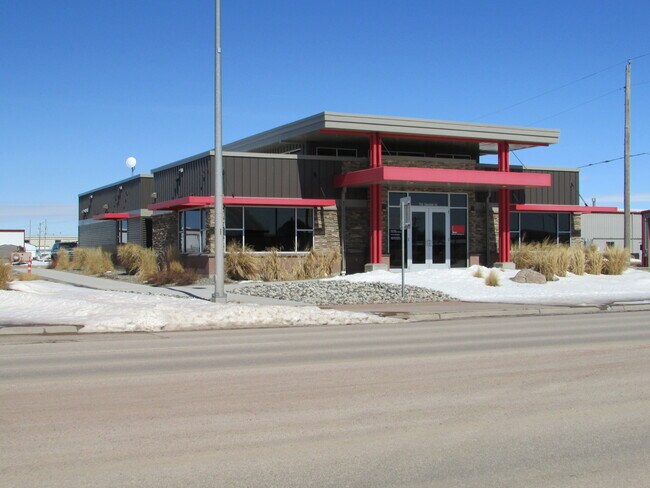


Property Detail
701 Sinclair St
R0010787
HITT EST SURVEY TRACT E PT AKA, S34 T50 R72 SWSE PT AKA NORTHERN PRODUCTION ADD ANNEXATION UNPLATTED CITY
Autorepair
Campbell
B and X Area of moderate flood hazard, usually the area between the limits of the 100-year and 500-year floods.
Wyoming
2024
5.41 AC
2025
Wyoming Area
000200
Other Market Areas
18,528 SF
Gillette, WY
NEARBY LISTINGS FOR SALE OR LEASE
DEMOGRAPHICS near 701 Sinclair St
1 mile
3 mile
5 mile
2025 Total Population
6,033
26,435
38,563
2030 Population
6,293
27,430
39,981
Pop Growth 2025-2030
+ 4.31%
+ 3.76%
+ 3.68%
Average Age
34
36
36
2025 Total Households
2,195
10,112
14,686
HH Growth 2025-2030
+ 4.33%
+ 3.86%
+ 3.78%
Median Household Inc
$105,134
$88,789
$90,002
Avg Household Size
2.60
2.50
2.50
2025 Avg HH Vehicles
2.00
2.00
2.00
Median Home Value
$272,970
$269,236
$268,998
Median Year Built
1997
1987
1989
Nearby Places
Map Layers
Map Styles
 Street
 Aerial
Transit
 Traffic
 Biking
Places
Listings with unknown addresses are not visible on the map
- Restaurants
- Banks
- Shops
- Fitness
- Groceries
SALE & LEASE HISTORY
LISTING DATE
SALE/LEASE

Dec 15, 2020
For Sale
Nearby Properties
Address
Land Use
TOTAL SIZE
Lot Size
Zoning
Address
Land Use
TOTAL SIZE
Lot Size
Zoning
154,664 SF
33.94 AC
Address
Land Use
TOTAL SIZE
Lot Size
Zoning
251,351 SF
9.22 AC
Address
Land Use
TOTAL SIZE
Lot Size
Zoning
212,478 SF
16.33 AC
Address
Land Use
TOTAL SIZE
Lot Size
Zoning
121,282 SF
7 AC
Address
Land Use
TOTAL SIZE
Lot Size
Zoning
208,513 SF
11.57 AC
Address
Land Use
TOTAL SIZE
Lot Size
Zoning
95,399 SF
9.64 AC
Address
Land Use
TOTAL SIZE
Lot Size
Zoning
101,890 SF
12.89 AC
Address
Land Use
TOTAL SIZE
Lot Size
Zoning
121,543 SF
0.79 AC
Address
Land Use
TOTAL SIZE
Lot Size
Zoning
54,956 SF
1.85 AC
Address
Land Use
TOTAL SIZE
Lot Size
Zoning
68,510 SF
2.53 AC
Address
Land Use
TOTAL SIZE
Lot Size
Zoning
121,307 SF
5.28 AC
Address
Land Use
TOTAL SIZE
Lot Size
Zoning
90,760 SF
3.96 AC
Address
Land Use
TOTAL SIZE
Lot Size
Zoning
70,450 SF
6.57 AC
Address
Land Use
TOTAL SIZE
Lot Size
Zoning
67,200 SF
4.89 AC
Address
Land Use
TOTAL SIZE
Lot Size
Zoning
53,670 SF
1.67 AC
Address
Land Use
TOTAL SIZE
Lot Size
Zoning
48,094 SF
2.64 AC
Address
Land Use
TOTAL SIZE
Lot Size
Zoning
65,966 SF
9.89 AC
Address
Land Use
TOTAL SIZE
Lot Size
Zoning
78,320 SF
7.52 AC
Address
Land Use
TOTAL SIZE
Lot Size
Zoning
53,373 SF
4.26 AC
Address
Land Use
TOTAL SIZE
Lot Size
Zoning
61,928 SF
3.63 AC
Address
Land Use
TOTAL SIZE
Lot Size
Zoning
42,891 SF
2.15 AC
Address
Land Use
TOTAL SIZE
Lot Size
Zoning
85,920 SF
3.25 AC
Address
Land Use
TOTAL SIZE
Lot Size
Zoning
71,720 SF
10 AC
Address
Land Use
TOTAL SIZE
Lot Size
Zoning
41,466 SF
1.77 AC
Address
Land Use
TOTAL SIZE
Lot Size
Zoning
56,378 SF
4.37 AC
Address
Land Use
TOTAL SIZE
Lot Size
Zoning
41,295 SF
7.61 AC
Address
Land Use
TOTAL SIZE
Lot Size
Zoning
86,272 SF
6.14 AC
Address
Land Use
TOTAL SIZE
Lot Size
Zoning
37,659 SF
2.87 AC
Address
Land Use
TOTAL SIZE
Lot Size
Zoning
53,110 SF
0.40 AC
Address
Land Use
TOTAL SIZE
Lot Size
Zoning
47,814 SF
2.15 AC
The World's #1 Commercial Real Estate Marketplace
Connect with us
© 2026 CoStar Group
The information above has been obtained from sources believed reliable. While we do not doubt its accuracy we have not verified it and make no guarantee, warranty or representation about it. It is your responsibility to independently confirm its accuracy and completeness. Any projections, opinions, assumptions, or estimates used are for example only and do not represent the current or future performance of the property. The value of this transaction to you depends on tax and other factors which should be evaluated by your tax, financial, and legal advisors. You and your advisors should conduct a careful, independent investigation of the property to determine to your satisfaction the suitability of the property for your needs.