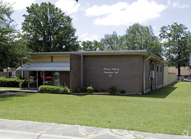
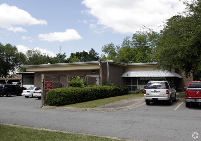
Property Record
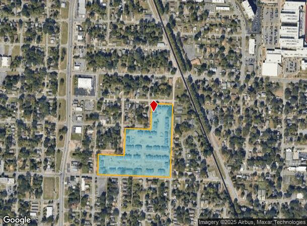
701 W 19Th St, North Little Rock, AR 72114
NEARBY LISTINGS FOR SALE OR LEASE
Property Detail
701 W 19Th St
Little Rock-North Little Rock-Conway, AR
Silver City Courts Addn
33N-256-01-001-00
ALL OF THE PLAT OF LOTS 1 AND 2 SILVER CITY COURTS ADDITION AND ALL OF BLOCKS 5, 11, AND 12 OF CR SCHAERS ADDITION TOGETHER WITH THE STREETS AND ALLEYS CONTAINED THEREIN CONTAINING 12.34 ACRES MOL
Apartment
Pulaski
X
Arkansas
05119C0344G
1r
2025
12.34 AC
2025
North Little Rock
003002
Little Rock/N Little Rock
34,159 SF
DEMOGRAPHICS near 701 W 19Th St
1 Mile
3 Mile
5 Mile
2024 Total Population
9,344
60,535
129,856
2029 Population
9,676
61,186
131,173
Pop Growth 2024-2029
+ 3.55%
+ 1.08%
+ 1.01%
Average Age
39
39
40
2024 Total Households
4,266
29,287
59,440
HH Growth 2024-2029
+ 3.47%
+ 1.08%
+ 1.06%
Median Household Inc
$30,118
$45,497
$46,862
Avg Household Size
2.10
2.00
2.10
2024 Avg HH Vehicles
1.00
1.00
2.00
Median Home Value
$85,312
$159,608
$164,200
Median Year Built
1966
1967
1967
Nearby Places
Map Layers
Map Styles
 Street
 Aerial
- Restaurants
- Banks
- Shops
- Fitness
- Groceries
PUBLIC TRANSPORTATION
COMMUTER RAIL
DRIVE
WALK
Distance
7 min
3.3 mi
AIRPORT
Bill and Hillary Clinton Ntl/Adams Field
DRIVE
WALK
Distance
Bill and Hillary Clinton Ntl/Adams Field
13 min
7.4 mi
Nearby Properties
Address
Land Use
TOTAL SIZE
Lot Size
Zoning
Address
Land Use
TOTAL SIZE
Lot Size
Zoning
1.80 AC
Address
Land Use
TOTAL SIZE
Lot Size
Zoning
0.90 AC
Address
Land Use
TOTAL SIZE
Lot Size
Zoning
0.45 AC
Address
Land Use
TOTAL SIZE
Lot Size
Zoning
1,000,000 SF
9.38 AC
Address
Land Use
TOTAL SIZE
Lot Size
Zoning
333,096 SF
11.62 AC
Address
Land Use
TOTAL SIZE
Lot Size
Zoning
237,144 SF
1.26 AC
Address
Land Use
TOTAL SIZE
Lot Size
Zoning
526,829 SF
33.78 AC
Address
Land Use
TOTAL SIZE
Lot Size
Zoning
180,616 SF
0.91 AC
Address
Land Use
TOTAL SIZE
Lot Size
Zoning
12,562 SF
2.26 AC
Address
Land Use
TOTAL SIZE
Lot Size
Zoning
297,814 SF
86.09 AC
Address
Land Use
TOTAL SIZE
Lot Size
Zoning
22,017 SF
2.06 AC
Address
Land Use
TOTAL SIZE
Lot Size
Zoning
305,882 SF
7.82 AC
Address
Land Use
TOTAL SIZE
Lot Size
Zoning
761,810 SF
75.61 AC
Address
Land Use
TOTAL SIZE
Lot Size
Zoning
576 SF
62.63 AC
Address
Land Use
TOTAL SIZE
Lot Size
Zoning
2,636 SF
0.67 AC
Address
Land Use
TOTAL SIZE
Lot Size
Zoning
137,538 SF
31.58 AC
Address
Land Use
TOTAL SIZE
Lot Size
Zoning
260,000 SF
5.80 AC
Address
Land Use
TOTAL SIZE
Lot Size
Zoning
143,553 SF
12.76 AC
Address
Land Use
TOTAL SIZE
Lot Size
Zoning
130,742 SF
15.71 AC
Address
Land Use
TOTAL SIZE
Lot Size
Zoning
7,859 SF
175.11 AC
Address
Land Use
TOTAL SIZE
Lot Size
Zoning
95,719 SF
32.76 AC
Address
Land Use
TOTAL SIZE
Lot Size
Zoning
346,974 SF
Address
Land Use
TOTAL SIZE
Lot Size
Zoning
138,352 SF
2.95 AC
Address
Land Use
TOTAL SIZE
Lot Size
Zoning
61,225 SF
5.66 AC
Address
Land Use
TOTAL SIZE
Lot Size
Zoning
269,624 SF
3.40 AC
Address
Land Use
TOTAL SIZE
Lot Size
Zoning
361,910 SF
Address
Land Use
TOTAL SIZE
Lot Size
Zoning
41,925 SF
13 AC
Address
Land Use
TOTAL SIZE
Lot Size
Zoning
83,652 SF
12.55 AC
Address
Land Use
TOTAL SIZE
Lot Size
Zoning
220,800 SF
2.92 AC
Address
Land Use
TOTAL SIZE
Lot Size
Zoning
9,272 SF
0.58 AC
The World's #1 Commercial Real Estate Marketplace
Connect with us
© 2026 CoStar Group
The information above has been obtained from sources believed reliable. While we do not doubt its accuracy we have not verified it and make no guarantee, warranty or representation about it. It is your responsibility to independently confirm its accuracy and completeness. Any projections, opinions, assumptions, or estimates used are for example only and do not represent the current or future performance of the property. The value of this transaction to you depends on tax and other factors which should be evaluated by your tax, financial, and legal advisors. You and your advisors should conduct a careful, independent investigation of the property to determine to your satisfaction the suitability of the property for your needs.