Property Record
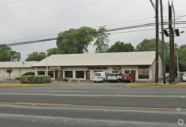
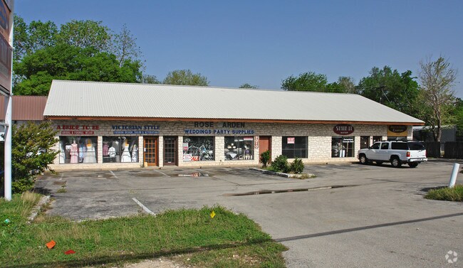
7010 Burnet Rd, Austin, TX 78757

Property Detail
7010 Burnet Rd
Austin-Round Rock-San Marcos, TX
LOT 4-5 BLK 3 GREEN ACRES
237418
Travis
Stripcommercialcenter
Texas
B and X Area of moderate flood hazard, usually the area between the limits of the 100-year and 500-year floods.
4-5
2025
0.43 AC
2025
Central
001501
Austin
5,000 SF
NEARBY LISTINGS FOR SALE OR LEASE
DEMOGRAPHICS near 7010 Burnet Rd
1 mile
3 mile
5 mile
2025 Total Population
16,511
144,510
348,511
2030 Population
17,608
151,341
365,117
Pop Growth 2025-2030
+ 6.64%
+ 4.73%
+ 4.76%
Average Age
40
38
37
2025 Total Households
8,002
66,291
154,513
HH Growth 2025-2030
+ 7.94%
+ 5.53%
+ 5.59%
Median Household Inc
$106,473
$80,982
$83,340
Avg Household Size
2.00
2.10
2.10
2025 Avg HH Vehicles
2.00
2.00
2.00
Median Home Value
$771,681
$755,595
$748,827
Median Year Built
1972
1980
1986
Nearby Places
Map Layers
Map Styles
 Street
 Aerial
Transit
 Traffic
 Biking
Places
Listings with unknown addresses are not visible on the map
- Restaurants
- Banks
- Shops
- Fitness
- Groceries
PUBLIC TRANSPORTATION
COMMUTER RAIL
Austin (Texas Eagle - Amtrak)
Drive
Walk
Distance
Austin (Texas Eagle - Amtrak)
13 min
7.5 mi
AIRPORT
Austin-Bergstrom International
Drive
Walk
Distance
Austin-Bergstrom International
30 min
16.1 mi
Freight Ports
Calhoun Port
Drive
Walk
Distance
Calhoun Port
196 min
159.6 mi
Nearby Properties
Address
Land Use
TOTAL SIZE
Lot Size
Zoning
Address
Land Use
TOTAL SIZE
Lot Size
Zoning
230.30 AC
Address
Land Use
TOTAL SIZE
Lot Size
Zoning
74.69 AC
Address
Land Use
TOTAL SIZE
Lot Size
Zoning
623,000 SF
11.78 AC
Address
Land Use
TOTAL SIZE
Lot Size
Zoning
614,532 SF
66.07 AC
Address
Land Use
TOTAL SIZE
Lot Size
Zoning
1,234 SF
96.75 AC
Address
Land Use
TOTAL SIZE
Lot Size
Zoning
95.86 AC
Address
Land Use
TOTAL SIZE
Lot Size
Zoning
73.48 AC
Address
Land Use
TOTAL SIZE
Lot Size
Zoning
510,500 SF
9.26 AC
Address
Land Use
TOTAL SIZE
Lot Size
Zoning
Address
Land Use
TOTAL SIZE
Lot Size
Zoning
480,823 SF
18.46 AC
Address
Land Use
TOTAL SIZE
Lot Size
Zoning
354,008 SF
39.99 AC
Address
Land Use
TOTAL SIZE
Lot Size
Zoning
346,319 SF
6.53 AC
Address
Land Use
TOTAL SIZE
Lot Size
Zoning
45 AC
Address
Land Use
TOTAL SIZE
Lot Size
Zoning
303,622 SF
5.21 AC
Address
Land Use
TOTAL SIZE
Lot Size
Zoning
425,200 SF
2.49 AC
Address
Land Use
TOTAL SIZE
Lot Size
Zoning
314,319 SF
5.97 AC
Address
Land Use
TOTAL SIZE
Lot Size
Zoning
45.78 AC
Address
Land Use
TOTAL SIZE
Lot Size
Zoning
365,130 SF
18.15 AC
Address
Land Use
TOTAL SIZE
Lot Size
Zoning
286,276 SF
4.53 AC
Address
Land Use
TOTAL SIZE
Lot Size
Zoning
274,228 SF
4.95 AC
Address
Land Use
TOTAL SIZE
Lot Size
Zoning
276,772 SF
4.68 AC
Address
Land Use
TOTAL SIZE
Lot Size
Zoning
32.82 AC
Address
Land Use
TOTAL SIZE
Lot Size
Zoning
39.26 AC
Address
Land Use
TOTAL SIZE
Lot Size
Zoning
467,647 SF
3.54 AC
Address
Land Use
TOTAL SIZE
Lot Size
Zoning
227,700 SF
3.97 AC
Address
Land Use
TOTAL SIZE
Lot Size
Zoning
332,202 SF
31.81 AC
Address
Land Use
TOTAL SIZE
Lot Size
Zoning
16.79 AC
Address
Land Use
TOTAL SIZE
Lot Size
Zoning
18.45 AC
Address
Land Use
TOTAL SIZE
Lot Size
Zoning
248,325 SF
2.46 AC
Address
Land Use
TOTAL SIZE
Lot Size
Zoning
292,402 SF
4.76 AC
The World's #1 Commercial Real Estate Marketplace
Connect with us
© 2026 CoStar Group
The information above has been obtained from sources believed reliable. While we do not doubt its accuracy we have not verified it and make no guarantee, warranty or representation about it. It is your responsibility to independently confirm its accuracy and completeness. Any projections, opinions, assumptions, or estimates used are for example only and do not represent the current or future performance of the property. The value of this transaction to you depends on tax and other factors which should be evaluated by your tax, financial, and legal advisors. You and your advisors should conduct a careful, independent investigation of the property to determine to your satisfaction the suitability of the property for your needs.