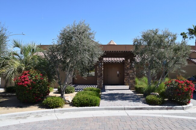
Property Record
70115 Highway 111, Rancho Mirage, CA 92270


NEARBY LISTINGS FOR SALE OR LEASE
Property Detail
70115 Highway 111
Riverside-San Bernardino-Ontario, CA
Parcel Map 8551
689-160-006
.04 ACRES M/L IN POR PAR 3 PM 036/014 PM 8551
Officebuilding
Riverside
X
California
06065C1589G
3
2024
1.26 AC
2025
Coachella Valley
045103
Inland Empire (California)
8,581 SF
DEMOGRAPHICS near 70115 Highway 111
1 Mile
3 Mile
5 Mile
2024 Total Population
3,687
34,863
117,945
2029 Population
4,137
38,616
129,394
Pop Growth 2024-2029
+ 12.21%
+ 10.76%
+ 9.71%
Average Age
57
57
50
2024 Total Households
1,928
17,653
52,769
HH Growth 2024-2029
+ 11.98%
+ 10.63%
+ 10.03%
Median Household Inc
$78,936
$78,005
$68,791
Avg Household Size
1.80
1.90
2.20
2024 Avg HH Vehicles
2.00
2.00
2.00
Median Home Value
$550,277
$621,943
$555,595
Median Year Built
1982
1983
1985
Nearby Places
Map Layers
Map Styles
 Street
 Aerial
- Restaurants
- Banks
- Shops
- Fitness
- Groceries
PUBLIC TRANSPORTATION
AIRPORT
Palm Springs International
DRIVE
WALK
Distance
Palm Springs International
13 min
7.3 mi
Freight Ports
Port of San Diego
DRIVE
WALK
Distance
Port of San Diego
165 min
135.1 mi
SALE & LEASE HISTORY
LISTING DATE
SALE/LEASE

Mar 07, 2018
For Lease
Jun 04, 2018
For Sale
Feb 15, 2023
For Sale
Nearby Properties
Address
Land Use
TOTAL SIZE
Lot Size
Zoning
Address
Land Use
TOTAL SIZE
Lot Size
Zoning
370,095 SF
53.22 AC
Address
Land Use
TOTAL SIZE
Lot Size
Zoning
445,569 SF
17.55 AC
PUDC
Address
Land Use
TOTAL SIZE
Lot Size
Zoning
68.20 AC
Address
Land Use
TOTAL SIZE
Lot Size
Zoning
21,118 SF
162.93 AC
Address
Land Use
TOTAL SIZE
Lot Size
Zoning
217,730 SF
8.64 AC
R1010
Address
Land Use
TOTAL SIZE
Lot Size
Zoning
91,939 SF
8.80 AC
Address
Land Use
TOTAL SIZE
Lot Size
Zoning
186,531 SF
6 AC
Address
Land Use
TOTAL SIZE
Lot Size
Zoning
103,940 SF
4.56 AC
Address
Land Use
TOTAL SIZE
Lot Size
Zoning
179,685 SF
9.36 AC
Address
Land Use
TOTAL SIZE
Lot Size
Zoning
Address
Land Use
TOTAL SIZE
Lot Size
Zoning
208,000 SF
16.04 AC
Address
Land Use
TOTAL SIZE
Lot Size
Zoning
136,875 SF
8.87 AC
O
Address
Land Use
TOTAL SIZE
Lot Size
Zoning
58,823 SF
5.87 AC
C-N
Address
Land Use
TOTAL SIZE
Lot Size
Zoning
141,574 SF
44.60 AC
Address
Land Use
TOTAL SIZE
Lot Size
Zoning
44,823 SF
12.07 AC
CG
Address
Land Use
TOTAL SIZE
Lot Size
Zoning
Address
Land Use
TOTAL SIZE
Lot Size
Zoning
41,962 SF
5 AC
Address
Land Use
TOTAL SIZE
Lot Size
Zoning
38,388 SF
8.31 AC
R3
Address
Land Use
TOTAL SIZE
Lot Size
Zoning
36,514 SF
2.10 AC
PUDA
Address
Land Use
TOTAL SIZE
Lot Size
Zoning
92,722 SF
5.55 AC
O
Address
Land Use
TOTAL SIZE
Lot Size
Zoning
32,158 SF
1.96 AC
PUDLC
Address
Land Use
TOTAL SIZE
Lot Size
Zoning
66,732 SF
1.80 AC
PCC
Address
Land Use
TOTAL SIZE
Lot Size
Zoning
71,665 SF
3.31 AC
CN
Address
Land Use
TOTAL SIZE
Lot Size
Zoning
6,717 SF
17.79 AC
Address
Land Use
TOTAL SIZE
Lot Size
Zoning
5.15 AC
CG
Address
Land Use
TOTAL SIZE
Lot Size
Zoning
32,333 SF
2.80 AC
C-N
Address
Land Use
TOTAL SIZE
Lot Size
Zoning
102,304 SF
8.98 AC
CPS
Address
Land Use
TOTAL SIZE
Lot Size
Zoning
46,528 SF
1.89 AC
CPS
Address
Land Use
TOTAL SIZE
Lot Size
Zoning
22,594 SF
1.37 AC
POC3
The World's #1 Commercial Real Estate Marketplace
Connect with us
© 2025 CoStar Group
The information above has been obtained from sources believed reliable. While we do not doubt its accuracy we have not verified it and make no guarantee, warranty or representation about it. It is your responsibility to independently confirm its accuracy and completeness. Any projections, opinions, assumptions, or estimates used are for example only and do not represent the current or future performance of the property. The value of this transaction to you depends on tax and other factors which should be evaluated by your tax, financial, and legal advisors. You and your advisors should conduct a careful, independent investigation of the property to determine to your satisfaction the suitability of the property for your needs.