Property Record
7012 Route 7, Pownal, VT 05261
This Property Is For Sale
NEARBY LISTINGS FOR SALE OR LEASE
-
-
View all Pownal listings for sale on LoopNet.com
Property Detail
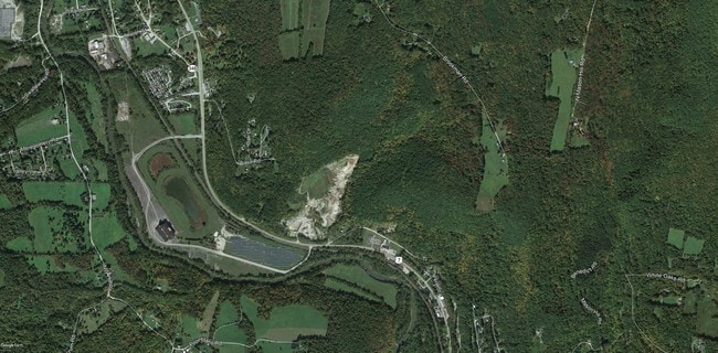
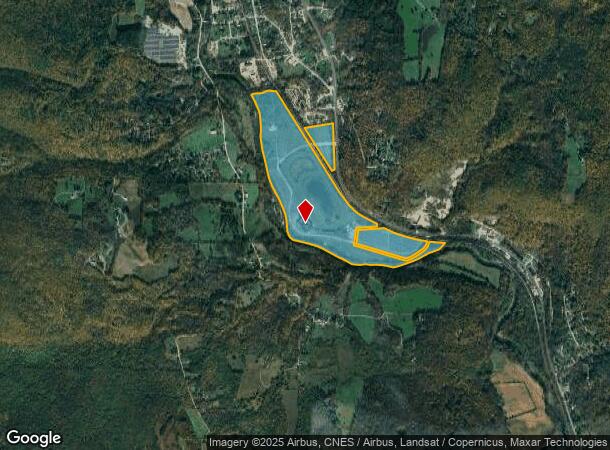
7012 Route 7
(156)US7-21
LAND & BLD
Commercialnec
Bennington
AE
Vermont
50003C0513D
144.77 AC
2024
Vermont South Area
2024
Other Market Areas
971300
Bennington, VT
31,200 SF
DEMOGRAPHICS near 7012 Route 7
1 Mile
3 Mile
5 Mile
2024 Total Population
563
3,381
10,730
2029 Population
559
3,375
10,736
Pop Growth 2024-2029
(0.71%)
(0.18%)
+ 0.06%
Average Age
44
45
42
2024 Total Households
234
1,379
3,942
HH Growth 2024-2029
(0.85%)
(0.15%)
+ 0.33%
Median Household Inc
$75,521
$79,649
$78,506
Avg Household Size
2.30
2.20
2.20
2024 Avg HH Vehicles
2.00
2.00
2.00
Median Home Value
$231,818
$297,745
$309,649
Median Year Built
1970
1962
1961
Nearby Places
Map Layers
Map Styles
 Street
 Aerial
- Restaurants
- Banks
- Shops
- Fitness
- Groceries
PUBLIC TRANSPORTATION
AIRPORT
Albany International
DRIVE
WALK
Distance
Albany International
64 min
38.7 mi
Freight Ports
Albany, NY Port
DRIVE
WALK
Distance
Albany, NY Port
69 min
41.4 mi
Nearby Properties
Address
Land Use
TOTAL SIZE
Lot Size
Zoning
Address
Land Use
TOTAL SIZE
Lot Size
Zoning
0.66 AC
Address
Land Use
TOTAL SIZE
Lot Size
Zoning
2,492 SF
6.80 AC
GR
Address
Land Use
TOTAL SIZE
Lot Size
Zoning
146,228 SF
27 AC
PB
Address
Land Use
TOTAL SIZE
Lot Size
Zoning
Address
Land Use
TOTAL SIZE
Lot Size
Zoning
1,343 AC
RR2
Address
Land Use
TOTAL SIZE
Lot Size
Zoning
2.34 AC
Address
Land Use
TOTAL SIZE
Lot Size
Zoning
1,820 SF
28.84 AC
Address
Land Use
TOTAL SIZE
Lot Size
Zoning
Address
Land Use
TOTAL SIZE
Lot Size
Zoning
9,339 SF
4.50 AC
GR
Address
Land Use
TOTAL SIZE
Lot Size
Zoning
4,854 SF
15.76 AC
RR2
Address
Land Use
TOTAL SIZE
Lot Size
Zoning
3.02 AC
Address
Land Use
TOTAL SIZE
Lot Size
Zoning
4,990 SF
42.50 AC
GR
Address
Land Use
TOTAL SIZE
Lot Size
Zoning
Address
Land Use
TOTAL SIZE
Lot Size
Zoning
3,352 SF
2.85 AC
GR
Address
Land Use
TOTAL SIZE
Lot Size
Zoning
24,555 SF
58.51 AC
LI
Address
Land Use
TOTAL SIZE
Lot Size
Zoning
18,672 SF
6.78 AC
GR
Address
Land Use
TOTAL SIZE
Lot Size
Zoning
12,968 SF
0.92 AC
GR
Address
Land Use
TOTAL SIZE
Lot Size
Zoning
10,167 SF
9.91 AC
PB
Address
Land Use
TOTAL SIZE
Lot Size
Zoning
1,723 SF
0.42 AC
PB
Address
Land Use
TOTAL SIZE
Lot Size
Zoning
49,671 SF
32.70 AC
LI
Address
Land Use
TOTAL SIZE
Lot Size
Zoning
6,052 SF
5.41 AC
Address
Land Use
TOTAL SIZE
Lot Size
Zoning
5,500 SF
129.01 AC
Address
Land Use
TOTAL SIZE
Lot Size
Zoning
7,874 SF
11.54 AC
LI
Address
Land Use
TOTAL SIZE
Lot Size
Zoning
60,000 SF
32 AC
LI
Address
Land Use
TOTAL SIZE
Lot Size
Zoning
2,500 SF
14.17 AC
LI
Address
Land Use
TOTAL SIZE
Lot Size
Zoning
11.90 AC
GR
Address
Land Use
TOTAL SIZE
Lot Size
Zoning
5 AC
PB
Address
Land Use
TOTAL SIZE
Lot Size
Zoning
503.35 AC
Address
Land Use
TOTAL SIZE
Lot Size
Zoning
2,492 SF
6 AC
GR
Address
Land Use
TOTAL SIZE
Lot Size
Zoning
26 AC
RR2
The World's #1 Commercial Real Estate Marketplace
Connect with us
© 2025 CoStar Group
The information above has been obtained from sources believed reliable. While we do not doubt its accuracy we have not verified it and make no guarantee, warranty or representation about it. It is your responsibility to independently confirm its accuracy and completeness. Any projections, opinions, assumptions, or estimates used are for example only and do not represent the current or future performance of the property. The value of this transaction to you depends on tax and other factors which should be evaluated by your tax, financial, and legal advisors. You and your advisors should conduct a careful, independent investigation of the property to determine to your satisfaction the suitability of the property for your needs.